Vector Maps logo
Home Why it works Popular maps Districts Samples Customizer Create Your Map
VectorMaps.uk
Home Popular maps Districts Samples Customizer Create Your Map Privacy Disclaimer
Home / UK Maps / Roxburgh, Ettrick and Lauderdale / Stow Map

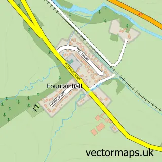
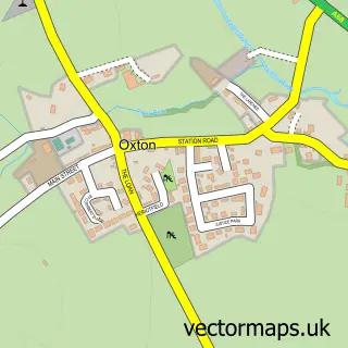
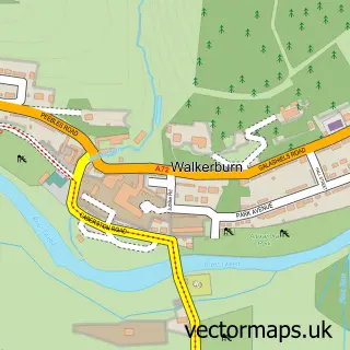
This Stow street map is a detailed vector street map covering a 750m x 750m area. Select a larger area to create and download your own vector street map of Stow.

Stow is a village in Roxburgh, Ettrick And Lauderdale, in the South Scotland of Scotland. Historically, the area formed part of Midlothian. The settlement falls within the Berwickshire, Roxburgh And Selkirk parliamentary constituency. It is served by the

The 750-metre map sample for Stow covers 179 mapped buildings and approximately 22.7 km of road detail, of which 11 named roads are named. The immediate area includes 1 railway station and 1 GP surgery. The wider area around Stow features 1 food and drink venue. To create a larger or custom map of Stow, the map builder lets you define your own coverage area and download editable SVG, PDF and PNG files.

179Buildings
22.66 kmRoads
11Named roads
0Residents within 2 miles
Create your own

Create a larger editable map of Stow

Choose any area you need and generate a high-quality vector map instantly. Perfect for print, planning, design, business and personal use.

Choose any location
Editable SVG files
Any size up to A0
PDF, PNG & more
Instant download
High quality guaranteed
Create My Custom Map
Secure, private & no credit card required
Stow Vector Street Map
750m Sample
Stow vector street map sample showing roads, buildings and local features in a 750 metre preview area
Buy Stow Map Print from £12.95 Buy Stow Digital Map from £6

This Stow street map in Roxburgh, Ettrick and Lauderdale is available as downloadable SVG, PDF and PNG map files, or as a printed map for planning, business, display, education, local information and design work. You can also create a larger custom map area using the map selector.

What this Stow map sample shows

Stow lies within Scottish Borders parish, part of Galashiels And District ward in the Scottish Borders local authority area. The postcode geography for this area includes the TD postcode area, the TD1 postcode district and the TD1 2 postcode sector. Residents fall under the Borders for NHS services.

Local features near Stow

Within 2 miles

Amenities and services in and around Stow.

1 Railway stations
1 GP surgeries 1 within 2 miles
1 Food & drink
2 Healthcare POIs
1 Vehicle services

Counts are approximate and based on publicly available data.

Administrative and postcode information for Stow

The local authority covering Stow is Scottish Borders, within the county of Roxburgh, Ettrick And Lauderdale. The settlement lies within Galashiels And District ward and Scottish Borders civil parish. The TD1 postcode district and TD1 2 postcode sector serve the immediate area. NHS provision in the area is delivered through Borders.

Parish SCOTTISH BORDERS
Ward Galashiels and District
District / local authority Scottish Borders
County Roxburgh, Ettrick and Lauderdale
Historic county Midlothian
Postcode district TD1
Postcode sector TD1 2
Parliamentary constituency Berwickshire, Roxburgh and Selkirk
Region South Scotland
Country Scotland

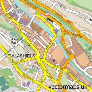
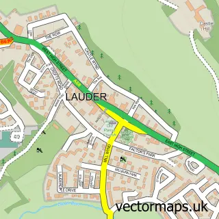
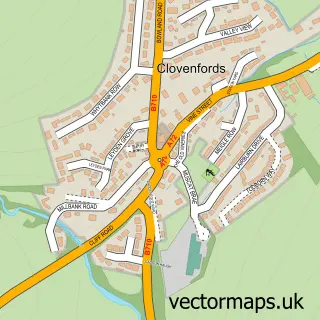
Nearby street map samples around Stow

Street map sample of Galashiels, Roxburgh, Ettrick and Lauderdale Galashiels Town - Roxburgh, Ettrick and Lauderdale - 5.8 miles Street map sample of Edinburgh, City of Edinburgh Edinburgh City - City of Edinburgh - 22.0 miles Street map sample of Fountainhall, Roxburgh, Ettrick and Lauderdale Fountainhall Village - Roxburgh, Ettrick and Lauderdale - 3.4 miles Street map sample of Lauder, Roxburgh, Ettrick and Lauderdale Lauder Village - Roxburgh, Ettrick and Lauderdale - 4.8 miles Street map sample of Clovenfords, Roxburgh, Ettrick and Lauderdale Clovenfords Village - Roxburgh, Ettrick and Lauderdale - 5.2 miles Street map sample of Oxton, Roxburgh, Ettrick and Lauderdale Oxton Village - Roxburgh, Ettrick and Lauderdale - 6.0 miles Street map sample of Caddonfoot, Roxburgh, Ettrick and Lauderdale Caddonfoot Village - Roxburgh, Ettrick and Lauderdale - 6.1 miles Street map sample of Heriot, Roxburgh, Ettrick and Lauderdale Heriot Village - Roxburgh, Ettrick and Lauderdale - 6.5 miles Street map sample of Tweedbank, Roxburgh, Ettrick and Lauderdale Tweedbank Village - Roxburgh, Ettrick and Lauderdale - 7.2 miles Street map sample of Walkerburn, Tweeddale Walkerburn Village - Tweeddale - 7.7 miles

More street maps in Roxburgh, Ettrick and Lauderdale

Street map sample of Fountainhall, Roxburgh, Ettrick and Lauderdale Fountainhall Village - 3.4 miles Street map sample of Lauder, Roxburgh, Ettrick and Lauderdale Lauder Village - 4.8 miles Street map sample of Clovenfords, Roxburgh, Ettrick and Lauderdale Clovenfords Village - 5.2 miles Street map sample of Galashiels, Roxburgh, Ettrick and Lauderdale Galashiels Town - 5.8 miles Street map sample of Oxton, Roxburgh, Ettrick and Lauderdale Oxton Village - 6.0 miles

750 metre map area coverage

Boundary, postcode and point of interest information for the 750m x 750m rectangle centred on this sample map.

Boundaries containing map centre

Constituency: Berwickshire, Roxburgh and Selkirk Co Const

District: Scottish Borders

Icb: Borders

Postcode District: TD1

Postcode Sector: TD1 2

Ward: Galashiels and District Ward

Nearby boundaries intersecting sample

No additional intersecting boundaries found.

Postcode coverage

TD1 TD1 2

POI category counts

Doctor: 2

Train Station: 2

Animal Shelter: 1

Architectural Designer: 1

Automotive Repair: 1

Bar And Grill Restaurant: 1

Bicycle Shop: 1

Bookstore: 1

Builders: 1

Business Equipment And Supply: 1

Sample points of interest

  • Velvetcushion Animal Shelter
  • Hunter Architecture Architectural Designer
  • Millburn Garage Automotive Repair
  • The Station House Bar And Grill Restaurant
  • Stow Cycle Hub Bicycle Shop
  • The Wedale Bookshop Bookstore
  • Norskved Builders
  • Inkjet-direct.com Business Equipment And Supply
  • St Mary of Wedale Parish Church Catholic Church
  • Stow St Mary of Wedale and Heriot Parish Church Church Cathedral
  • Cloudhouse Cafe and Gallery Coffee Shop
  • Stow Community Trust Community Services Non Profits

Create a larger editable map of Stow

This sample shows only a 750 metre area. To create a larger map of Stow, use our map builder to choose your own coverage area, add titles and download editable SVG, PDF and PNG files.

Create a custom map of Stow

Phone 01751 473136 | Copyright Vectormaps.uk 2026

Samples Customizer Privacy Disclaimer
Stow Vector Street Map
Stow enlarged street map sample showing a 750 metre preview area