Vector Maps logo
Home Why it works Popular maps Districts Samples Customizer Create Your Map
VectorMaps.uk
Home Popular maps Districts Samples Customizer Create Your Map Privacy Disclaimer
Home / UK Maps / Roxburgh, Ettrick and Lauderdale / Lauder Map

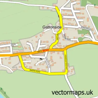
This Lauder street map is a detailed vector street map covering a 750m x 750m area. Select a larger area to create and download your own vector street map of Lauder.

Lauder is a village in Roxburgh, Ettrick And Lauderdale, in the South Scotland of Scotland. Historically, the area formed part of Berwickshire. The settlement falls within the Berwickshire, Roxburgh And Selkirk parliamentary constituency. It is served by

The 750-metre map sample for Lauder covers 326 mapped buildings and approximately 16.7 km of road detail, of which 29 named roads are named. The immediate area includes 2 pubs and 1 MOT station within 2 miles. The wider area around Lauder features 2 tourism points of interest, 6 food and drink venues and 6 hotels. To create a larger or custom map of Lauder, the map builder lets you define your own coverage area and download editable SVG, PDF and PNG files.

326Buildings
16.65 kmRoads
29Named roads
0Residents within 2 miles
Create your own

Create a larger editable map of Lauder

Choose any area you need and generate a high-quality vector map instantly. Perfect for print, planning, design, business and personal use.

Choose any location
Editable SVG files
Any size up to A0
PDF, PNG & more
Instant download
High quality guaranteed
Create My Custom Map
Secure, private & no credit card required
Lauder Vector Street Map
750m Sample
Lauder vector street map sample showing roads, buildings and local features in a 750 metre preview area
Buy Lauder Map Print from £12.95 Buy Lauder Digital Map from £6

This Lauder street map in Roxburgh, Ettrick and Lauderdale is available as downloadable SVG, PDF and PNG map files, or as a printed map for planning, business, display, education, local information and design work. You can also create a larger custom map area using the map selector.

What this Lauder map sample shows

Lauder lies within Scottish Borders parish, part of Leaderdale And Melrose ward in the Scottish Borders local authority area. The postcode geography for this area includes the TD postcode area, the TD2 postcode district and the TD2 6 postcode sector. Residents fall under the Borders for NHS services.

Local features near Lauder

Within 2 miles

Amenities and services in and around Lauder.

1 MOT stations within 2 miles
2 Tourism & leisure
6 Food & drink
2 Pubs
6 Hotels
2 Healthcare POIs
3 Vehicle services

Counts are approximate and based on publicly available data.

Administrative and postcode information for Lauder

The local authority covering Lauder is Scottish Borders, within the county of Roxburgh, Ettrick And Lauderdale. The settlement lies within Leaderdale And Melrose ward and Scottish Borders civil parish. The TD2 postcode district and TD2 6 postcode sector serve the immediate area. NHS provision in the area is delivered through Borders.

Parish SCOTTISH BORDERS
Ward Leaderdale and Melrose
District / local authority Scottish Borders
County Roxburgh, Ettrick and Lauderdale
Historic county Berwickshire
Postcode district TD2
Postcode sector TD2 6
Parliamentary constituency Berwickshire, Roxburgh and Selkirk
Region South Scotland
Country Scotland

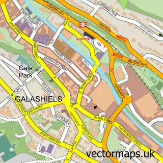
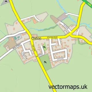
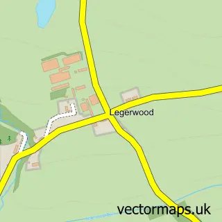
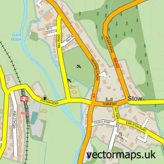
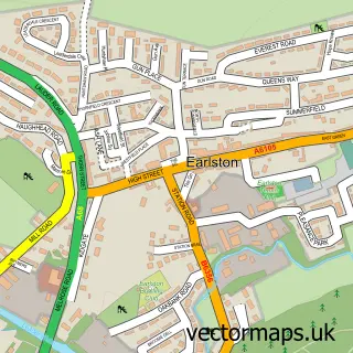
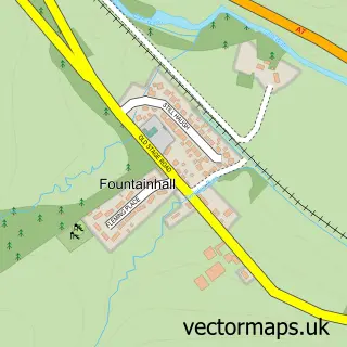
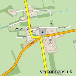
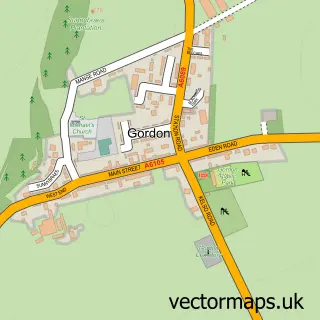
Nearby street map samples around Lauder

Street map sample of Galashiels, Roxburgh, Ettrick and Lauderdale Galashiels Town - Roxburgh, Ettrick and Lauderdale - 7.5 miles Street map sample of Edinburgh, City of Edinburgh Edinburgh City - City of Edinburgh - 23.5 miles Street map sample of Oxton, Roxburgh, Ettrick and Lauderdale Oxton Village - Roxburgh, Ettrick and Lauderdale - 4.2 miles Street map sample of Legerwood, Roxburgh, Ettrick and Lauderdale Legerwood Village - Roxburgh, Ettrick and Lauderdale - 4.4 miles Street map sample of Stow, Roxburgh, Ettrick and Lauderdale Stow Village - Roxburgh, Ettrick and Lauderdale - 4.8 miles Street map sample of Earlston, Roxburgh, Ettrick and Lauderdale Earlston Village - Roxburgh, Ettrick and Lauderdale - 6.3 miles Street map sample of Fountainhall, Roxburgh, Ettrick and Lauderdale Fountainhall Village - Roxburgh, Ettrick and Lauderdale - 6.3 miles Street map sample of Westruther, Berwickshire Westruther Village - Berwickshire - 6.6 miles Street map sample of Gordon, Berwickshire Gordon Village - Berwickshire - 7.7 miles Street map sample of Gattonside, Roxburgh, Ettrick and Lauderdale Gattonside Village - Roxburgh, Ettrick and Lauderdale - 7.8 miles

More street maps in Roxburgh, Ettrick and Lauderdale

Street map sample of Oxton, Roxburgh, Ettrick and Lauderdale Oxton Village - 4.2 miles Street map sample of Legerwood, Roxburgh, Ettrick and Lauderdale Legerwood Village - 4.4 miles Street map sample of Stow, Roxburgh, Ettrick and Lauderdale Stow Village - 4.8 miles Street map sample of Earlston, Roxburgh, Ettrick and Lauderdale Earlston Village - 6.3 miles Street map sample of Fountainhall, Roxburgh, Ettrick and Lauderdale Fountainhall Village - 6.3 miles

750 metre map area coverage

Boundary, postcode and point of interest information for the 750m x 750m rectangle centred on this sample map.

Boundaries containing map centre

Constituency: Berwickshire, Roxburgh and Selkirk Co Const

District: Scottish Borders

Icb: Borders

Postcode District: TD2

Postcode Sector: TD2 6

Ward: Leaderdale and Melrose Ward

Nearby boundaries intersecting sample

No additional intersecting boundaries found.

Postcode coverage

TD2 TD2 6

POI category counts

Hotel: 6

Bakery: 2

Beauty Salon: 2

Bed And Breakfast: 2

Community Center: 2

Convenience Store: 2

Elementary School: 2

Hair Salon: 2

Professional Services: 2

Pub: 2

Sample points of interest

  • Flat Cat Gallery Art Gallery
  • Lauderdale Land Rovers Auto Company
  • Lauderdale Coachworks Automotive Repair
  • Firebrick Bakery Bakery
  • Lauder Bakery Bakery
  • Bank of Scotland Bank Credit Union
  • Avenue Studio Hair And Beauty Beauty Salon
  • Borders Body & Mind Beauty Salon
  • Lornebank Homestay Bed And Breakfast
  • No 16 Market Place Bed And Breakfast
  • Dalply Ltd Building Supply Store
  • Lauderdale Coaches Bus Service

Create a larger editable map of Lauder

This sample shows only a 750 metre area. To create a larger map of Lauder, use our map builder to choose your own coverage area, add titles and download editable SVG, PDF and PNG files.

Create a custom map of Lauder

Phone 01751 473136 | Copyright Vectormaps.uk 2026

Samples Customizer Privacy Disclaimer
Lauder Vector Street Map
Lauder enlarged street map sample showing a 750 metre preview area