Vector Maps logo
Home Why it works Popular maps Districts Samples Customizer Create Your Map
VectorMaps.uk
Home Popular maps Districts Samples Customizer Create Your Map Privacy Disclaimer
Home / UK Maps / Roxburgh, Ettrick and Lauderdale / Earlston Map

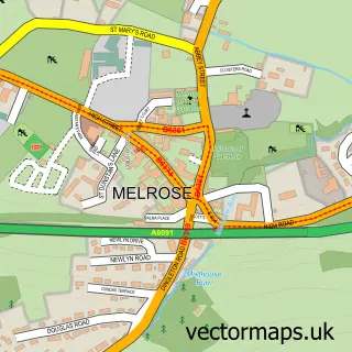
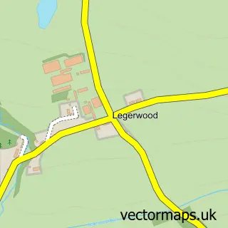
This Earlston street map is a detailed vector street map covering a 750m x 750m area. Select a larger area to create and download your own vector street map of Earlston.

Earlston is a village in Roxburgh, Ettrick And Lauderdale, in the South Scotland of Scotland. Historically, the area formed part of Berwickshire. The settlement falls within the Berwickshire, Roxburgh And Selkirk parliamentary constituency. It is served b

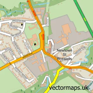
The 750-metre map sample for Earlston covers 398 mapped buildings and approximately 21.8 km of road detail, of which 41 named roads are named. The immediate area includes 1 GP surgery, 1 pub and 1 MOT station. The wider area around Earlston features 4 food and drink venues and 1 hotel. To create a larger or custom map of Earlston, the map builder lets you define your own coverage area and download editable SVG, PDF and PNG files.

398Buildings
21.81 kmRoads
41Named roads
0Residents within 2 miles
Create your own

Create a larger editable map of Earlston

Choose any area you need and generate a high-quality vector map instantly. Perfect for print, planning, design, business and personal use.

Choose any location
Editable SVG files
Any size up to A0
PDF, PNG & more
Instant download
High quality guaranteed
Create My Custom Map
Secure, private & no credit card required
Earlston Vector Street Map
750m Sample
Earlston vector street map sample showing roads, buildings and local features in a 750 metre preview area
Buy Earlston Map Print from £12.95 Buy Earlston Digital Map from £6

This Earlston street map in Roxburgh, Ettrick and Lauderdale is available as downloadable SVG, PDF and PNG map files, or as a printed map for planning, business, display, education, local information and design work. You can also create a larger custom map area using the map selector.

What this Earlston map sample shows

Earlston lies within Scottish Borders parish, part of Leaderdale And Melrose ward in the Scottish Borders local authority area. The postcode geography for this area includes the TD postcode area, the TD4 postcode district and the TD4 6 postcode sector. Residents fall under the Borders for NHS services.

Local features near Earlston

Within 2 miles

Amenities and services in and around Earlston.

1 GP surgeries 1 within 2 miles
1 MOT stations 1 within 2 miles
4 Food & drink
1 Pubs
1 Hotels
4 Healthcare POIs
6 Vehicle services

Counts are approximate and based on publicly available data.

Administrative and postcode information for Earlston

Earlston lies within Scottish Borders parish, part of Leaderdale And Melrose ward in the Scottish Borders local authority area. The postcode geography for this area includes the TD postcode area, the TD4 postcode district and the TD4 6 postcode sector. Residents fall under the Borders for NHS services.

Parish SCOTTISH BORDERS
Ward Leaderdale and Melrose
District / local authority Scottish Borders
County Roxburgh, Ettrick and Lauderdale
Historic county Berwickshire
Postcode district TD4
Postcode sector TD4 6
Parliamentary constituency Berwickshire, Roxburgh and Selkirk
Region South Scotland
Country Scotland

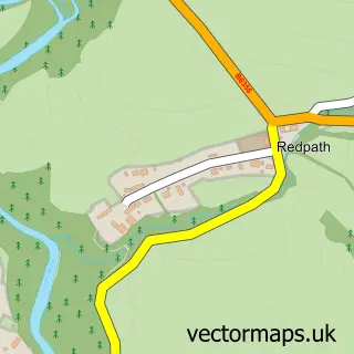
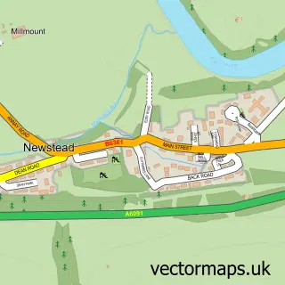
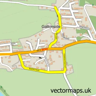
Nearby street map samples around Earlston

Street map sample of Melrose, Roxburgh, Ettrick and Lauderdale Melrose Town - Roxburgh, Ettrick and Lauderdale - 3.3 miles Street map sample of Edinburgh, City of Edinburgh Edinburgh City - City of Edinburgh - 29.5 miles Street map sample of Redpath, Roxburgh, Ettrick and Lauderdale Redpath Village - Roxburgh, Ettrick and Lauderdale - 1.8 miles Street map sample of Newstead, Roxburgh, Ettrick and Lauderdale Newstead Village - Roxburgh, Ettrick and Lauderdale - 2.8 miles Street map sample of Gattonside, Roxburgh, Ettrick and Lauderdale Gattonside Village - Roxburgh, Ettrick and Lauderdale - 2.9 miles Street map sample of Legerwood, Roxburgh, Ettrick and Lauderdale Legerwood Village - Roxburgh, Ettrick and Lauderdale - 3.1 miles Street map sample of Darnick, Roxburgh, Ettrick and Lauderdale Darnick Village - Roxburgh, Ettrick and Lauderdale - 3.7 miles Street map sample of Dryburgh, Roxburgh, Ettrick and Lauderdale Dryburgh Village - Roxburgh, Ettrick and Lauderdale - 4.1 miles Street map sample of Tweedbank, Roxburgh, Ettrick and Lauderdale Tweedbank Village - Roxburgh, Ettrick and Lauderdale - 4.2 miles Street map sample of Newtown St Boswells, Roxburgh, Ettrick and Lauderdale Newtown St Boswells Village - Roxburgh, Ettrick and Lauderdale - 4.2 miles

More street maps in Roxburgh, Ettrick and Lauderdale

Street map sample of Redpath, Roxburgh, Ettrick and Lauderdale Redpath Village - 1.8 miles Street map sample of Newstead, Roxburgh, Ettrick and Lauderdale Newstead Village - 2.8 miles Street map sample of Gattonside, Roxburgh, Ettrick and Lauderdale Gattonside Village - 2.9 miles Street map sample of Legerwood, Roxburgh, Ettrick and Lauderdale Legerwood Village - 3.1 miles Street map sample of Melrose, Roxburgh, Ettrick and Lauderdale Melrose Town - 3.3 miles

750 metre map area coverage

Boundary, postcode and point of interest information for the 750m x 750m rectangle centred on this sample map.

Boundaries containing map centre

Constituency: Berwickshire, Roxburgh and Selkirk Co Const

District: Scottish Borders

Icb: Borders

Postcode District: TD4

Postcode Sector: TD4 6

Ward: Leaderdale and Melrose Ward

Nearby boundaries intersecting sample

No additional intersecting boundaries found.

Postcode coverage

TD4 TD4 6

POI category counts

Automotive Repair: 4

Convenience Store: 3

Cafe: 2

Car Wash: 2

Driving School: 2

Flowers And Gifts Shop: 2

Gas Station: 2

Grocery Store: 2

Industrial Equipment: 2

Package Locker: 2

Sample points of interest

  • Tom Davidson Gallery Art Gallery
  • Bill Falconer Engines Automotive Repair
  • Keith Robertson Cars Automotive Repair
  • S & M Scott Automotive Repair
  • Scott's Garage Automotive Repair
  • The Royal Bank of Scotland Banks
  • Black Bull Earlston Bar
  • Leader body and beauty Beauty Salon
  • Broomfield House Bed And Breakfast
  • A & E Garage Services Brake Service And Repair
  • Rodger Builders Ltd Building Supply Store
  • W Donaldson & Son Family Butcher Butcher Shop

Create a larger editable map of Earlston

This sample shows only a 750 metre area. To create a larger map of Earlston, use our map builder to choose your own coverage area, add titles and download editable SVG, PDF and PNG files.

Create a custom map of Earlston

Phone 01751 473136 | Copyright Vectormaps.uk 2026

Samples Customizer Privacy Disclaimer
Earlston Vector Street Map
Earlston enlarged street map sample showing a 750 metre preview area