Vector Maps logo
Home Why it works Popular maps Districts Samples Customizer Create Your Map
VectorMaps.uk
Home Popular maps Districts Samples Customizer Create Your Map Privacy Disclaimer
Home / UK Maps / Roxburgh, Ettrick and Lauderdale / Melrose Map

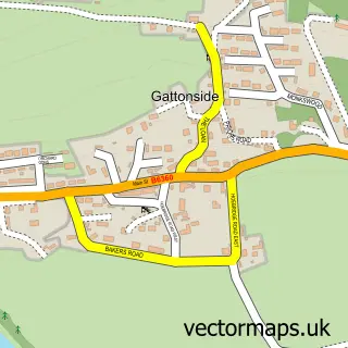
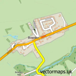
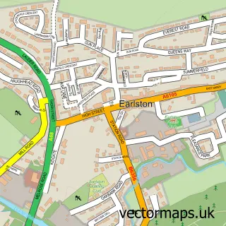
This Melrose street map is a detailed vector street map covering a 750m x 750m area. Select a larger area to create and download your own vector street map of Melrose.

Melrose is a town in Roxburgh, Ettrick And Lauderdale, in the South Scotland of Scotland. Historically, the area formed part of Roxburghshire. The settlement falls within the Berwickshire, Roxburgh And Selkirk parliamentary constituency. It is served by t

The 750-metre map sample for Melrose covers 179 mapped buildings and approximately 15.7 km of road detail, of which 22 named roads are named. The immediate area includes 3 pubs and 2 MOT stations within 2 miles. The wider area around Melrose features 11 tourism points of interest, 12 food and drink venues and 8 hotels. To create a larger or custom map of Melrose, the map builder lets you define your own coverage area and download editable SVG, PDF and PNG files.

179Buildings
15.65 kmRoads
22Named roads
0Residents within 2 miles
Create your own

Create a larger editable map of Melrose

Choose any area you need and generate a high-quality vector map instantly. Perfect for print, planning, design, business and personal use.

Choose any location
Editable SVG files
Any size up to A0
PDF, PNG & more
Instant download
High quality guaranteed
Create My Custom Map
Secure, private & no credit card required
Melrose Vector Street Map
750m Sample
Melrose vector street map sample showing roads, buildings and local features in a 750 metre preview area
Buy Melrose Map Print from £12.95 Buy Melrose Digital Map from £6

This Melrose street map in Roxburgh, Ettrick and Lauderdale is available as downloadable SVG, PDF and PNG map files, or as a printed map for planning, business, display, education, local information and design work. You can also create a larger custom map area using the map selector.

What this Melrose map sample shows

Melrose lies within Scottish Borders parish, part of Leaderdale And Melrose ward in the Scottish Borders local authority area. The postcode geography for this area includes the TD postcode area, the TD6 postcode district and the TD6 9 postcode sector. Residents fall under the Borders for NHS services.

Local features near Melrose

Within 2 miles

Amenities and services in and around Melrose.

1 Campsites within 2 miles
2 MOT stations within 2 miles
11 Tourism & leisure
12 Food & drink
3 Pubs
8 Hotels
3 Healthcare POIs
2 Vehicle services

Counts are approximate and based on publicly available data.

Administrative and postcode information for Melrose

The local authority covering Melrose is Scottish Borders, within the county of Roxburgh, Ettrick And Lauderdale. The settlement lies within Leaderdale And Melrose ward and Scottish Borders civil parish. The TD6 postcode district and TD6 9 postcode sector serve the immediate area. NHS provision in the area is delivered through Borders.

Parish SCOTTISH BORDERS
Ward Leaderdale and Melrose
District / local authority Scottish Borders
County Roxburgh, Ettrick and Lauderdale
Historic county Roxburghshire
Postcode district TD6
Postcode sector TD6 9
Parliamentary constituency Berwickshire, Roxburgh and Selkirk
Region South Scotland
Country Scotland

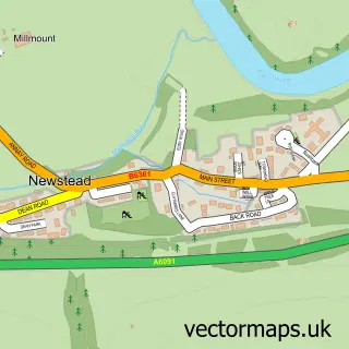
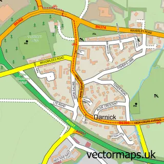
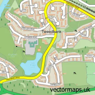
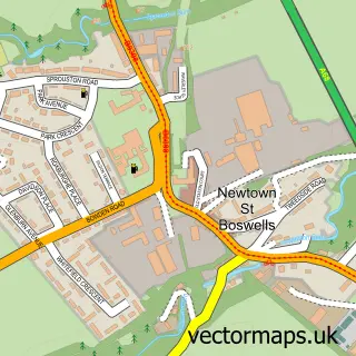
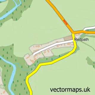
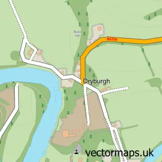
Nearby street map samples around Melrose

Street map sample of Edinburgh, City of Edinburgh Edinburgh City - City of Edinburgh - 30.6 miles Street map sample of Gattonside, Roxburgh, Ettrick and Lauderdale Gattonside Village - Roxburgh, Ettrick and Lauderdale - 0.7 miles Street map sample of Newstead, Roxburgh, Ettrick and Lauderdale Newstead Village - Roxburgh, Ettrick and Lauderdale - 0.9 miles Street map sample of Darnick, Roxburgh, Ettrick and Lauderdale Darnick Village - Roxburgh, Ettrick and Lauderdale - 1.0 miles Street map sample of Tweedbank, Roxburgh, Ettrick and Lauderdale Tweedbank Village - Roxburgh, Ettrick and Lauderdale - 1.8 miles Street map sample of Bowden, Roxburgh, Ettrick and Lauderdale Bowden Village - Roxburgh, Ettrick and Lauderdale - 2.2 miles Street map sample of Newtown St Boswells, Roxburgh, Ettrick and Lauderdale Newtown St Boswells Village - Roxburgh, Ettrick and Lauderdale - 2.3 miles Street map sample of Redpath, Roxburgh, Ettrick and Lauderdale Redpath Village - Roxburgh, Ettrick and Lauderdale - 2.4 miles Street map sample of Dryburgh, Roxburgh, Ettrick and Lauderdale Dryburgh Village - Roxburgh, Ettrick and Lauderdale - 3.0 miles Street map sample of Earlston, Roxburgh, Ettrick and Lauderdale Earlston Village - Roxburgh, Ettrick and Lauderdale - 3.3 miles

More street maps in Roxburgh, Ettrick and Lauderdale

Street map sample of Gattonside, Roxburgh, Ettrick and Lauderdale Gattonside Village - 0.7 miles Street map sample of Newstead, Roxburgh, Ettrick and Lauderdale Newstead Village - 0.9 miles Street map sample of Darnick, Roxburgh, Ettrick and Lauderdale Darnick Village - 1.0 miles Street map sample of Tweedbank, Roxburgh, Ettrick and Lauderdale Tweedbank Village - 1.8 miles Street map sample of Bowden, Roxburgh, Ettrick and Lauderdale Bowden Village - 2.2 miles

750 metre map area coverage

Boundary, postcode and point of interest information for the 750m x 750m rectangle centred on this sample map.

Boundaries containing map centre

Constituency: Berwickshire, Roxburgh and Selkirk Co Const

District: Scottish Borders

Icb: Borders

Postcode District: TD6

Postcode Sector: TD6 9

Ward: Leaderdale and Melrose Ward

Nearby boundaries intersecting sample

No additional intersecting boundaries found.

Postcode coverage

TD6 TD6 9

POI category counts

Hotel: 8

Flowers And Gifts Shop: 7

Beauty Salon: 5

Real Estate Agent: 5

Bed And Breakfast: 4

Cafe: 4

Clothing Store: 3

Coffee Shop: 3

Museum: 3

Nursery And Gardening: 3

Sample points of interest

  • Douglas Home & Co. Chartered Accountants Accountant
  • Sonas Acupuncture Acupuncture
  • Down to Earth Health Alternative Medicine
  • Tweed Valley Mountain Rescue Team Ambulance And Ems Services
  • Ben Murdock Antiques and Interiors Antique Store
  • Priorwood Antiques Antique Store
  • Abbey Art, Art Shop & Gallery Art Gallery
  • The Gallery Melrose Art Gallery
  • Derrick Armitage Mixed Media and Digital Art Arts And Crafts
  • Natural Crafts Arts And Crafts
  • Borders Book Festival Arts And Entertainment
  • Ormiston Institute Arts And Entertainment

Create a larger editable map of Melrose

This sample shows only a 750 metre area. To create a larger map of Melrose, use our map builder to choose your own coverage area, add titles and download editable SVG, PDF and PNG files.

Create a custom map of Melrose

Phone 01751 473136 | Copyright Vectormaps.uk 2026

Samples Customizer Privacy Disclaimer
Melrose Vector Street Map
Melrose enlarged street map sample showing a 750 metre preview area