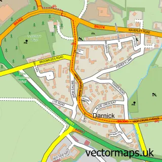
This Newstead street map is a detailed vector street map covering a 750m x 750m area. Select a larger area to create and download your own vector street map of Newstead.
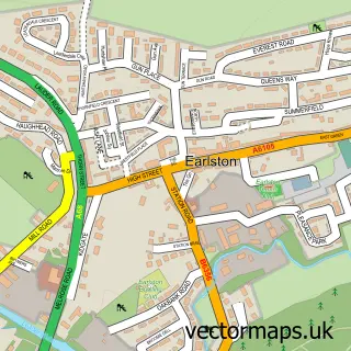
The 750-metre map sample for Newstead covers 103 mapped buildings and approximately 9.9 km of road detail, of which 12 named roads are named. The immediate area includes 1 GP surgery within 2 miles and 3 MOT stations within 2 miles. The wider area around Newstead features 2 tourism points of interest, 1 hotel and 1 campsite within 2 miles. To create a larger or custom map of Newstead, the map builder lets you define your own coverage area and download editable SVG, PDF and PNG files.
Create a larger editable map of Newstead
Choose any area you need and generate a high-quality vector map instantly. Perfect for print, planning, design, business and personal use.

This Newstead street map in Roxburgh, Ettrick and Lauderdale is available as downloadable SVG, PDF and PNG map files, or as a printed map for planning, business, display, education, local information and design work. You can also create a larger custom map area using the map selector.
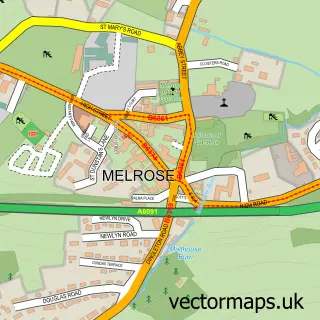
What this Newstead map sample shows
Newstead lies within Scottish Borders parish, part of Leaderdale And Melrose ward in the Scottish Borders local authority area. The postcode geography for this area includes the TD postcode area, the TD6 postcode district and the TD6 9 postcode sector. Residents fall under the Borders for NHS services.
Local features near Newstead
Within 2 milesAmenities and services in and around Newstead.
Administrative and postcode information for Newstead
Newstead lies within Scottish Borders parish, part of Leaderdale And Melrose ward in the Scottish Borders local authority area. The postcode geography for this area includes the TD postcode area, the TD6 postcode district and the TD6 9 postcode sector. Residents fall under the Borders for NHS services.
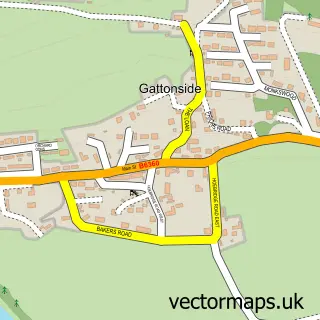
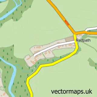
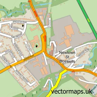
Nearby street map samples around Newstead

More street maps in Roxburgh, Ettrick and Lauderdale
750 metre map area coverage
Boundary, postcode and point of interest information for the 750m x 750m rectangle centred on this sample map.
Boundaries containing map centre
Constituency: Berwickshire, Roxburgh and Selkirk Co Const
District: Scottish Borders
Icb: Borders
Postcode District: TD6
Postcode Sector: TD6 9
Ward: Leaderdale and Melrose Ward
Nearby boundaries intersecting sample
No additional intersecting boundaries found.
Postcode coverage
POI category counts
Advertising Agency: 1
Alternative Medicine: 1
Beauty Salon: 1
Cottage: 1
Driving School: 1
Flowers And Gifts Shop: 1
Graphic Designer: 1
History Museum: 1
Hotel: 1
Museum: 1
Sample points of interest
- Paul McLean Graphic Design
- Border Hypnotherapy Centre
- Wilson's Professional Hair Stylists
- Hawthorn Cottage
- Callum Dickson a D I Driving Intuition Melrose
- Buttonmoon
- Pmgd
- Trimontium Roman Fort Site
- Melrose Self Catering Cottages
- Trimontium Trust
- Tweed Pest Control
- Newstead Village Community Trust
Create a larger editable map of Newstead
This sample shows only a 750 metre area. To create a larger map of Newstead, use our map builder to choose your own coverage area, add titles and download editable SVG, PDF and PNG files.
Create a custom map of Newstead