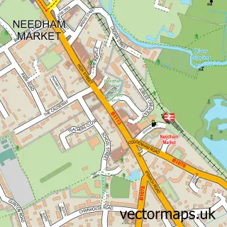
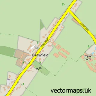
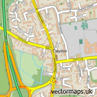
This Coddenham street map is a detailed vector street map covering a 750m x 750m area. Select a larger area to create and download your own vector street map of Coddenham.
The 750-metre map sample for Coddenham covers 141 mapped buildings and approximately 5.7 km of road detail, of which 10 named roads are named. The immediate area includes 1 pub and 1 MOT station within 2 miles. The wider area around Coddenham features 1 food and drink venue. To create a larger or custom map of Coddenham, the map builder lets you define your own coverage area and download editable SVG, PDF and PNG files.
Create a larger editable map of Coddenham
Choose any area you need and generate a high-quality vector map instantly. Perfect for print, planning, design, business and personal use.

This Coddenham street map in Suffolk is available as downloadable SVG, PDF and PNG map files, or as a printed map for planning, business, display, education, local information and design work. You can also create a larger custom map area using the map selector.
What this Coddenham map sample shows
Coddenham lies within Coddenham Cp parish, part of Claydon & Barham ward in the Mid Suffolk District local authority area. The postcode geography for this area includes the IP postcode area, the IP6 postcode district and the IP6 9 postcode sector. Residents fall under the Nhs Suffolk And North East Essex Integrated Care Board for NHS services.
Local features near Coddenham
Within 2 milesAmenities and services in and around Coddenham.
Administrative and postcode information for Coddenham
Coddenham lies within Coddenham Cp parish, part of Claydon & Barham ward in the Mid Suffolk District local authority area. The postcode geography for this area includes the IP postcode area, the IP6 postcode district and the IP6 9 postcode sector. Residents fall under the Nhs Suffolk And North East Essex Integrated Care Board for NHS services.
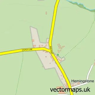
Nearby street map samples around Coddenham

More street maps in Suffolk
750 metre map area coverage
Boundary, postcode and point of interest information for the 750m x 750m rectangle centred on this sample map.
Boundaries containing map centre
Constituency: Central Suffolk and North Ipswich Co Const
County: Suffolk County
District: Mid Suffolk District
Icb: NHS Essex ICB
Parish: Coddenham CP
Police Force: suffolk
Postcode District: IP6
Postcode Sector: IP6 9
Ward: Claydon & Barham Ward
Nearby boundaries intersecting sample
Parish: Hemingstone CP
Postcode coverage
POI category counts
Church Cathedral: 2
Tree Services: 2
Amateur Sports Team: 1
Anglican Church: 1
Community Center: 1
Convenience Store: 1
Fabric Store: 1
Hair Salon: 1
Lodge: 1
Pub: 1
Sample points of interest
- Coddenham Athletic FC
- Coddenham, St Mary
- Playford Church
- St Marys Church Coddenham
- The Coddenham Centre
- Coddenham Community Shop
- Sarah Rose Soft Furnishings
- The Beauty Spot
- Broom Hill Self Catering Holiday Lodges
- Coddenham Country Club
- Helmingham Primary School & Nursery
- Post Office-Coddenham
Create a larger editable map of Coddenham
This sample shows only a 750 metre area. To create a larger map of Coddenham, use our map builder to choose your own coverage area, add titles and download editable SVG, PDF and PNG files.
Create a custom map of Coddenham