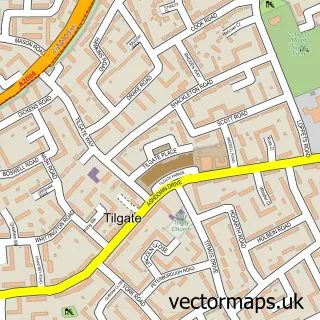
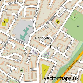
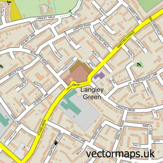
This Crawley street map is a detailed vector street map covering a 750m x 750m area. Select a larger area to create and download your own vector street map of Crawley.
The 750-metre map sample for Crawley covers 146 mapped buildings and approximately 14.9 km of road detail, of which 21 named roads are named. The immediate area includes 1 school, 12 GP surgeries within 2 miles, 1 pub and 2 MOT stations, with 25 within 2 miles. The wider area around Crawley features 3 tourism points of interest, 9 food and drink venues and 3 hotels. To create a larger or custom map of Crawley, the map builder lets you define your own coverage area and download editable SVG, PDF and PNG files.
Create a larger editable map of Crawley
Choose any area you need and generate a high-quality vector map instantly. Perfect for print, planning, design, business and personal use.

This Crawley street map in West Sussex is available as downloadable SVG, PDF and PNG map files, or as a printed map for planning, business, display, education, local information and design work. You can also create a larger custom map area using the map selector.
What this Crawley map sample shows
Crawley lies within West Sussex County parish, part of Three Bridges ward in the Crawley District (B) local authority area. The postcode geography for this area includes the RH postcode area, the RH10 postcode district and the RH10 1 postcode sector. Residents fall under the Nhs Sussex Integrated Care Board for NHS services.
Local features near Crawley
Within 2 milesAmenities and services in and around Crawley.
Administrative and postcode information for Crawley
The local authority covering Crawley is Crawley District (B), within the county of West Sussex. The settlement lies within Three Bridges ward and West Sussex County civil parish. The RH10 postcode district and RH10 1 postcode sector serve the immediate area. NHS provision in the area is delivered through Surrey And Sussex Healthcare Nhs Trust.
Nearby street map samples around Crawley

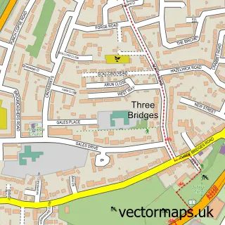
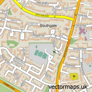
More street maps in West Sussex
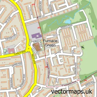
750 metre map area coverage
Boundary, postcode and point of interest information for the 750m x 750m rectangle centred on this sample map.
Boundaries containing map centre
Constituency: Crawley Boro Const
County: West Sussex County
District: Crawley District (B)
Icb: NHS Surrey and Sussex ICB
Police Force: sussex
Postcode District: RH10
Postcode Sector: RH10 6
Ward: Furnace Green Ward
Nearby boundaries intersecting sample
Postcode Sector: RH10 1, RH10 5
Ward: Southgate Ward, Three Bridges Ward, Tilgate Ward
Postcode coverage
POI category counts
Automotive Repair: 9
Clothing Store: 7
Building Supply Store: 6
Coffee Shop: 4
Hardware Store: 4
Retail: 4
Carpet Store: 3
Department Store: 3
Flowers And Gifts Shop: 3
Gift Shop: 3
Sample points of interest
- Inspire Fitness
- Ann Summers
- Smiggle
- Barclays ATM
- I & J Supplies
- Sawyers Autosmart
- Halfords Autocentres
- ARS Auto Repair Services
- Abbey Accident Autos
- Bss
- Harwoods Crawley Accident Repair Centre
- Jpnimports England
Create a larger editable map of Crawley
This sample shows only a 750 metre area. To create a larger map of Crawley, use our map builder to choose your own coverage area, add titles and download editable SVG, PDF and PNG files.
Create a custom map of Crawley