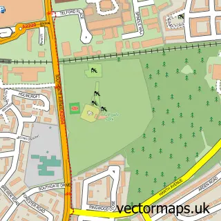
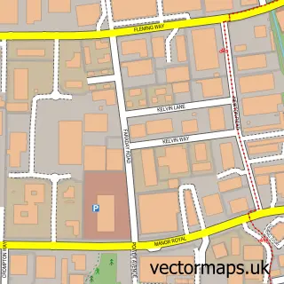
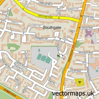
This Three Bridges street map is a detailed vector street map covering a 750m x 750m area. Select a larger area to create and download your own vector street map of Three Bridges.
The 750-metre map sample for Three Bridges covers 395 mapped buildings and approximately 18.8 km of road detail, of which 35 named roads are named. The immediate area includes 1 school, 1 GP surgery, with 9 within 2 miles, 3 pubs and 28 MOT stations within 2 miles. The wider area around Three Bridges features 1 tourism point of interest and 8 food and drink venues. To create a larger or custom map of Three Bridges, the map builder lets you define your own coverage area and download editable SVG, PDF and PNG files.
Create a larger editable map of Three Bridges
Choose any area you need and generate a high-quality vector map instantly. Perfect for print, planning, design, business and personal use.

This Three Bridges street map in West Sussex is available as downloadable SVG, PDF and PNG map files, or as a printed map for planning, business, display, education, local information and design work. You can also create a larger custom map area using the map selector.
What this Three Bridges map sample shows
Three Bridges lies within West Sussex County parish, part of Three Bridges ward in the Crawley District (B) local authority area. The postcode geography for this area includes the RH postcode area, the RH10 postcode district and the RH10 8 postcode sector. Residents fall under the Nhs Sussex Integrated Care Board for NHS services.
Local features near Three Bridges
Within 2 milesAmenities and services in and around Three Bridges.
Administrative and postcode information for Three Bridges
Three Bridges lies within West Sussex County parish, part of Three Bridges ward in the Crawley District (B) local authority area. The postcode geography for this area includes the RH postcode area, the RH10 postcode district and the RH10 8 postcode sector. Residents fall under the Nhs Sussex Integrated Care Board for NHS services.
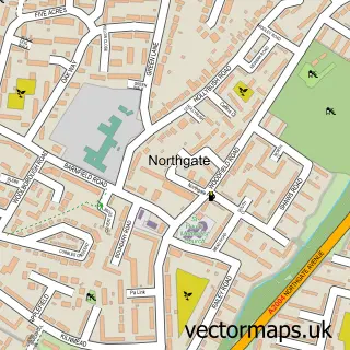
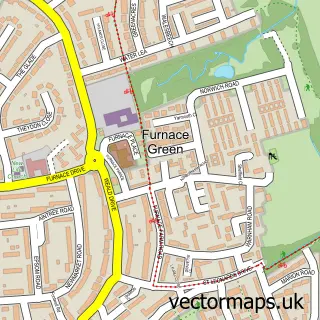
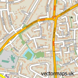
Nearby street map samples around Three Bridges

More street maps in West Sussex
750 metre map area coverage
Boundary, postcode and point of interest information for the 750m x 750m rectangle centred on this sample map.
Boundaries containing map centre
Constituency: Crawley Boro Const
County: West Sussex County
District: Crawley District (B)
Icb: NHS Surrey and Sussex ICB
Police Force: sussex
Postcode District: RH10
Postcode Sector: RH10 1
Ward: Three Bridges Ward
Nearby boundaries intersecting sample
Postcode Sector: RH10 8
Ward: Northgate & West Green Ward
Postcode coverage
POI category counts
Beauty Salon: 4
Building Supply Store: 4
Flowers And Gifts Shop: 4
Accountant: 3
Automotive Repair: 3
Chinese Restaurant: 3
Health And Medical: 3
Pub: 3
Anglican Church: 2
Bed And Breakfast: 2
Sample points of interest
- Curve Accountancy
- Taxave Accountancy
- Taxave Business Centre
- Infinity Media UK
- Church at St Richard’s, Three Bridges
- St Richard's Church
- Three Bridges Playing Field
- S&P Mobile Car Detailing and Valet
- J Long
- Paul Starling
- Protech Motor Services
- Bengal Spices
Create a larger editable map of Three Bridges
This sample shows only a 750 metre area. To create a larger map of Three Bridges, use our map builder to choose your own coverage area, add titles and download editable SVG, PDF and PNG files.
Create a custom map of Three Bridges