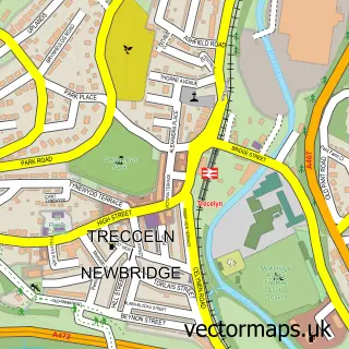
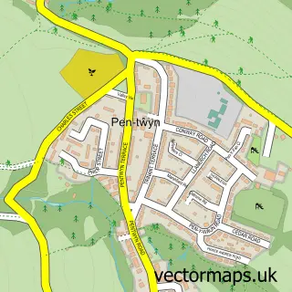
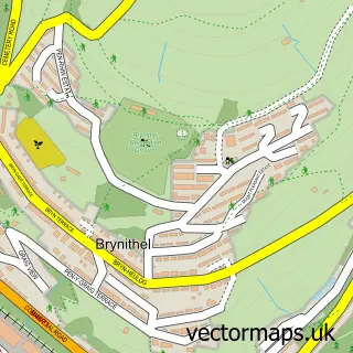
This Croespen-maen street map is a detailed vector street map covering a 750m x 750m area. Select a larger area to create and download your own vector street map of Croespen-maen.
The 750-metre map sample for Croespen-maen covers 438 mapped buildings and approximately 18.9 km of road detail, of which 28 named roads are named. The immediate area includes 1 GP surgery within 2 miles and 10 MOT stations within 2 miles. The wider area around Croespen-maen features 1 food and drink venue. To create a larger or custom map of Croespen-maen, the map builder lets you define your own coverage area and download editable SVG, PDF and PNG files.
Create a larger editable map of Croespen-maen
Choose any area you need and generate a high-quality vector map instantly. Perfect for print, planning, design, business and personal use.

This Croespen-maen street map in Gwent is available as downloadable SVG, PDF and PNG map files, or as a printed map for planning, business, display, education, local information and design work. You can also create a larger custom map area using the map selector.
What this Croespen-maen map sample shows
Croespen-maen lies within Penmaen Community parish, part of Penmaen ward in the Caerffili - Caerphilly local authority area. The postcode geography for this area includes the NP postcode area, the NP12 postcode district and the NP12 0 postcode sector. Residents fall under the Aneurin Bevan University Health Board for NHS services.
Local features near Croespen-maen
Within 2 milesAmenities and services in and around Croespen-maen.
Administrative and postcode information for Croespen-maen
The local authority covering Croespen-maen is Caerffili - Caerphilly, within the county of Gwent. The settlement lies within Penmaen ward and Penmaen Community civil parish. The NP12 postcode district and NP12 0 postcode sector serve the immediate area. NHS provision in the area is delivered through Aneurin Bevan University Health Board.
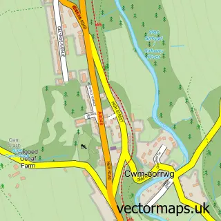
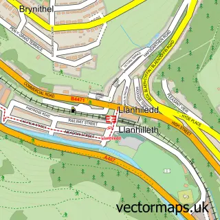
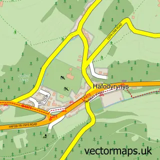
Nearby street map samples around Croespen-maen

More street maps in Gwent
750 metre map area coverage
Boundary, postcode and point of interest information for the 750m x 750m rectangle centred on this sample map.
Boundaries containing map centre
Constituency: Newport West and Islwyn Co Const
District: Caerffili - Caerphilly
Icb: Aneurin Bevan University
Parish: Crumlin Community
Police Force: gwent
Postcode District: NP11
Postcode Sector: NP11 3
Nearby boundaries intersecting sample
Parish: Penmaen Community
Postcode District: NP12
Postcode Sector: NP12 0, NP12 4
Postcode coverage
POI category counts
Building Supply Store: 3
Convenience Store: 3
Post Office: 2
Coffee Shop: 1
Commercial Industrial: 1
Community Services Non Profits: 1
Courier And Delivery Services: 1
Driving School: 1
Education: 1
Hardware Store: 1
Sample points of interest
- Dragon Insulations Limited
- Gaselec
- Oakwood Kitchens
- Costa Express
- A Schulman Inc
- Croespenmaen Community Hall
- Morrisons Daily
- Nisa Extra
- Nisa Stores
- Sameday Courier Services 786
- Ron Pepper
- J P Training Consultancy
Create a larger editable map of Croespen-maen
This sample shows only a 750 metre area. To create a larger map of Croespen-maen, use our map builder to choose your own coverage area, add titles and download editable SVG, PDF and PNG files.
Create a custom map of Croespen-maen