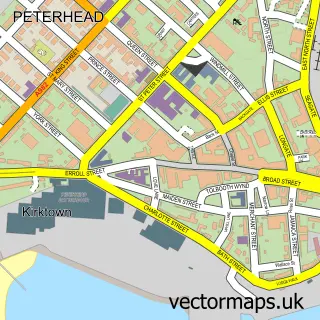
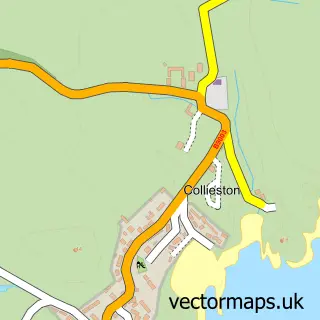
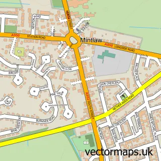
This Cruden Bay street map is a detailed vector street map covering a 750m x 750m area. Select a larger area to create and download your own vector street map of Cruden Bay.
The 750-metre map sample for Cruden Bay covers 129 mapped buildings and approximately 9.6 km of road detail, of which 16 named roads are named. The immediate area includes 1 pub and 1 MOT station. The wider area around Cruden Bay features 1 food and drink venue and 1 hotel. To create a larger or custom map of Cruden Bay, the map builder lets you define your own coverage area and download editable SVG, PDF and PNG files.
Create a larger editable map of Cruden Bay
Choose any area you need and generate a high-quality vector map instantly. Perfect for print, planning, design, business and personal use.

This Cruden Bay street map in Aberdeenshire is available as downloadable SVG, PDF and PNG map files, or as a printed map for planning, business, display, education, local information and design work. You can also create a larger custom map area using the map selector.
What this Cruden Bay map sample shows
Cruden Bay lies within Aberdeenshire parish, part of Peterhead South And Cruden ward in the Aberdeenshire local authority area. The postcode geography for this area includes the AB postcode area, the AB42 postcode district and the AB42 0 postcode sector. Residents fall under the Grampian for NHS services.
Local features near Cruden Bay
Within 2 milesAmenities and services in and around Cruden Bay.
Administrative and postcode information for Cruden Bay
The local authority covering Cruden Bay is Aberdeenshire, within the county of Aberdeenshire. The settlement lies within Peterhead South And Cruden ward and Aberdeenshire civil parish. The AB42 postcode district and AB42 0 postcode sector serve the immediate area. NHS provision in the area is delivered through Grampian.
Nearby street map samples around Cruden Bay

More street maps in Aberdeenshire
750 metre map area coverage
Boundary, postcode and point of interest information for the 750m x 750m rectangle centred on this sample map.
Boundaries containing map centre
Constituency: Aberdeenshire North and Moray East Co Const
District: Aberdeenshire
Icb: Grampian
Postcode District: AB42
Postcode Sector: AB42 0
Ward: Peterhead South and Cruden Ward
Nearby boundaries intersecting sample
No additional intersecting boundaries found.
Postcode coverage
POI category counts
Bed And Breakfast: 4
Pharmacy: 2
Automotive Repair: 1
Bar: 1
Beach: 1
Beauty And Spa: 1
Beauty Salon: 1
Church Cathedral: 1
Doctor: 1
Elementary School: 1
Sample points of interest
- Cruden Bay Garage Ltd
- The Fairway
- Cruden Bay
- Enhanced by Hannah
- Relax Beauty & Care
- By the Bay Bed and Breakfast
- Cruden Bay Bed & Breakfast
- Cruden Bay Bed & Breakfast
- Outlander Boutique B&B Cruden Bay
- Cruden Bay Congregational Church
- Cruden Medical Group (Aulton Road)
- Port Erroll School
Create a larger editable map of Cruden Bay
This sample shows only a 750 metre area. To create a larger map of Cruden Bay, use our map builder to choose your own coverage area, add titles and download editable SVG, PDF and PNG files.
Create a custom map of Cruden Bay