Vector Maps logo
Home Why it works Popular maps Districts Samples Customizer Create Your Map
VectorMaps.uk
Home Popular maps Districts Samples Customizer Create Your Map Privacy Disclaimer
Home / UK Maps / Aberdeenshire / Longside Map

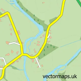
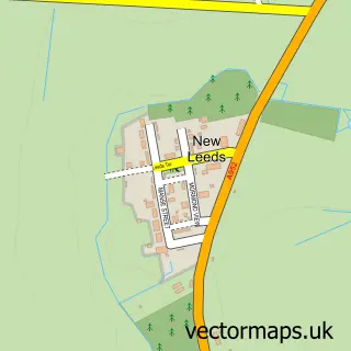
This Longside street map is a detailed vector street map covering a 750m x 750m area. Select a larger area to create and download your own vector street map of Longside.

Longside is a village in Aberdeenshire, in the North East Scotland of Scotland. The settlement falls within the Banff And Buchan parliamentary constituency. It is served by the AB42 postcode district, with AB42 4 as the local postcode sector.

The 750-metre map sample for Longside covers 131 mapped buildings and approximately 16.6 km of road detail, of which 20 named roads are named. The immediate area includes 1 MOT station, with 2 within 2 miles. The wider area around Longside features 2 food and drink venues. To create a larger or custom map of Longside, the map builder lets you define your own coverage area and download editable SVG, PDF and PNG files.

131Buildings
16.63 kmRoads
20Named roads
0Residents within 2 miles
Create your own

Create a larger editable map of Longside

Choose any area you need and generate a high-quality vector map instantly. Perfect for print, planning, design, business and personal use.

Choose any location
Editable SVG files
Any size up to A0
PDF, PNG & more
Instant download
High quality guaranteed
Create My Custom Map
Secure, private & no credit card required
Longside Vector Street Map
750m Sample
Longside vector street map sample showing roads, buildings and local features in a 750 metre preview area
Buy Longside Map Print from £12.95 Buy Longside Digital Map from £6

This Longside street map in Aberdeenshire is available as downloadable SVG, PDF and PNG map files, or as a printed map for planning, business, display, education, local information and design work. You can also create a larger custom map area using the map selector.

What this Longside map sample shows

Longside lies within Aberdeenshire parish, part of Central Buchan ward in the Aberdeenshire local authority area. The postcode geography for this area includes the AB postcode area, the AB42 postcode district and the AB42 4 postcode sector. Residents fall under the Grampian for NHS services.

Local features near Longside

Within 2 miles

Amenities and services in and around Longside.

1 MOT stations 2 within 2 miles
2 Food & drink

Counts are approximate and based on publicly available data.

Administrative and postcode information for Longside

Longside lies within Aberdeenshire parish, part of Central Buchan ward in the Aberdeenshire local authority area. The postcode geography for this area includes the AB postcode area, the AB42 postcode district and the AB42 4 postcode sector. Residents fall under the Grampian for NHS services.

Parish ABERDEENSHIRE
Ward Central Buchan
District / local authority Aberdeenshire
County Aberdeenshire
Historic county Aberdeenshire
Postcode district AB42
Postcode sector AB42 4
Parliamentary constituency Banff and Buchan
Region North East Scotland
Country Scotland

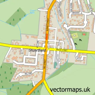
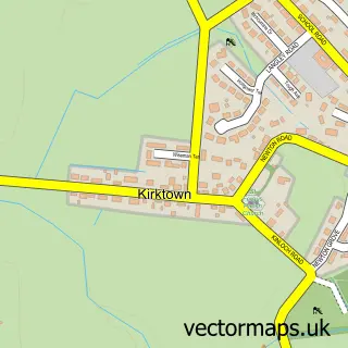
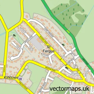
Nearby street map samples around Longside

Street map sample of Peterhead, Aberdeenshire Peterhead Town - Aberdeenshire - 5.9 miles Street map sample of Aberdeen, City of Aberdeen Aberdeen City - City of Aberdeen - 26.1 miles Street map sample of Mintlaw, Aberdeenshire Mintlaw Village - Aberdeenshire - 2.3 miles Street map sample of Old Deer, Aberdeenshire Old Deer Village - Aberdeenshire - 3.7 miles Street map sample of Fetterangus, Aberdeenshire Fetterangus Village - Aberdeenshire - 3.8 miles Street map sample of Inverugie, Aberdeenshire Inverugie Village - Aberdeenshire - 4.0 miles Street map sample of Stuartfield, Aberdeenshire Stuartfield Village - Aberdeenshire - 4.1 miles Street map sample of Kirktown, Aberdeenshire Kirktown Village - Aberdeenshire - 4.4 miles Street map sample of St Fergus, Aberdeenshire St Fergus Village - Aberdeenshire - 4.7 miles Street map sample of New Leeds, Aberdeenshire New Leeds Village - Aberdeenshire - 5.2 miles

More street maps in Aberdeenshire

Street map sample of Mintlaw, Aberdeenshire Mintlaw Village - 2.3 miles Street map sample of Old Deer, Aberdeenshire Old Deer Village - 3.7 miles Street map sample of Fetterangus, Aberdeenshire Fetterangus Village - 3.8 miles Street map sample of Inverugie, Aberdeenshire Inverugie Village - 4.0 miles Street map sample of Stuartfield, Aberdeenshire Stuartfield Village - 4.1 miles

750 metre map area coverage

Boundary, postcode and point of interest information for the 750m x 750m rectangle centred on this sample map.

Boundaries containing map centre

Constituency: Aberdeenshire North and Moray East Co Const

District: Aberdeenshire

Icb: Grampian

Postcode District: AB42

Postcode Sector: AB42 4

Ward: Central Buchan Ward

Nearby boundaries intersecting sample

No additional intersecting boundaries found.

Postcode coverage

AB42 AB42 4

POI category counts

Beauty Salon: 2

Post Office: 2

Sports Club And League: 2

Automotive: 1

Automotive Parts And Accessories: 1

Bridal Shop: 1

Cafe: 1

Car Dealer: 1

Catholic Church: 1

Church Cathedral: 1

Sample points of interest

  • Cairngall Motor Services Automotive
  • Halfords Automotive Parts And Accessories
  • Beautannics Beauty Salon
  • Sassy Face Beauty Salon
  • CM Bridal and Evening Designs Bridal Shop
  • Country Cravings Cafe
  • Duthie Motors Car Dealer
  • Longside Catholic Church
  • Longside Parish Church Church Cathedral
  • SYMPOSIUM coffee house Longside Coffee Shop
  • Premier Convenience Store
  • Longside Driving School Driving School

Create a larger editable map of Longside

This sample shows only a 750 metre area. To create a larger map of Longside, use our map builder to choose your own coverage area, add titles and download editable SVG, PDF and PNG files.

Create a custom map of Longside

Phone 01751 473136 | Copyright Vectormaps.uk 2026

Samples Customizer Privacy Disclaimer
Longside Vector Street Map
Longside enlarged street map sample showing a 750 metre preview area