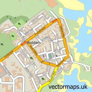
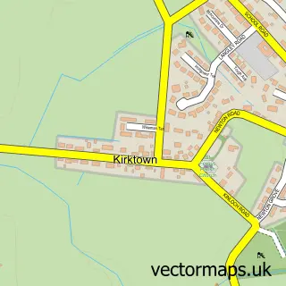
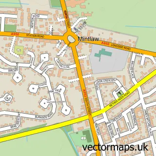
This Peterhead street map is a detailed vector street map covering a 750m x 750m area. Select a larger area to create and download your own vector street map of Peterhead.
The 750-metre map sample for Peterhead covers 99 mapped buildings and approximately 18.8 km of road detail, of which 45 named roads are named. The immediate area includes 1 GP surgery within 2 miles, 7 pubs and 2 MOT stations, with 9 within 2 miles. The wider area around Peterhead features 4 tourism points of interest, 16 food and drink venues and 10 hotels. To create a larger or custom map of Peterhead, the map builder lets you define your own coverage area and download editable SVG, PDF and PNG files.
Create a larger editable map of Peterhead
Choose any area you need and generate a high-quality vector map instantly. Perfect for print, planning, design, business and personal use.

This Peterhead street map in Aberdeenshire is available as downloadable SVG, PDF and PNG map files, or as a printed map for planning, business, display, education, local information and design work. You can also create a larger custom map area using the map selector.
What this Peterhead map sample shows
Peterhead lies within Aberdeenshire parish, part of Peterhead North And Rattray ward in the Aberdeenshire local authority area. The postcode geography for this area includes the AB postcode area, the AB42 postcode district and the AB42 2 postcode sector. Residents fall under the Grampian for NHS services.
Local features near Peterhead
Within 2 milesAmenities and services in and around Peterhead.
Administrative and postcode information for Peterhead
The local authority covering Peterhead is Aberdeenshire, within the county of Aberdeenshire. The settlement lies within Peterhead North And Rattray ward and Aberdeenshire civil parish. The AB42 postcode district and AB42 2 postcode sector serve the immediate area. NHS provision in the area is delivered through Grampian.
Nearby street map samples around Peterhead

More street maps in Aberdeenshire
750 metre map area coverage
Boundary, postcode and point of interest information for the 750m x 750m rectangle centred on this sample map.
Boundaries containing map centre
Constituency: Aberdeenshire North and Moray East Co Const
District: Aberdeenshire
Icb: Grampian
Postcode District: AB42
Postcode Sector: AB42 1
Ward: Peterhead North and Rattray Ward
Nearby boundaries intersecting sample
No additional intersecting boundaries found.
Postcode coverage
POI category counts
Beauty Salon: 20
Hair Salon: 10
Hotel: 10
Bakery: 7
Bank Credit Union: 7
Church Cathedral: 7
Flowers And Gifts Shop: 7
Professional Services: 7
Pub: 7
Bed And Breakfast: 6
Sample points of interest
- Blue Star Guest House
- Aberdein Considine
- Goldwells
- Millennium Leisure, Health & Fitness Club
- Olympia Nutrition & Bodybuilding
- North East Weekly
- Kai's Curiosities
- Life Skills
- Little Potters
- Peterhead Scottish Week
- Hawco Peterhead
- Peterhead Car Medic
Create a larger editable map of Peterhead
This sample shows only a 750 metre area. To create a larger map of Peterhead, use our map builder to choose your own coverage area, add titles and download editable SVG, PDF and PNG files.
Create a custom map of Peterhead