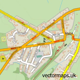
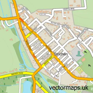
This Old Deer street map is a detailed vector street map covering a 750m x 750m area. Select a larger area to create and download your own vector street map of Old Deer.
The 750-metre map sample for Old Deer covers 91 mapped buildings and approximately 8.7 km of road detail, of which 5 named roads are named. The immediate area includes 1 GP surgery within 2 miles and 3 MOT stations within 2 miles. The wider area around Old Deer features 1 tourism point of interest, 1 hotel and 1 campsite within 2 miles. To create a larger or custom map of Old Deer, the map builder lets you define your own coverage area and download editable SVG, PDF and PNG files.
Create a larger editable map of Old Deer
Choose any area you need and generate a high-quality vector map instantly. Perfect for print, planning, design, business and personal use.

This Old Deer street map in Aberdeenshire is available as downloadable SVG, PDF and PNG map files, or as a printed map for planning, business, display, education, local information and design work. You can also create a larger custom map area using the map selector.
What this Old Deer map sample shows
Old Deer lies within Aberdeenshire parish, part of Central Buchan ward in the Aberdeenshire local authority area. The postcode geography for this area includes the AB postcode area, the AB42 postcode district and the AB42 5 postcode sector. Residents fall under the Grampian for NHS services.
Local features near Old Deer
Within 2 milesAmenities and services in and around Old Deer.
Administrative and postcode information for Old Deer
The local authority covering Old Deer is Aberdeenshire, within the county of Aberdeenshire. The settlement lies within Central Buchan ward and Aberdeenshire civil parish. The AB42 postcode district and AB42 5 postcode sector serve the immediate area. NHS provision in the area is delivered through Grampian.
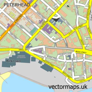
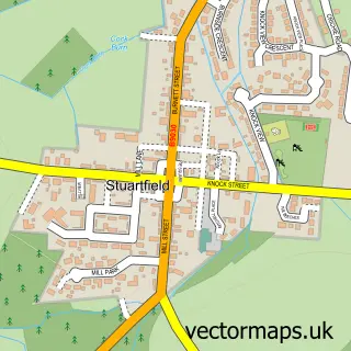
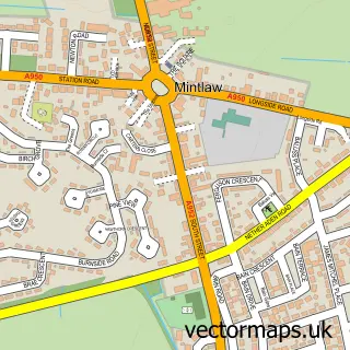
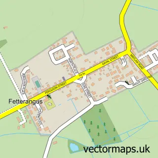
Nearby street map samples around Old Deer

More street maps in Aberdeenshire
750 metre map area coverage
Boundary, postcode and point of interest information for the 750m x 750m rectangle centred on this sample map.
Boundaries containing map centre
Constituency: Gordon and Buchan Co Const
District: Aberdeenshire
Icb: Grampian
Postcode District: AB42
Postcode Sector: AB42 5
Ward: Central Buchan Ward
Nearby boundaries intersecting sample
Postcode Sector: AB42 4
Postcode coverage
POI category counts
Church Cathedral: 2
Bed And Breakfast: 1
Building Supply Store: 1
Electrician: 1
Fountain: 1
Hotel: 1
Metal Fabricator: 1
Museum: 1
Sporting Goods: 1
Weight Loss Center: 1
Sample points of interest
- Aden House
- MSM Electrical Services
- Deer Parish Church
- St Drostans Episcopal Church
- MSM Electrical Services
- Aikey Brae Stone Circle
- Aden Arms
- Thistle Marine (Peterhead)
- Aberdeenshire Farming Museum
- Golf Addict
- Slimming World With Corrie, Old Deer
Create a larger editable map of Old Deer
This sample shows only a 750 metre area. To create a larger map of Old Deer, use our map builder to choose your own coverage area, add titles and download editable SVG, PDF and PNG files.
Create a custom map of Old Deer