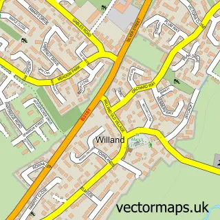
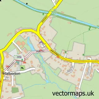
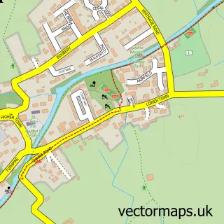
This Cullompton street map is a detailed vector street map covering a 750m x 750m area. Select a larger area to create and download your own vector street map of Cullompton.
The 750-metre map sample for Cullompton covers 364 mapped buildings and approximately 14.0 km of road detail, of which 33 named roads are named. The immediate area includes 1 school, 1 GP surgery, with 2 within 2 miles, 4 pubs and 7 MOT stations within 2 miles. The wider area around Cullompton features 3 tourism points of interest, 7 food and drink venues and 2 hotels. To create a larger or custom map of Cullompton, the map builder lets you define your own coverage area and download editable SVG, PDF and PNG files.
Create a larger editable map of Cullompton
Choose any area you need and generate a high-quality vector map instantly. Perfect for print, planning, design, business and personal use.

This Cullompton street map in Devon is available as downloadable SVG, PDF and PNG map files, or as a printed map for planning, business, display, education, local information and design work. You can also create a larger custom map area using the map selector.
What this Cullompton map sample shows
Cullompton lies within Cullompton Cp parish, part of Cullompton North ward in the Mid Devon District local authority area. The postcode geography for this area includes the EX postcode area, the EX15 postcode district and the EX15 1 postcode sector. Residents fall under the Nhs Devon Integrated Care Board for NHS services.
Local features near Cullompton
Within 2 milesAmenities and services in and around Cullompton.
Administrative and postcode information for Cullompton
The local authority covering Cullompton is Mid Devon District, within the county of Devon. The settlement lies within Cullompton North ward and Cullompton Cp civil parish. The EX15 postcode district and EX15 1 postcode sector serve the immediate area. NHS provision in the area is delivered through Royal Devon University Healthcare Nhs Foundation Trust.
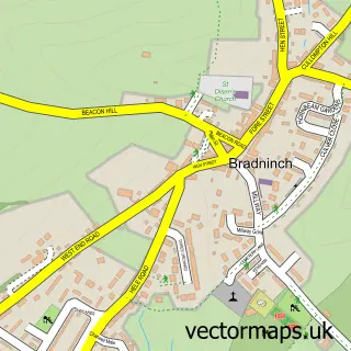
Nearby street map samples around Cullompton

More street maps in Devon
750 metre map area coverage
Boundary, postcode and point of interest information for the 750m x 750m rectangle centred on this sample map.
Boundaries containing map centre
Constituency: Honiton and Sidmouth Co Const
County: Devon County
District: Mid Devon District
Icb: NHS Devon ICB
Parish: Cullompton CP
Police Force: devon and cornwall
Postcode District: EX15
Postcode Sector: EX15 1
Ward: Cullompton St. Andrews Ward
Nearby boundaries intersecting sample
Ward: Cullompton Padbrook Ward
Postcode coverage
POI category counts
Beauty And Spa: 7
Hair Salon: 7
Dentist: 6
Real Estate Agent: 6
Beauty Salon: 5
Charity Organization: 5
Flowers And Gifts Shop: 5
Professional Services: 5
Bakery: 4
Banks: 4
Sample points of interest
- Batchelor & Co
- Mortimore & Co.
- Mortimore and Co Chartered Certified Accountants
- Adopstar Ltd
- Foxhill View Poultry
- Eastern Eye
- St Andrew's Church
- Michael Speirs Associates
- Vik Westaway Art
- China Orchids
- Tiverton Field Events - Car Boot Sale
- A&M Coatings & Line-X Cullompton
Create a larger editable map of Cullompton
This sample shows only a 750 metre area. To create a larger map of Cullompton, use our map builder to choose your own coverage area, add titles and download editable SVG, PDF and PNG files.
Create a custom map of Cullompton