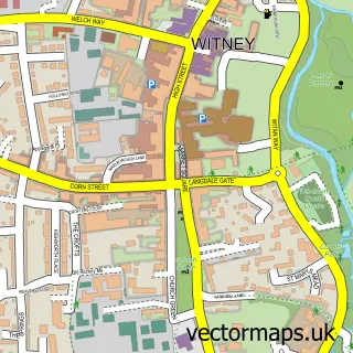
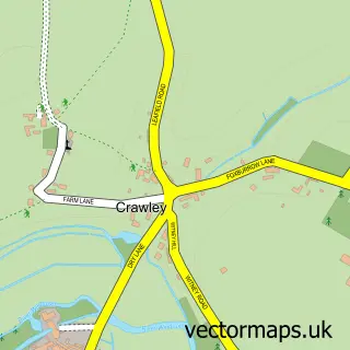
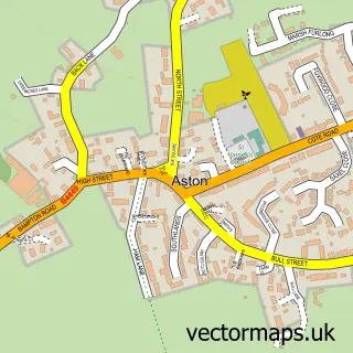
This Curbridge street map is a detailed vector street map covering a 750m x 750m area. Select a larger area to create and download your own vector street map of Curbridge.
The 750-metre map sample for Curbridge covers 129 mapped buildings and approximately 20.4 km of road detail, of which 5 named roads are named. The immediate area includes 2 GP surgeries within 2 miles and 15 MOT stations within 2 miles. The wider area around Curbridge features 1 food and drink venue. To create a larger or custom map of Curbridge, the map builder lets you define your own coverage area and download editable SVG, PDF and PNG files.
Create a larger editable map of Curbridge
Choose any area you need and generate a high-quality vector map instantly. Perfect for print, planning, design, business and personal use.

This Curbridge street map in Oxfordshire is available as downloadable SVG, PDF and PNG map files, or as a printed map for planning, business, display, education, local information and design work. You can also create a larger custom map area using the map selector.
What this Curbridge map sample shows
Curbridge lies within Curbridge Cp parish, part of Ducklington ward in the West Oxfordshire District local authority area. The postcode geography for this area includes the OX postcode area, the OX29 postcode district and the OX29 7 postcode sector. Residents fall under the Nhs Buckinghamshire, Oxfordshire And Berkshire West Integrated Care Board for NHS services.
Local features near Curbridge
Within 2 milesAmenities and services in and around Curbridge.
Administrative and postcode information for Curbridge
Curbridge lies within Curbridge Cp parish, part of Ducklington ward in the West Oxfordshire District local authority area. The postcode geography for this area includes the OX postcode area, the OX29 postcode district and the OX29 7 postcode sector. Residents fall under the Nhs Buckinghamshire, Oxfordshire And Berkshire West Integrated Care Board for NHS services.
Nearby street map samples around Curbridge

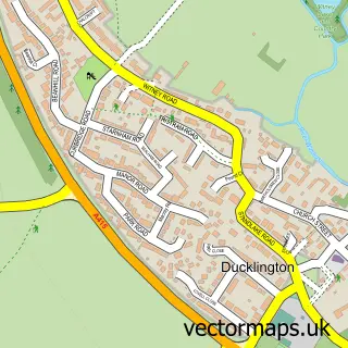
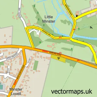
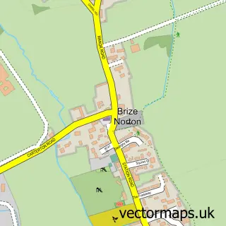
More street maps in Oxfordshire
750 metre map area coverage
Boundary, postcode and point of interest information for the 750m x 750m rectangle centred on this sample map.
Boundaries containing map centre
Constituency: Witney Co Const
County: Oxfordshire County
District: West Oxfordshire District
Icb: NHS Thames Valley ICB
Parish: Curbridge CP
Police Force: thames valley
Postcode District: OX29
Postcode Sector: OX29 7
Ward: Ducklington Ward
Nearby boundaries intersecting sample
Parish: Witney CP
Ward: Witney West Ward
Postcode coverage
POI category counts
Anglican Church: 1
Appliance Repair Service: 1
Bakery: 1
Building Supply Store: 1
General Dentistry: 1
Pet Boarding: 1
Restaurant: 1
Software Development: 1
Sports Club And League: 1
Town Hall: 1
Sample points of interest
- St. John the Baptist
- Edward Stuart Restoration
- Caked in It
- S E Electrical Services
- Curbridge Dental Hygiene Care
- Muddy Paws Dog Walking, Boarding and Day Care
- Caked In It - Wedding And Celebration Cakes
- Metaxis Ltd
- Tatty Bumpkin Oxford
- Curbridge Parish Hall
Create a larger editable map of Curbridge
This sample shows only a 750 metre area. To create a larger map of Curbridge, use our map builder to choose your own coverage area, add titles and download editable SVG, PDF and PNG files.
Create a custom map of Curbridge