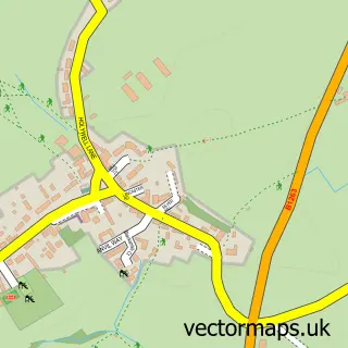
This Dalton-on-Tees street map is a detailed vector street map covering a 750m x 750m area. Select a larger area to create and download your own vector street map of Dalton-on-Tees.
The 750-metre map sample for Dalton-on-Tees covers 81 mapped buildings and approximately 9.9 km of road detail, of which 5 named roads are named. The immediate area includes 1 GP surgery within 2 miles, 2 pubs and 1 MOT station within 2 miles. The wider area around Dalton-on-Tees features 3 food and drink venues. To create a larger or custom map of Dalton-on-Tees, the map builder lets you define your own coverage area and download editable SVG, PDF and PNG files.
Create a larger editable map of Dalton-on-Tees
Choose any area you need and generate a high-quality vector map instantly. Perfect for print, planning, design, business and personal use.

This Dalton-on-Tees street map in North Yorkshire is available as downloadable SVG, PDF and PNG map files, or as a printed map for planning, business, display, education, local information and design work. You can also create a larger custom map area using the map selector.
What this Dalton-on-Tees map sample shows
Dalton-on-Tees lies within Dalton-On-Tees Cp parish, part of Croft & Middleton Tyas ward in the North Yorkshire local authority area. The postcode geography for this area includes the DL postcode area, the DL2 postcode district and the DL2 2 postcode sector. Residents fall under the Nhs Humber And North Yorkshire Integrated Care Board for NHS services.
Local features near Dalton-on-Tees
Within 2 milesAmenities and services in and around Dalton-on-Tees.
Administrative and postcode information for Dalton-on-Tees
The local authority covering Dalton-on-Tees is North Yorkshire, within the county of North Yorkshire. The settlement lies within Croft & Middleton Tyas ward and Dalton-On-Tees Cp civil parish. The DL2 postcode district and DL2 2 postcode sector serve the immediate area. NHS provision in the area is delivered through South Tees Hospitals Nhs Foundation Trust.
Nearby street map samples around Dalton-on-Tees
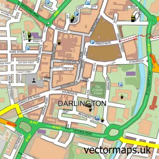

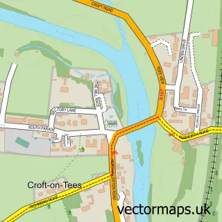

More street maps in North Yorkshire
750 metre map area coverage
Boundary, postcode and point of interest information for the 750m x 750m rectangle centred on this sample map.
Boundaries containing map centre
Constituency: Richmond and Northallerton Co Const
District: North Yorkshire
Icb: NHS Humber and North Yorkshire ICB
Parish: Dalton-on-Tees CP
Police Force: north yorkshire
Postcode District: DL2
Postcode Sector: DL2 2
Nearby boundaries intersecting sample
Parish: Croft-on-Tees CP
Postcode coverage
POI category counts
Pub: 2
Roofing: 2
Community Center: 1
Naturopathic Holistic: 1
Restaurant: 1
Sample points of interest
- Dalton on Tees Village Hall
- Debbie Bell Hypnotherapy
- Chequers Inn
- The Chequers Inn
- Cask Marque Chequers Inn Darlington
- Darlington Roofing Contractors
- Kearney Roofing
Create a larger editable map of Dalton-on-Tees
This sample shows only a 750 metre area. To create a larger map of Dalton-on-Tees, use our map builder to choose your own coverage area, add titles and download editable SVG, PDF and PNG files.
Create a custom map of Dalton-on-Tees