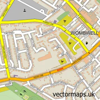
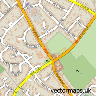
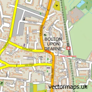
This Darfield street map is a detailed vector street map covering a 750m x 750m area. Select a larger area to create and download your own vector street map of Darfield.
The 750-metre map sample for Darfield covers 652 mapped buildings and approximately 19.8 km of road detail, of which 51 named roads are named. The immediate area includes 1 school, 1 GP surgery, with 3 within 2 miles, 3 pubs and 1 MOT station, with 9 within 2 miles. The wider area around Darfield features 2 tourism points of interest, 6 food and drink venues and 1 hotel. To create a larger or custom map of Darfield, the map builder lets you define your own coverage area and download editable SVG, PDF and PNG files.
Create a larger editable map of Darfield
Choose any area you need and generate a high-quality vector map instantly. Perfect for print, planning, design, business and personal use.

This Darfield street map in South Yorkshire is available as downloadable SVG, PDF and PNG map files, or as a printed map for planning, business, display, education, local information and design work. You can also create a larger custom map area using the map selector.
What this Darfield map sample shows
Darfield lies within Barnsley District (B) parish, part of Darfield ward in the Barnsley District (B) local authority area. The postcode geography for this area includes the S postcode area, the S73 postcode district and the S73 9 postcode sector. Residents fall under the Nhs South Yorkshire Integrated Care Board for NHS services.
Local features near Darfield
Within 2 milesAmenities and services in and around Darfield.
Administrative and postcode information for Darfield
Darfield lies within Barnsley District (B) parish, part of Darfield ward in the Barnsley District (B) local authority area. The postcode geography for this area includes the S postcode area, the S73 postcode district and the S73 9 postcode sector. Residents fall under the Nhs South Yorkshire Integrated Care Board for NHS services.
Nearby street map samples around Darfield

More street maps in South Yorkshire
750 metre map area coverage
Boundary, postcode and point of interest information for the 750m x 750m rectangle centred on this sample map.
Boundaries containing map centre
Constituency: Barnsley South Co Const
District: Barnsley District (B)
Icb: NHS South Yorkshire ICB
Police Force: south yorkshire
Postcode District: S73
Postcode Sector: S73 9
Ward: Darfield Ward
Nearby boundaries intersecting sample
No additional intersecting boundaries found.
Postcode coverage
POI category counts
Beauty Salon: 4
Convenience Store: 4
Business Management Services: 3
Dentist: 3
Pharmacy: 3
Pub: 3
Building Contractor: 2
Coffee Shop: 2
Dance School: 2
Fitness Trainer: 2
Sample points of interest
- Radar dog rescue
- InstaVolt Charging Station
- Whites
- Jazz at the Centre
- Top cut Barbers
- Moodyhair
- Clares Tan & Beauty
- Lisa's New Creations
- Studio 95 - Lashes by Hanna
- The Beauty Parlour
- Coral
- ALANDA Construction
Create a larger editable map of Darfield
This sample shows only a 750 metre area. To create a larger map of Darfield, use our map builder to choose your own coverage area, add titles and download editable SVG, PDF and PNG files.
Create a custom map of Darfield