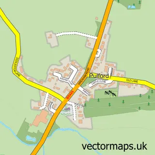
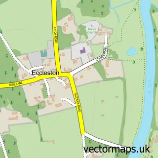
This Dodleston street map is a detailed vector street map covering a 750m x 750m area. Select a larger area to create and download your own vector street map of Dodleston.
The 750-metre map sample for Dodleston covers 232 mapped buildings and approximately 10.5 km of road detail, of which 10 named roads are named. The immediate area includes 1 school, 1 pub and 1 MOT station within 2 miles. The wider area around Dodleston features 3 tourism points of interest and 2 food and drink venues. To create a larger or custom map of Dodleston, the map builder lets you define your own coverage area and download editable SVG, PDF and PNG files.
Create a larger editable map of Dodleston
Choose any area you need and generate a high-quality vector map instantly. Perfect for print, planning, design, business and personal use.

This Dodleston street map in Cheshire is available as downloadable SVG, PDF and PNG map files, or as a printed map for planning, business, display, education, local information and design work. You can also create a larger custom map area using the map selector.
What this Dodleston map sample shows
Dodleston lies within Dodleston Cp parish, part of Christleton & Huntington ward in the Cheshire West And Chester (B) local authority area. The postcode geography for this area includes the CH postcode area, the CH4 postcode district and the CH4 9 postcode sector. Residents fall under the Nhs Cheshire And Merseyside Integrated Care Board for NHS services.
Local features near Dodleston
Within 2 milesAmenities and services in and around Dodleston.
Administrative and postcode information for Dodleston
Dodleston lies within Dodleston Cp parish, part of Christleton & Huntington ward in the Cheshire West And Chester (B) local authority area. The postcode geography for this area includes the CH postcode area, the CH4 postcode district and the CH4 9 postcode sector. Residents fall under the Nhs Cheshire And Merseyside Integrated Care Board for NHS services.
Nearby street map samples around Dodleston


More street maps in Cheshire
750 metre map area coverage
Boundary, postcode and point of interest information for the 750m x 750m rectangle centred on this sample map.
Boundaries containing map centre
Constituency: Chester South and Eddisbury Co Const
District: Cheshire West and Chester (B)
Icb: NHS Cheshire and Merseyside ICB
Parish: Dodleston CP
Police Force: cheshire
Postcode District: CH4
Postcode Sector: CH4 9
Ward: Christleton & Huntington Ward
Nearby boundaries intersecting sample
No additional intersecting boundaries found.
Postcode coverage
POI category counts
Post Office: 3
Church Cathedral: 2
Anglican Church: 1
Attractions And Activities: 1
Automotive Repair: 1
Beer Bar: 1
Business Consulting: 1
Castle: 1
Corporate Office: 1
Dance School: 1
Sample points of interest
- St Mary's Church
- Cricket Field
- prep'n'check
- The Red Lion
- Augmentis
- Dodlestone Castle
- St Mary C of E Church
- St. Mary's Church, Dodleston
- Cheshire SEO - Digital Marketing Agency
- Sophie Gallie Dance Academy
- Chester Market Car Park
- Chapel Stores Dodleston
Create a larger editable map of Dodleston
This sample shows only a 750 metre area. To create a larger map of Dodleston, use our map builder to choose your own coverage area, add titles and download editable SVG, PDF and PNG files.
Create a custom map of Dodleston