Vector Maps logo
Home Why it works Popular maps Districts Samples Customizer Create Your Map
VectorMaps.uk
Home Popular maps Districts Samples Customizer Create Your Map Privacy Disclaimer
Home / UK Maps / Greater Manchester / Dukinfield Map

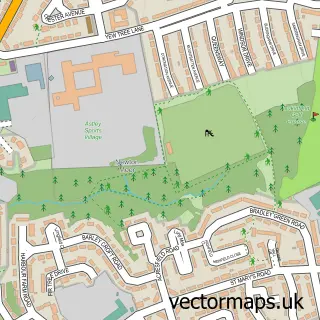
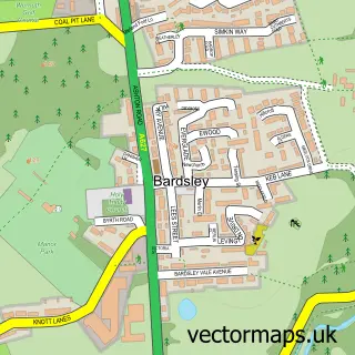
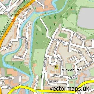
This Dukinfield street map is a detailed vector street map covering a 750m x 750m area. Select a larger area to create and download your own vector street map of Dukinfield.

Dukinfield is a town in Greater Manchester, in the North West of England. Historically, the area formed part of Cheshire. The settlement falls within the Denton And Reddish parliamentary constituency. It is served by the SK16 postcode district, with SK16

The 750-metre map sample for Dukinfield covers 397 mapped buildings and approximately 20.3 km of road detail, of which 48 named roads are named. The immediate area includes 1 school, 2 GP surgeries, with 20 within 2 miles, 4 pubs and 50 MOT stations within 2 miles. The wider area around Dukinfield features 3 tourism points of interest and 6 food and drink venues. To create a larger or custom map of Dukinfield, the map builder lets you define your own coverage area and download editable SVG, PDF and PNG files.

397Buildings
20.27 kmRoads
48Named roads
54,810Residents within 2 miles
Create your own

Create a larger editable map of Dukinfield

Choose any area you need and generate a high-quality vector map instantly. Perfect for print, planning, design, business and personal use.

Choose any location
Editable SVG files
Any size up to A0
PDF, PNG & more
Instant download
High quality guaranteed
Create My Custom Map
Secure, private & no credit card required
Dukinfield Vector Street Map
750m Sample
Dukinfield vector street map sample showing roads, buildings and local features in a 750 metre preview area
Buy Dukinfield Map Print from £12.95 Buy Dukinfield Digital Map from £6

This Dukinfield street map in Greater Manchester is available as downloadable SVG, PDF and PNG map files, or as a printed map for planning, business, display, education, local information and design work. You can also create a larger custom map area using the map selector.

What this Dukinfield map sample shows

Dukinfield lies within Tameside District (B) parish, part of Dukinfield ward in the Tameside District (B) local authority area. The postcode geography for this area includes the SK postcode area, the SK16 postcode district and the SK16 4 postcode sector. Residents fall under the Nhs Greater Manchester Integrated Care Board for NHS services.

Local features near Dukinfield

Within 2 miles

Amenities and services in and around Dukinfield.

1 Schools
2 GP surgeries 20 within 2 miles
50 MOT stations within 2 miles
3 Tourism & leisure
6 Food & drink
4 Pubs
10 Healthcare POIs
3 Vehicle services

Counts are approximate and based on publicly available data.

Administrative and postcode information for Dukinfield

Dukinfield lies within Tameside District (B) parish, part of Dukinfield ward in the Tameside District (B) local authority area. The postcode geography for this area includes the SK postcode area, the SK16 postcode district and the SK16 4 postcode sector. Residents fall under the Nhs Greater Manchester Integrated Care Board for NHS services.

Parish TAMESIDE DISTRICT (B)
Ward Dukinfield
District / local authority Tameside District (B)
County Greater Manchester
Historic county Cheshire
Postcode district SK16
Postcode sector SK16 4
Parliamentary constituency Denton and Reddish
Region North West
Country England

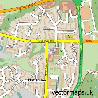
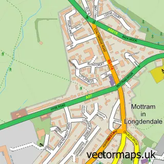
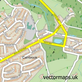
Nearby street map samples around Dukinfield

Street map sample of Manchester, Greater Manchester Manchester City - Greater Manchester - 6.3 miles Street map sample of Newtonmoor, Greater Manchester Newtonmoor Village - Greater Manchester - 1.1 miles Street map sample of Haughton Green, Greater Manchester Haughton Green Village - Greater Manchester - 2.6 miles Street map sample of Woodhouses, Greater Manchester Woodhouses Village - Greater Manchester - 2.6 miles Street map sample of Millbrook, Greater Manchester Millbrook Village - Greater Manchester - 2.7 miles Street map sample of Bardsley, Greater Manchester Bardsley Village - Greater Manchester - 2.7 miles Street map sample of Hattersley, Greater Manchester Hattersley Village - Greater Manchester - 3.2 miles Street map sample of Mottram, Greater Manchester Mottram Village - Greater Manchester - 3.5 miles Street map sample of Carrbrook, Greater Manchester Carrbrook Village - Greater Manchester - 3.6 miles Street map sample of Micklehurst, Greater Manchester Micklehurst Village - Greater Manchester - 3.7 miles

More street maps in Greater Manchester

Street map sample of Ashton-under-Lyne, Greater Manchester Ashton-under-Lyne Town - 0.8 miles Street map sample of Newtonmoor, Greater Manchester Newtonmoor Village - 1.1 miles Street map sample of Audenshaw, Greater Manchester Audenshaw Town - 1.3 miles Street map sample of Stalybridge, Greater Manchester Stalybridge Town - 1.6 miles Street map sample of Denton, Greater Manchester Denton Town - 1.7 miles

750 metre map area coverage

Boundary, postcode and point of interest information for the 750m x 750m rectangle centred on this sample map.

Boundaries containing map centre

Constituency: Ashton-under-Lyne Boro Const

District: Tameside District (B)

Icb: NHS Greater Manchester ICB

Police Force: greater manchester

Postcode District: SK16

Postcode Sector: SK16 4

Ward: Dukinfield Ward

Nearby boundaries intersecting sample

Postcode Sector: SK16 5

Postcode coverage

SK16 SK16 4 SK16 5

POI category counts

Dentist: 5

Professional Services: 5

Doctor: 4

Pub: 4

Automotive Repair: 3

Bakery: 3

Convenience Store: 3

Furniture Store: 3

Park: 3

Assisted Living Facility: 2

Sample points of interest

  • Fletchers Accountants Accountant
  • Alexican Advertising Agency
  • Sharon Hall Hypnotherapy Alternative Medicine
  • St Luke's Church Anglican Church
  • Forbo Siegling Appliance Manufacturer
  • Smart Move Mobility Appliance Store
  • John Elliott Architectural Services Architectural Designer
  • Elements of Creativity Arts And Entertainment
  • Blackcliffe Assisted Living Facility
  • New Charter Housing Trust Group Assisted Living Facility
  • Multisaver (swap) Atms
  • Smart Car Source Automotive Consultant

Create a larger editable map of Dukinfield

This sample shows only a 750 metre area. To create a larger map of Dukinfield, use our map builder to choose your own coverage area, add titles and download editable SVG, PDF and PNG files.

Create a custom map of Dukinfield

Phone 01751 473136 | Copyright Vectormaps.uk 2026

Samples Customizer Privacy Disclaimer
Dukinfield Vector Street Map
Dukinfield enlarged street map sample showing a 750 metre preview area