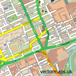
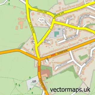
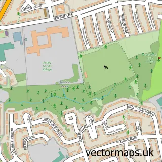
This Bardsley street map is a detailed vector street map covering a 750m x 750m area. Select a larger area to create and download your own vector street map of Bardsley.
The 750-metre map sample for Bardsley covers 235 mapped buildings and approximately 13.8 km of road detail, of which 29 named roads are named. The immediate area includes 17 GP surgeries within 2 miles, 1 pub and 36 MOT stations within 2 miles. The wider area around Bardsley features 5 food and drink venues and 1 hotel. To create a larger or custom map of Bardsley, the map builder lets you define your own coverage area and download editable SVG, PDF and PNG files.
Create a larger editable map of Bardsley
Choose any area you need and generate a high-quality vector map instantly. Perfect for print, planning, design, business and personal use.

This Bardsley street map in Greater Manchester is available as downloadable SVG, PDF and PNG map files, or as a printed map for planning, business, display, education, local information and design work. You can also create a larger custom map area using the map selector.
What this Bardsley map sample shows
Bardsley lies within Oldham District (B) parish, part of Medlock Vale ward in the Oldham District (B) local authority area. The postcode geography for this area includes the OL postcode area, the OL8 postcode district and the OL8 2 postcode sector. Residents fall under the Nhs Greater Manchester Integrated Care Board for NHS services.
Local features near Bardsley
Within 2 milesAmenities and services in and around Bardsley.
Administrative and postcode information for Bardsley
The local authority covering Bardsley is Oldham District (B), within the county of Greater Manchester. The settlement lies within Medlock Vale ward and Oldham District (B) civil parish. The OL8 postcode district and OL8 2 postcode sector serve the immediate area. NHS provision in the area is delivered through Manchester University Nhs Foundation Trust.
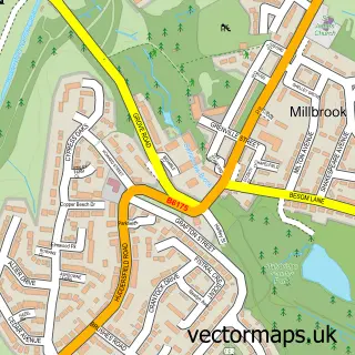
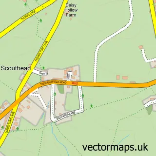
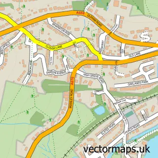
Nearby street map samples around Bardsley

More street maps in Greater Manchester
750 metre map area coverage
Boundary, postcode and point of interest information for the 750m x 750m rectangle centred on this sample map.
Boundaries containing map centre
Constituency: Oldham West, Chadderton and Royton Boro Const
District: Oldham District (B)
Icb: NHS Greater Manchester ICB
Police Force: greater manchester
Postcode District: OL8
Postcode Sector: OL8 2
Ward: Medlock Vale Ward
Nearby boundaries intersecting sample
Constituency: Ashton-under-Lyne Boro Const
District: Tameside District (B)
Postcode District: OL7
Postcode Sector: OL7 9, OL8 3
Ward: Ashton Waterloo Ward, Hollinwood Ward
Postcode coverage
POI category counts
Church Cathedral: 3
Beauty Salon: 2
Business Management Services: 2
Cafe: 2
Contractor: 2
Convenience Store: 2
Gym: 2
Preschool: 2
Professional Services: 2
Restaurant: 2
Sample points of interest
- Aesthetics by Michele's Nails and Beauty
- Nadia's Beauty Salon Reading
- Best Western Hotel Smokies Park
- A Sutcliffe
- Bardsley Post Office
- Post Office-Bardsley
- Cafe Aris
- Go Barista
- Best Hand Car Wash
- Vale Nursery
- Bardsley Methodist Church
- Holy Trinity Church Downall Green | Ashton in Makerfield
Create a larger editable map of Bardsley
This sample shows only a 750 metre area. To create a larger map of Bardsley, use our map builder to choose your own coverage area, add titles and download editable SVG, PDF and PNG files.
Create a custom map of Bardsley