Vector Maps logo
Home Why it works Popular maps Districts Samples Customizer Create Your Map
VectorMaps.uk
Home Popular maps Districts Samples Customizer Create Your Map Privacy Disclaimer
Home / UK Maps / Greater Manchester / Lees Map

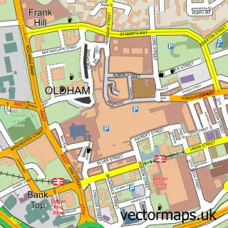
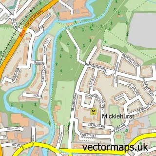
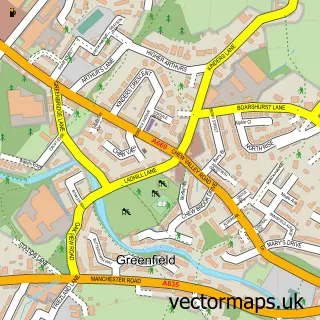
This Lees street map is a detailed vector street map covering a 750m x 750m area. Select a larger area to create and download your own vector street map of Lees.

Lees is a village in Greater Manchester, in the North West of England. Historically, the area formed part of Lancashire. The settlement falls within the Oldham East And Saddleworth parliamentary constituency. It is served by the OL4 postcode district, wit

The 750-metre map sample for Lees covers 396 mapped buildings and approximately 21.5 km of road detail, of which 76 named roads are named. The immediate area includes 1 school, 2 GP surgeries, with 18 within 2 miles, 4 pubs and 32 MOT stations within 2 miles. The wider area around Lees features 2 tourism points of interest and 11 food and drink venues. To create a larger or custom map of Lees, the map builder lets you define your own coverage area and download editable SVG, PDF and PNG files.

396Buildings
21.45 kmRoads
76Named roads
34,337Residents within 2 miles
Create your own

Create a larger editable map of Lees

Choose any area you need and generate a high-quality vector map instantly. Perfect for print, planning, design, business and personal use.

Choose any location
Editable SVG files
Any size up to A0
PDF, PNG & more
Instant download
High quality guaranteed
Create My Custom Map
Secure, private & no credit card required
Lees Vector Street Map
750m Sample
Lees vector street map sample showing roads, buildings and local features in a 750 metre preview area
Buy Lees Map Print from £12.95 Buy Lees Digital Map from £6

This Lees street map in Greater Manchester is available as downloadable SVG, PDF and PNG map files, or as a printed map for planning, business, display, education, local information and design work. You can also create a larger custom map area using the map selector.

What this Lees map sample shows

Lees lies within Oldham District (B) parish, part of Waterhead ward in the Oldham District (B) local authority area. The postcode geography for this area includes the OL postcode area, the OL4 postcode district and the OL4 3 postcode sector. Residents fall under the Nhs Greater Manchester Integrated Care Board for NHS services.

Local features near Lees

Within 2 miles

Amenities and services in and around Lees.

1 Schools
2 GP surgeries 18 within 2 miles
32 MOT stations within 2 miles
2 Tourism & leisure
11 Food & drink
4 Pubs
9 Healthcare POIs
5 Vehicle services

Counts are approximate and based on publicly available data.

Administrative and postcode information for Lees

The local authority covering Lees is Oldham District (B), within the county of Greater Manchester. The settlement lies within Waterhead ward and Oldham District (B) civil parish. The OL4 postcode district and OL4 3 postcode sector serve the immediate area. NHS provision in the area is delivered through Manchester University Nhs Foundation Trust.

Parish OLDHAM DISTRICT (B)
Ward Waterhead
District / local authority Oldham District (B)
County Greater Manchester
Historic county Lancashire
Postcode district OL4
Postcode sector OL4 3
Parliamentary constituency Oldham East and Saddleworth
Region North West
Country England

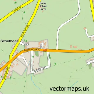
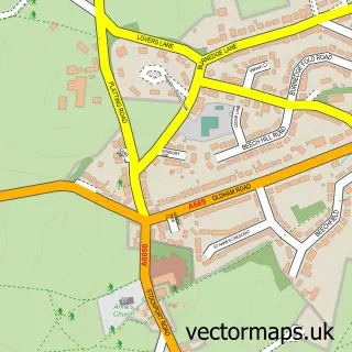
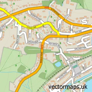
Nearby street map samples around Lees

Street map sample of Oldham, Greater Manchester Oldham Town - Greater Manchester - 1.7 miles Street map sample of Manchester, Greater Manchester Manchester City - Greater Manchester - 8.1 miles Street map sample of Scouthead, Greater Manchester Scouthead Village - Greater Manchester - 1.3 miles Street map sample of Lydgate, Greater Manchester Lydgate Village - Greater Manchester - 1.3 miles Street map sample of Grasscroft, Greater Manchester Grasscroft Village - Greater Manchester - 1.8 miles Street map sample of Micklehurst, Greater Manchester Micklehurst Village - Greater Manchester - 2.1 miles Street map sample of Bardsley, Greater Manchester Bardsley Village - Greater Manchester - 2.2 miles Street map sample of Luzley Brook, Greater Manchester Luzley Brook Village - Greater Manchester - 2.4 miles Street map sample of Dobcross, Greater Manchester Dobcross Village - Greater Manchester - 2.7 miles Street map sample of Greenfield, Greater Manchester Greenfield Village - Greater Manchester - 2.8 miles

More street maps in Greater Manchester

Street map sample of Scouthead, Greater Manchester Scouthead Village - 1.3 miles Street map sample of Lydgate, Greater Manchester Lydgate Village - 1.3 miles Street map sample of Oldham, Greater Manchester Oldham Town - 1.7 miles Street map sample of Grasscroft, Greater Manchester Grasscroft Village - 1.8 miles Street map sample of Micklehurst, Greater Manchester Micklehurst Village - 2.1 miles

750 metre map area coverage

Boundary, postcode and point of interest information for the 750m x 750m rectangle centred on this sample map.

Boundaries containing map centre

Constituency: Oldham East and Saddleworth Co Const

District: Oldham District (B)

Icb: NHS Greater Manchester ICB

Police Force: greater manchester

Postcode District: OL4

Postcode Sector: OL4 3

Ward: Saddleworth West & Lees Ward

Nearby boundaries intersecting sample

Parish: Saddleworth CP

Postcode Sector: OL4 4, OL4 5

Ward: Waterhead Ward

Postcode coverage

OL4 OL4 3 OL4 4 OL4 5

POI category counts

Beauty Salon: 10

Hair Salon: 9

Professional Services: 7

Contractor: 5

Building Supply Store: 4

Pub: 4

Real Estate Agent: 4

Retail: 4

Accountant: 3

Automotive Repair: 3

Sample points of interest

  • D G Bookkeeping Accountant
  • Freeman Accountancy Accountant
  • Mintons Accountants Accountant
  • Lees Brook Nature Reserve Active Life
  • St Thomas Leesfield, Parish of Leesfield Anglican Church
  • Cad Architectural Animal Shelter
  • RSPCA Animal Shelter
  • Cotec Converting Machinery Appliance Manufacturer
  • L F Services (Vacuum Cleaner Repairs) Appliance Repair Service
  • LF Services Appliance Repair Service
  • A & D Appliance Centre Appliance Store
  • Oakdene Care Home Assisted Living Facility

Create a larger editable map of Lees

This sample shows only a 750 metre area. To create a larger map of Lees, use our map builder to choose your own coverage area, add titles and download editable SVG, PDF and PNG files.

Create a custom map of Lees

Phone 01751 473136 | Copyright Vectormaps.uk 2026

Samples Customizer Privacy Disclaimer
Lees Vector Street Map
Lees enlarged street map sample showing a 750 metre preview area