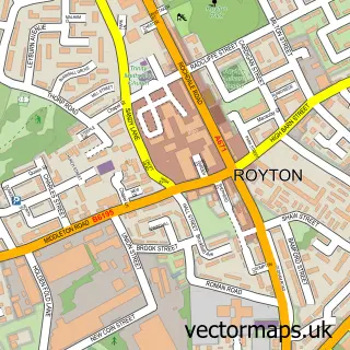
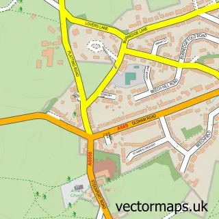
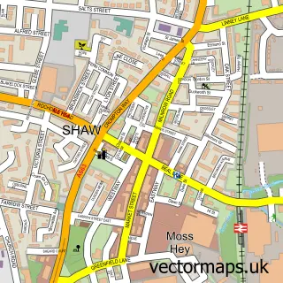
This Luzley Brook street map is a detailed vector street map covering a 750m x 750m area. Select a larger area to create and download your own vector street map of Luzley Brook.
The 750-metre map sample for Luzley Brook covers 478 mapped buildings and approximately 17.4 km of road detail, of which 37 named roads are named. The immediate area includes 1 school, 17 GP surgeries within 2 miles, 1 pub and 1 MOT station, with 41 within 2 miles. The wider area around Luzley Brook features 2 tourism points of interest and 2 food and drink venues. To create a larger or custom map of Luzley Brook, the map builder lets you define your own coverage area and download editable SVG, PDF and PNG files.
Create a larger editable map of Luzley Brook
Choose any area you need and generate a high-quality vector map instantly. Perfect for print, planning, design, business and personal use.

This Luzley Brook street map in Greater Manchester is available as downloadable SVG, PDF and PNG map files, or as a printed map for planning, business, display, education, local information and design work. You can also create a larger custom map area using the map selector.
What this Luzley Brook map sample shows
Luzley Brook lies within Oldham District (B) parish, part of Royton South ward in the Oldham District (B) local authority area. The postcode geography for this area includes the OL postcode area, the OL2 postcode district and the OL2 6 postcode sector. Residents fall under the Nhs Greater Manchester Integrated Care Board for NHS services.
Local features near Luzley Brook
Within 2 milesAmenities and services in and around Luzley Brook.
Administrative and postcode information for Luzley Brook
Luzley Brook lies within Oldham District (B) parish, part of Royton South ward in the Oldham District (B) local authority area. The postcode geography for this area includes the OL postcode area, the OL2 postcode district and the OL2 6 postcode sector. Residents fall under the Nhs Greater Manchester Integrated Care Board for NHS services.
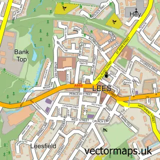
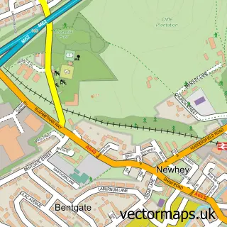
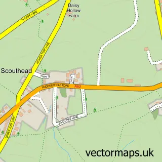
Nearby street map samples around Luzley Brook


More street maps in Greater Manchester
750 metre map area coverage
Boundary, postcode and point of interest information for the 750m x 750m rectangle centred on this sample map.
Boundaries containing map centre
Constituency: Oldham West, Chadderton and Royton Boro Const
District: Oldham District (B)
Icb: NHS Greater Manchester ICB
Police Force: greater manchester
Postcode District: OL2
Postcode Sector: OL2 6
Ward: Royton South Ward
Nearby boundaries intersecting sample
Constituency: Oldham East and Saddleworth Co Const
Parish: Shaw and Crompton CP
Ward: Crompton Ward
Postcode coverage
POI category counts
Professional Services: 4
Building Supply Store: 3
Contractor: 3
Carpenter: 2
Hardware Store: 2
Sports And Recreation Venue: 2
Accountant: 1
Appliance Manufacturer: 1
Attractions And Activities: 1
Auto Company: 1
Sample points of interest
- 1st Choice Accountancy Services
- Macdonald & Taylor
- Heyside Playing Fields
- Royton Car Services
- DL Plumbing Services
- The Red Rose Filling Station
- OTR Service and MOT Centre
- One Eyed Willy's Garden Bar
- Mr B's Barbers Emporium
- The H24 Hub
- Amara Nails and Beauty
- Visual Tint
Create a larger editable map of Luzley Brook
This sample shows only a 750 metre area. To create a larger map of Luzley Brook, use our map builder to choose your own coverage area, add titles and download editable SVG, PDF and PNG files.
Create a custom map of Luzley Brook