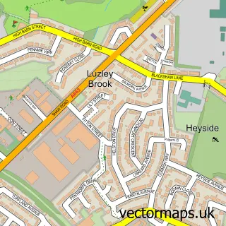
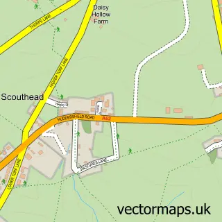
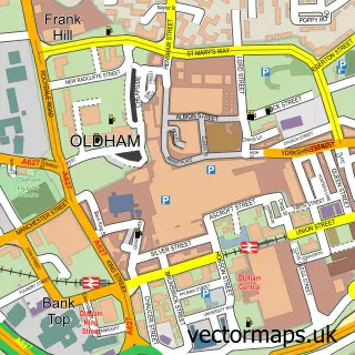
This Chadderton street map is a detailed vector street map covering a 750m x 750m area. Select a larger area to create and download your own vector street map of Chadderton.
The 750-metre map sample for Chadderton covers 343 mapped buildings and approximately 22.2 km of road detail, of which 56 named roads are named. The immediate area includes 2 GP surgeries, with 23 within 2 miles, 2 pubs and 3 MOT stations, with 64 within 2 miles. The wider area around Chadderton features 2 tourism points of interest and 10 food and drink venues. To create a larger or custom map of Chadderton, the map builder lets you define your own coverage area and download editable SVG, PDF and PNG files.
Create a larger editable map of Chadderton
Choose any area you need and generate a high-quality vector map instantly. Perfect for print, planning, design, business and personal use.

This Chadderton street map in Greater Manchester is available as downloadable SVG, PDF and PNG map files, or as a printed map for planning, business, display, education, local information and design work. You can also create a larger custom map area using the map selector.
What this Chadderton map sample shows
Chadderton lies within Oldham District (B) parish, part of Chadderton North ward in the Oldham District (B) local authority area. The postcode geography for this area includes the OL postcode area, the OL9 postcode district and the OL9 0 postcode sector. Residents fall under the Nhs Greater Manchester Integrated Care Board for NHS services.
Local features near Chadderton
Within 2 milesAmenities and services in and around Chadderton.
Administrative and postcode information for Chadderton
Chadderton lies within Oldham District (B) parish, part of Chadderton North ward in the Oldham District (B) local authority area. The postcode geography for this area includes the OL postcode area, the OL9 postcode district and the OL9 0 postcode sector. Residents fall under the Nhs Greater Manchester Integrated Care Board for NHS services.
Nearby street map samples around Chadderton


More street maps in Greater Manchester
750 metre map area coverage
Boundary, postcode and point of interest information for the 750m x 750m rectangle centred on this sample map.
Boundaries containing map centre
Constituency: Oldham West, Chadderton and Royton Boro Const
District: Oldham District (B)
Icb: NHS Greater Manchester ICB
Police Force: greater manchester
Postcode District: OL9
Postcode Sector: OL9 0
Ward: Chadderton Central Ward
Nearby boundaries intersecting sample
Postcode Sector: OL9 6, OL9 9
Ward: Coldhurst Ward
Postcode coverage
POI category counts
Automotive Repair: 10
Building Supply Store: 6
Retail: 6
Automotive Parts And Accessories: 5
Church Cathedral: 5
Community Services Non Profits: 5
Furniture Store: 5
Gym: 5
Indian Restaurant: 5
Betting Center: 4
Sample points of interest
- Ogden & Partington
- Wrigley Partington
- J and S Hydro Gardening
- Macdonalds
- St Mark
- RSPCA
- Lasercut and Create
- Wheelbase Alloys
- TIC Wallcoverings
- Hi-Way Components
- Jack’s Salvage Yard
- TPS - for Volkswagen Group Genuine Parts
Create a larger editable map of Chadderton
This sample shows only a 750 metre area. To create a larger map of Chadderton, use our map builder to choose your own coverage area, add titles and download editable SVG, PDF and PNG files.
Create a custom map of Chadderton