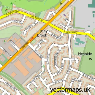
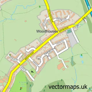
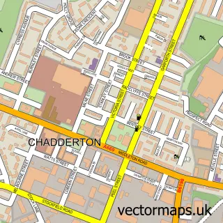
This Oldham street map is a detailed vector street map covering a 750m x 750m area. Select a larger area to create and download your own vector street map of Oldham.
The 750-metre map sample for Oldham covers 177 mapped buildings and approximately 26.5 km of road detail, of which 65 named roads are named. The immediate area includes 4 schools, 2 railway stations, 6 GP surgeries, with 26 within 2 miles and 13 pubs among other local services. The wider area around Oldham features 4 tourism points of interest, 50 food and drink venues and 1 hotel. To create a larger or custom map of Oldham, the map builder lets you define your own coverage area and download editable SVG, PDF and PNG files.
Create a larger editable map of Oldham
Choose any area you need and generate a high-quality vector map instantly. Perfect for print, planning, design, business and personal use.

This Oldham street map in Greater Manchester is available as downloadable SVG, PDF and PNG map files, or as a printed map for planning, business, display, education, local information and design work. You can also create a larger custom map area using the map selector.
What this Oldham map sample shows
Oldham lies within Oldham District (B) parish, part of Coldhurst ward in the Oldham District (B) local authority area. The postcode geography for this area includes the OL postcode area, the OL1 postcode district and the OL1 2 postcode sector. Residents fall under the Nhs Greater Manchester Integrated Care Board for NHS services.
Local features near Oldham
Within 2 milesAmenities and services in and around Oldham.
Administrative and postcode information for Oldham
The local authority covering Oldham is Oldham District (B), within the county of Greater Manchester. The settlement lies within Coldhurst ward and Oldham District (B) civil parish. The OL1 postcode district and OL1 2 postcode sector serve the immediate area. NHS provision in the area is delivered through Manchester University Nhs Foundation Trust.
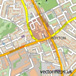
Nearby street map samples around Oldham


More street maps in Greater Manchester
750 metre map area coverage
Boundary, postcode and point of interest information for the 750m x 750m rectangle centred on this sample map.
Boundaries containing map centre
Constituency: Oldham West, Chadderton and Royton Boro Const
District: Oldham District (B)
Icb: NHS Greater Manchester ICB
Police Force: greater manchester
Postcode District: OL1
Postcode Sector: OL1 1
Ward: Coldhurst Ward
Nearby boundaries intersecting sample
Constituency: Oldham East and Saddleworth Co Const
Postcode District: OL4, OL8, OL9
Postcode Sector: OL1 2, OL1 3, OL4 1, OL8 1, OL9 6
Ward: St. Mary's Ward, Werneth Ward
Postcode coverage
POI category counts
Clothing Store: 25
Jewelry Store: 17
Bank Credit Union: 16
Mobile Phone Store: 16
Restaurant: 16
Employment Agencies: 15
Fast Food Restaurant: 14
Cafe: 13
Pub: 13
Community Services Non Profits: 12
Sample points of interest
- DCW Accounting Limited
- Gazzard & Co
- Liquid Accounts Ltd
- Pointax Accountants
- Danny Kay Worldwide Marketing Solutions
- Oldham Graphics
- Connect Church Oldham
- Brighthouse
- Storeys Amusements
- Gallery Oldham
- The Works
- Ruby Slippers Drama Academy
Create a larger editable map of Oldham
This sample shows only a 750 metre area. To create a larger map of Oldham, use our map builder to choose your own coverage area, add titles and download editable SVG, PDF and PNG files.
Create a custom map of Oldham