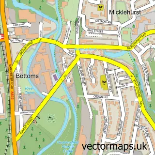
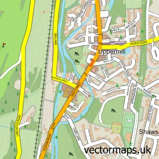
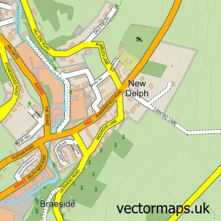
This Grasscroft street map is a detailed vector street map covering a 750m x 750m area. Select a larger area to create and download your own vector street map of Grasscroft.
The 750-metre map sample for Grasscroft covers 352 mapped buildings and approximately 16.1 km of road detail, of which 32 named roads are named. The immediate area includes 1 school, 6 GP surgeries within 2 miles and 7 MOT stations within 2 miles. To create a larger or custom map of Grasscroft, the map builder lets you define your own coverage area and download editable SVG, PDF and PNG files.
Create a larger editable map of Grasscroft
Choose any area you need and generate a high-quality vector map instantly. Perfect for print, planning, design, business and personal use.

This Grasscroft street map in Greater Manchester is available as downloadable SVG, PDF and PNG map files, or as a printed map for planning, business, display, education, local information and design work. You can also create a larger custom map area using the map selector.
What this Grasscroft map sample shows
Grasscroft lies within Saddleworth Cp parish, part of Saddleworth South ward in the Oldham District (B) local authority area. The postcode geography for this area includes the OL postcode area, the OL4 postcode district and the OL4 4 postcode sector. Residents fall under the Nhs Greater Manchester Integrated Care Board for NHS services.
Local features near Grasscroft
Within 2 milesAmenities and services in and around Grasscroft.
Administrative and postcode information for Grasscroft
The local authority covering Grasscroft is Oldham District (B), within the county of Greater Manchester. The settlement lies within Saddleworth South ward and Saddleworth Cp civil parish. The OL4 postcode district and OL4 4 postcode sector serve the immediate area. NHS provision in the area is delivered through Manchester University Nhs Foundation Trust.
Nearby street map samples around Grasscroft

More street maps in Greater Manchester
750 metre map area coverage
Boundary, postcode and point of interest information for the 750m x 750m rectangle centred on this sample map.
Boundaries containing map centre
Constituency: Oldham East and Saddleworth Co Const
District: Oldham District (B)
Icb: NHS Greater Manchester ICB
Parish: Saddleworth CP
Police Force: greater manchester
Postcode District: OL4
Postcode Sector: OL4 4
Ward: Saddleworth South Ward
Nearby boundaries intersecting sample
Postcode District: OL3
Postcode Sector: OL3 7
Postcode coverage
POI category counts
Advertising Agency: 1
Anglican Church: 1
Building Supply Store: 1
Business Consulting: 1
Candy Store: 1
Community Services Non Profits: 1
Contractor: 1
Elementary School: 1
Environmental Conservation Organization: 1
Financial Service: 1
Sample points of interest
- Claire Taylor Marketing and Communications
- Christ Church Friezland
- Saddleworth Stained Glass
- Neuw
- Sweetalicious
- Friezland Saddleworth
- Lichfield Construction
- Friezland Primary School
- Air Sampling Instruments
- Red Chilli Finance
- Fun Fest Greenfield Holiday Club
- Josie Jo Pretty Little Things
Create a larger editable map of Grasscroft
This sample shows only a 750 metre area. To create a larger map of Grasscroft, use our map builder to choose your own coverage area, add titles and download editable SVG, PDF and PNG files.
Create a custom map of Grasscroft