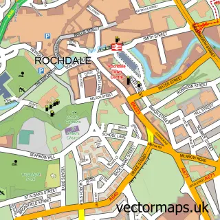
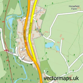
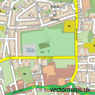
This Castleton street map is a detailed vector street map covering a 750m x 750m area. Select a larger area to create and download your own vector street map of Castleton.
The 750-metre map sample for Castleton covers 239 mapped buildings and approximately 16.1 km of road detail, of which 47 named roads are named. The immediate area includes 2 schools, 1 railway station, 1 GP surgery, with 12 within 2 miles and 1 pub among other local services. The wider area around Castleton features 3 food and drink venues. To create a larger or custom map of Castleton, the map builder lets you define your own coverage area and download editable SVG, PDF and PNG files.
Create a larger editable map of Castleton
Choose any area you need and generate a high-quality vector map instantly. Perfect for print, planning, design, business and personal use.

This Castleton street map in Greater Manchester is available as downloadable SVG, PDF and PNG map files, or as a printed map for planning, business, display, education, local information and design work. You can also create a larger custom map area using the map selector.
What this Castleton map sample shows
Castleton lies within Rochdale District (B) parish, part of Spotland And Falinge ward in the Rochdale District (B) local authority area. The postcode geography for this area includes the OL postcode area, the OL12 postcode district and the OL12 6 postcode sector. Residents fall under the Nhs Greater Manchester Integrated Care Board for NHS services.
Local features near Castleton
Within 2 milesAmenities and services in and around Castleton.
Administrative and postcode information for Castleton
The local authority covering Castleton is Rochdale District (B), within the county of Greater Manchester. The settlement lies within Spotland And Falinge ward and Rochdale District (B) civil parish. The OL12 postcode district and OL12 6 postcode sector serve the immediate area. NHS provision in the area is delivered through Manchester University Nhs Foundation Trust.
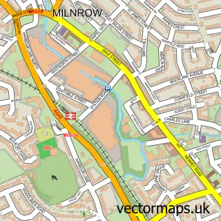
Nearby street map samples around Castleton


More street maps in Greater Manchester
750 metre map area coverage
Boundary, postcode and point of interest information for the 750m x 750m rectangle centred on this sample map.
Boundaries containing map centre
Constituency: Heywood and Middleton North Co Const
District: Rochdale District (B)
Icb: NHS Greater Manchester ICB
Police Force: greater manchester
Postcode District: OL11
Postcode Sector: OL11 3
Ward: Castleton Ward
Nearby boundaries intersecting sample
Postcode Sector: OL11 2
Postcode coverage
POI category counts
Automotive Repair: 6
Convenience Store: 5
Fast Food Restaurant: 5
Fish And Chips Restaurant: 5
Automotive Parts And Accessories: 4
Beauty Salon: 4
Storage Facility: 4
Used Car Dealer: 4
Barber: 3
Building Supply Store: 3
Sample points of interest
- DCW Accounting Ltd.
- NRA Accountancy & Taxation Services
- True Serenity
- True Serenity
- Bodyworks Rochdale Ltd.
- Finland Truck Parts
- Zambia Truck Parts
- kenyatruckparts
- ugandatruckparts
- Bodyworks Rochdale
- JB Mobile Servicing & Diagnostics
- MPH Prestige Ltd
Create a larger editable map of Castleton
This sample shows only a 750 metre area. To create a larger map of Castleton, use our map builder to choose your own coverage area, add titles and download editable SVG, PDF and PNG files.
Create a custom map of Castleton