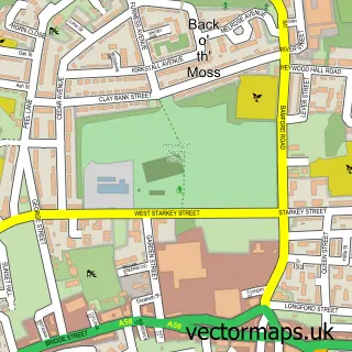
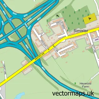
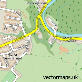
This Heap Bridge street map is a detailed vector street map covering a 750m x 750m area. Select a larger area to create and download your own vector street map of Heap Bridge.
The 750-metre map sample for Heap Bridge covers 146 mapped buildings and approximately 8.6 km of road detail, of which 12 named roads are named. The immediate area includes 1 school, 13 GP surgeries within 2 miles and 1 MOT station, with 30 within 2 miles. To create a larger or custom map of Heap Bridge, the map builder lets you define your own coverage area and download editable SVG, PDF and PNG files.
Create a larger editable map of Heap Bridge
Choose any area you need and generate a high-quality vector map instantly. Perfect for print, planning, design, business and personal use.

This Heap Bridge street map in Greater Manchester is available as downloadable SVG, PDF and PNG map files, or as a printed map for planning, business, display, education, local information and design work. You can also create a larger custom map area using the map selector.
What this Heap Bridge map sample shows
Heap Bridge lies within Bury District (B) parish, part of Moorside ward in the Bury District (B) local authority area. The postcode geography for this area includes the BL postcode area, the BL9 postcode district and the BL9 6 postcode sector. Residents fall under the Nhs Greater Manchester Integrated Care Board for NHS services.
Local features near Heap Bridge
Within 2 milesAmenities and services in and around Heap Bridge.
Administrative and postcode information for Heap Bridge
Heap Bridge lies within Bury District (B) parish, part of Moorside ward in the Bury District (B) local authority area. The postcode geography for this area includes the BL postcode area, the BL9 postcode district and the BL9 6 postcode sector. Residents fall under the Nhs Greater Manchester Integrated Care Board for NHS services.
Nearby street map samples around Heap Bridge

More street maps in Greater Manchester
750 metre map area coverage
Boundary, postcode and point of interest information for the 750m x 750m rectangle centred on this sample map.
Boundaries containing map centre
Constituency: Heywood and Middleton North Co Const
District: Rochdale District (B)
Icb: NHS Greater Manchester ICB
Police Force: greater manchester
Postcode District: BL9
Postcode Sector: BL9 7
Ward: West Heywood Ward
Nearby boundaries intersecting sample
Constituency: Bury North Boro Const
District: Bury District (B)
Postcode District: OL10
Postcode Sector: OL10 2
Ward: Bury East Ward
Postcode coverage
POI category counts
Building Supply Store: 3
Coal And Coke: 3
Contractor: 3
Car Wash: 2
Financial Service: 2
Professional Services: 2
Retail: 2
Accountant: 1
Automotive Repair: 1
Business Management Services: 1
Sample points of interest
- SKS Thompson Jones
- Heap Bridge MOT Centre
- M3 Exteriors
- Pentagon Auto Tints
- Pressures-On
- Cooke Fuels And Lubricants Ltd.
- Crown Oil Environmental Ltd
- BP Car Wash
- S&H Hand Car Wash
- Pentagon Protech Film
- Preston Joinery
- The Tile Shop
Create a larger editable map of Heap Bridge
This sample shows only a 750 metre area. To create a larger map of Heap Bridge, use our map builder to choose your own coverage area, add titles and download editable SVG, PDF and PNG files.
Create a custom map of Heap Bridge