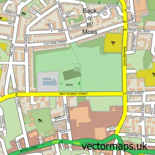
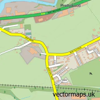
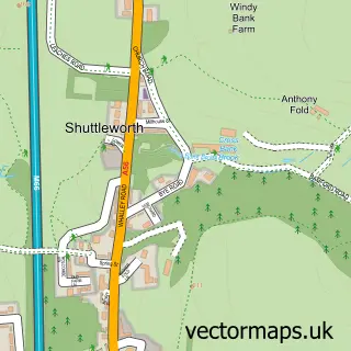
This Norden street map is a detailed vector street map covering a 750m x 750m area. Select a larger area to create and download your own vector street map of Norden.
The 750-metre map sample for Norden covers 455 mapped buildings and approximately 18.4 km of road detail, of which 49 named roads are named. The immediate area includes 1 school, 1 GP surgery within 2 miles, 2 pubs and 1 MOT station, with 8 within 2 miles. The wider area around Norden features 2 tourism points of interest and 4 food and drink venues. To create a larger or custom map of Norden, the map builder lets you define your own coverage area and download editable SVG, PDF and PNG files.
Create a larger editable map of Norden
Choose any area you need and generate a high-quality vector map instantly. Perfect for print, planning, design, business and personal use.

This Norden street map in Greater Manchester is available as downloadable SVG, PDF and PNG map files, or as a printed map for planning, business, display, education, local information and design work. You can also create a larger custom map area using the map selector.
What this Norden map sample shows
Norden lies within Rochdale District (B) parish, part of Norden ward in the Rochdale District (B) local authority area. The postcode geography for this area includes the OL postcode area, the OL12 postcode district and the OL12 7 postcode sector. Residents fall under the Nhs Greater Manchester Integrated Care Board for NHS services.
Local features near Norden
Within 2 milesAmenities and services in and around Norden.
Administrative and postcode information for Norden
Norden lies within Rochdale District (B) parish, part of Norden ward in the Rochdale District (B) local authority area. The postcode geography for this area includes the OL postcode area, the OL12 postcode district and the OL12 7 postcode sector. Residents fall under the Nhs Greater Manchester Integrated Care Board for NHS services.
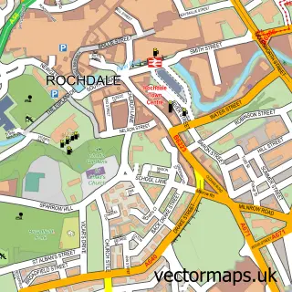
Nearby street map samples around Norden

More street maps in Greater Manchester
750 metre map area coverage
Boundary, postcode and point of interest information for the 750m x 750m rectangle centred on this sample map.
Boundaries containing map centre
Constituency: Heywood and Middleton North Co Const
District: Rochdale District (B)
Icb: NHS Greater Manchester ICB
Police Force: greater manchester
Postcode District: OL11
Postcode Sector: OL11 5
Ward: Norden Ward
Nearby boundaries intersecting sample
Postcode District: OL12
Postcode Sector: OL12 7
Postcode coverage
POI category counts
Bakery: 3
Beauty Salon: 3
Hair Salon: 3
Bar: 2
Cafe: 2
Carpet Store: 2
Clothing Store: 2
Elementary School: 2
Financial Service: 2
Home Service: 2
Sample points of interest
- St Paul's Norden
- Forever Yours Antiques
- The Cooperative Food (BF) Norden, Norden
- I & C Corlett Ltd
- Code Mileage Correction
- A & J Hilton
- Cakecraft by Julie
- Hiltons Bakery
- Yorkshire Building Society
- Cap and Whippet
- Hop & Vine
- Urban Gent Barbers
Create a larger editable map of Norden
This sample shows only a 750 metre area. To create a larger map of Norden, use our map builder to choose your own coverage area, add titles and download editable SVG, PDF and PNG files.
Create a custom map of Norden