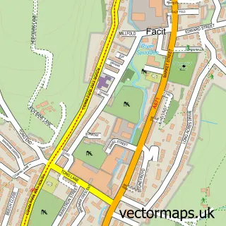
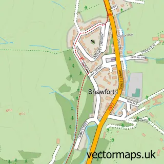
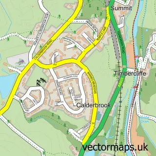
This Healey street map is a detailed vector street map covering a 750m x 750m area. Select a larger area to create and download your own vector street map of Healey.
The 750-metre map sample for Healey covers 188 mapped buildings and approximately 10.2 km of road detail, of which 20 named roads are named. The immediate area includes 1 school, 3 GP surgeries within 2 miles and 11 MOT stations within 2 miles. To create a larger or custom map of Healey, the map builder lets you define your own coverage area and download editable SVG, PDF and PNG files.
Create a larger editable map of Healey
Choose any area you need and generate a high-quality vector map instantly. Perfect for print, planning, design, business and personal use.

This Healey street map in Lancashire is available as downloadable SVG, PDF and PNG map files, or as a printed map for planning, business, display, education, local information and design work. You can also create a larger custom map area using the map selector.
What this Healey map sample shows
Healey lies within Whitworth Cp parish, part of Healey And Whitworth ward in the Rossendale District (B) local authority area. The postcode geography for this area includes the OL postcode area, the OL12 postcode district and the OL12 8 postcode sector. Residents fall under the Nhs Lancashire And South Cumbria Integrated Care Board for NHS services.
Local features near Healey
Within 2 milesAmenities and services in and around Healey.
Administrative and postcode information for Healey
The local authority covering Healey is Rossendale District (B), within the county of Lancashire. The settlement lies within Healey And Whitworth ward and Whitworth Cp civil parish. The OL12 postcode district and OL12 8 postcode sector serve the immediate area. NHS provision in the area is delivered through East Lancashire Hospitals Nhs Trust.
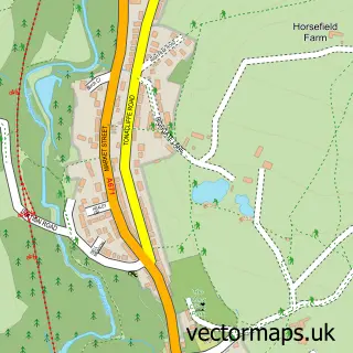
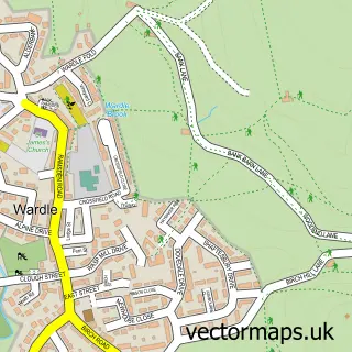
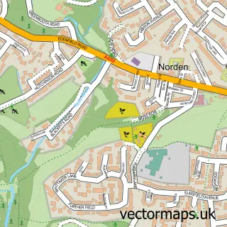
Nearby street map samples around Healey

More street maps in Lancashire
750 metre map area coverage
Boundary, postcode and point of interest information for the 750m x 750m rectangle centred on this sample map.
Boundaries containing map centre
Constituency: Rossendale and Darwen Co Const
County: Lancashire County
District: Rossendale District (B)
Icb: NHS Lancashire and South Cumbria ICB
Parish: Whitworth CP
Police Force: lancashire
Postcode District: OL12
Postcode Sector: OL12 8
Ward: Whitworth Ward
Nearby boundaries intersecting sample
Constituency: Heywood and Middleton North Co Const
District: Rochdale District (B)
Icb: NHS Greater Manchester ICB
Police Force: greater manchester
Postcode Sector: OL12 0
Ward: Norden Ward
Postcode coverage
POI category counts
American Restaurant: 1
Arts And Crafts: 1
Assisted Living Facility: 1
Automotive Repair: 1
Bed And Breakfast: 1
Community Services Non Profits: 1
Dance School: 1
Dog Trainer: 1
Elementary School: 1
Engineering Services: 1
Sample points of interest
- Porky's Pit Stop
- Andi's Art
- Healey House
- Ashton Engine Centre
- Hindle Pastures
- Tonacliffe Forest School & Community Allotment
- MJ Dance
- K9 Boot Camp
- Tonacliffe Primary School
- ltm pat testing
- Omc Outdoor Maintenance Co
- The Fudge Factory Wholesale / Cash & Carry
Create a larger editable map of Healey
This sample shows only a 750 metre area. To create a larger map of Healey, use our map builder to choose your own coverage area, add titles and download editable SVG, PDF and PNG files.
Create a custom map of Healey