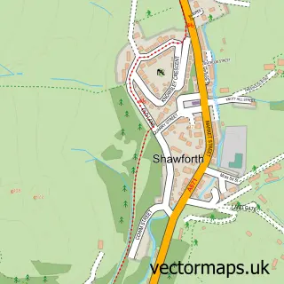
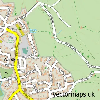
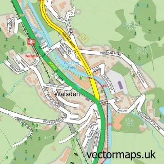
This Whitworth street map is a detailed vector street map covering a 750m x 750m area. Select a larger area to create and download your own vector street map of Whitworth.
The 750-metre map sample for Whitworth covers 342 mapped buildings and approximately 16.0 km of road detail, of which 38 named roads are named. The immediate area includes 1 school, 1 GP surgery, 2 pubs and 3 MOT stations within 2 miles. The wider area around Whitworth features 5 food and drink venues and 1 hotel. To create a larger or custom map of Whitworth, the map builder lets you define your own coverage area and download editable SVG, PDF and PNG files.
Create a larger editable map of Whitworth
Choose any area you need and generate a high-quality vector map instantly. Perfect for print, planning, design, business and personal use.

This Whitworth street map in Lancashire is available as downloadable SVG, PDF and PNG map files, or as a printed map for planning, business, display, education, local information and design work. You can also create a larger custom map area using the map selector.
What this Whitworth map sample shows
Whitworth lies within Whitworth Cp parish, part of Healey And Whitworth ward in the Rossendale District (B) local authority area. The postcode geography for this area includes the OL postcode area, the OL12 postcode district and the OL12 8 postcode sector. Residents fall under the Nhs Lancashire And South Cumbria Integrated Care Board for NHS services.
Local features near Whitworth
Within 2 milesAmenities and services in and around Whitworth.
Administrative and postcode information for Whitworth
The local authority covering Whitworth is Rossendale District (B), within the county of Lancashire. The settlement lies within Healey And Whitworth ward and Whitworth Cp civil parish. The OL12 postcode district and OL12 8 postcode sector serve the immediate area. NHS provision in the area is delivered through East Lancashire Hospitals Nhs Trust.
Nearby street map samples around Whitworth

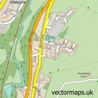
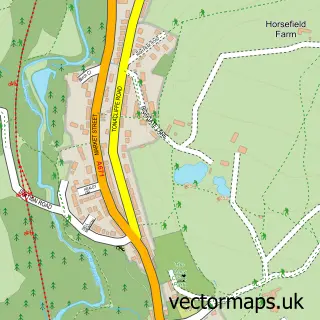
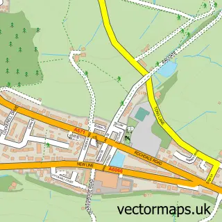
More street maps in Lancashire
750 metre map area coverage
Boundary, postcode and point of interest information for the 750m x 750m rectangle centred on this sample map.
Boundaries containing map centre
Constituency: Rossendale and Darwen Co Const
County: Lancashire County
District: Rossendale District (B)
Icb: NHS Lancashire and South Cumbria ICB
Parish: Whitworth CP
Police Force: lancashire
Postcode District: OL12
Postcode Sector: OL12 8
Ward: Whitworth Ward
Nearby boundaries intersecting sample
No additional intersecting boundaries found.
Postcode coverage
POI category counts
Automotive Repair: 4
Brewery: 3
Business Manufacturing And Supply: 3
Professional Services: 3
Tutoring Center: 3
Building Supply Store: 2
Do It Yourself Store: 2
Elementary School: 2
Event Planning: 2
Package Locker: 2
Sample points of interest
- Bejing Airport China
- The Gas Shop
- Whitworth Memorial Gardens
- Colourful Felt
- Simtek
- A1 Rochdale Auto Rescue
- Bluestone Garage
- Landrover Specialists
- Mitchells motor services
- Anglo Technical Textiles
- Profile PFB
- Noble Barber & Beard Specialist
Create a larger editable map of Whitworth
This sample shows only a 750 metre area. To create a larger map of Whitworth, use our map builder to choose your own coverage area, add titles and download editable SVG, PDF and PNG files.
Create a custom map of Whitworth