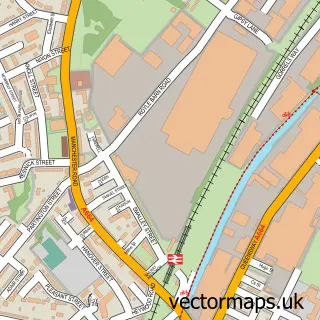
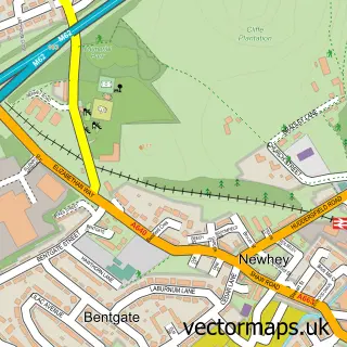
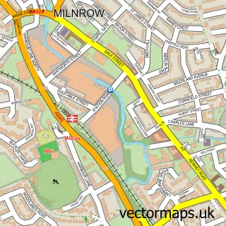
This Rochdale street map is a detailed vector street map covering a 750m x 750m area. Select a larger area to create and download your own vector street map of Rochdale.
The 750-metre map sample for Rochdale covers 182 mapped buildings and approximately 27.4 km of road detail, of which 78 named roads are named. The immediate area includes 1 school, 1 railway station, 16 GP surgeries within 2 miles and 14 pubs among other local services. The wider area around Rochdale features 15 tourism points of interest, 43 food and drink venues and 4 hotels. To create a larger or custom map of Rochdale, the map builder lets you define your own coverage area and download editable SVG, PDF and PNG files.
Create a larger editable map of Rochdale
Choose any area you need and generate a high-quality vector map instantly. Perfect for print, planning, design, business and personal use.

This Rochdale street map in Greater Manchester is available as downloadable SVG, PDF and PNG map files, or as a printed map for planning, business, display, education, local information and design work. You can also create a larger custom map area using the map selector.
What this Rochdale map sample shows
Rochdale lies within Rochdale District (B) parish, part of Spotland And Falinge ward in the Rochdale District (B) local authority area. The postcode geography for this area includes the OL postcode area, the OL12 postcode district and the OL12 6 postcode sector. Residents fall under the Nhs Greater Manchester Integrated Care Board for NHS services.
Local features near Rochdale
Within 2 milesAmenities and services in and around Rochdale.
Administrative and postcode information for Rochdale
The local authority covering Rochdale is Rochdale District (B), within the county of Greater Manchester. The settlement lies within Spotland And Falinge ward and Rochdale District (B) civil parish. The OL12 postcode district and OL12 6 postcode sector serve the immediate area. NHS provision in the area is delivered through Manchester University Nhs Foundation Trust.
Nearby street map samples around Rochdale


More street maps in Greater Manchester
750 metre map area coverage
Boundary, postcode and point of interest information for the 750m x 750m rectangle centred on this sample map.
Boundaries containing map centre
Constituency: Rochdale Co Const
District: Rochdale District (B)
Icb: NHS Greater Manchester ICB
Police Force: greater manchester
Postcode District: OL16
Postcode Sector: OL16 1
Ward: Central Rochdale Ward
Nearby boundaries intersecting sample
Postcode District: OL11, OL12
Postcode Sector: OL11 1, OL12 6, OL16 2, OL16 5
Ward: Milkstone & Deeplish Ward, Spotland & Falinge Ward
Postcode coverage
POI category counts
Clothing Store: 20
Beauty Salon: 19
Mobile Phone Store: 18
Charity Organization: 14
Professional Services: 14
Pub: 14
Automotive Repair: 13
Cafe: 11
Hair Salon: 11
Lawyer: 11
Sample points of interest
- Sattar & Co., Chartered Accountants
- Wyatt Morris Golland Ltd
- Microgym
- Bioenergy Therapy Centre
- Shirley Jamil - Holistic Harmonies
- Adult Community Training
- Leisuretime Rochdale
- GNF Design
- Paragon Media Research
- Pureii Interactive Media
- Bayou Louisiana Restaurant
- Tandoori Ghar
Create a larger editable map of Rochdale
This sample shows only a 750 metre area. To create a larger map of Rochdale, use our map builder to choose your own coverage area, add titles and download editable SVG, PDF and PNG files.
Create a custom map of Rochdale