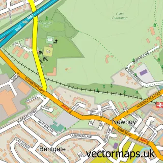
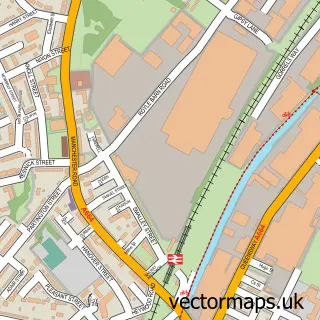
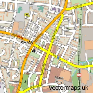
This Milnrow street map is a detailed vector street map covering a 750m x 750m area. Select a larger area to create and download your own vector street map of Milnrow.
The 750-metre map sample for Milnrow covers 480 mapped buildings and approximately 23.7 km of road detail, of which 70 named roads are named. The immediate area includes 2 schools, 1 railway station, 14 GP surgeries within 2 miles and 7 pubs among other local services. The wider area around Milnrow features 1 tourism point of interest, 19 food and drink venues and 1 hotel. To create a larger or custom map of Milnrow, the map builder lets you define your own coverage area and download editable SVG, PDF and PNG files.
Create a larger editable map of Milnrow
Choose any area you need and generate a high-quality vector map instantly. Perfect for print, planning, design, business and personal use.

This Milnrow street map in Greater Manchester is available as downloadable SVG, PDF and PNG map files, or as a printed map for planning, business, display, education, local information and design work. You can also create a larger custom map area using the map selector.
What this Milnrow map sample shows
Milnrow lies within Rochdale District (B) parish, part of Smallbridge And Firgrove ward in the Rochdale District (B) local authority area. The postcode geography for this area includes the OL postcode area, the OL16 postcode district and the OL16 3 postcode sector. Residents fall under the Nhs Greater Manchester Integrated Care Board for NHS services.
Local features near Milnrow
Within 2 milesAmenities and services in and around Milnrow.
Administrative and postcode information for Milnrow
Milnrow lies within Rochdale District (B) parish, part of Smallbridge And Firgrove ward in the Rochdale District (B) local authority area. The postcode geography for this area includes the OL postcode area, the OL16 postcode district and the OL16 3 postcode sector. Residents fall under the Nhs Greater Manchester Integrated Care Board for NHS services.
Nearby street map samples around Milnrow

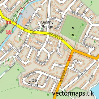

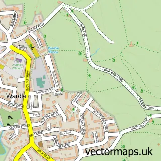
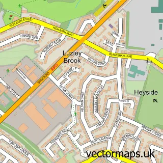
More street maps in Greater Manchester
750 metre map area coverage
Boundary, postcode and point of interest information for the 750m x 750m rectangle centred on this sample map.
Boundaries containing map centre
Constituency: Rochdale Co Const
District: Rochdale District (B)
Icb: NHS Greater Manchester ICB
Police Force: greater manchester
Postcode District: OL16
Postcode Sector: OL16 4
Ward: Milnrow & Newhey Ward
Nearby boundaries intersecting sample
Postcode Sector: OL16 3
Postcode coverage
POI category counts
Beauty Salon: 14
Pub: 7
Real Estate Agent: 7
Cafe: 6
Hair Salon: 6
Gas Station: 5
Beauty And Spa: 4
Coffee Shop: 4
Flowers And Gifts Shop: 4
Package Locker: 4
Sample points of interest
- Shaw Mitchell
- Knowldale Car Club
- Milnrow and District Horticultural Society
- Get Found First
- the Grid VR
- Yarn Barn
- The Freemasons Arms
- The Cooperative Food (BF) Milnrow (Temp) (ERF), Milnrow
- Milnrow Motor Co
- Waggon Garage
- Greggs
- Bridge Street Barbers
Create a larger editable map of Milnrow
This sample shows only a 750 metre area. To create a larger map of Milnrow, use our map builder to choose your own coverage area, add titles and download editable SVG, PDF and PNG files.
Create a custom map of Milnrow