Vector Maps logo
Home Why it works Popular maps Districts Samples Customizer Create Your Map
VectorMaps.uk
Home Popular maps Districts Samples Customizer Create Your Map Privacy Disclaimer
Home / UK Maps / Greater Manchester / Failsworth Map

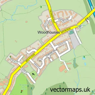
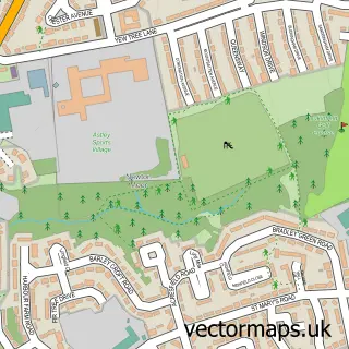
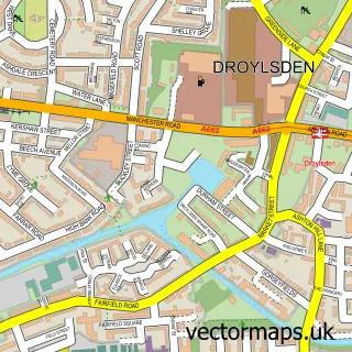
This Failsworth street map is a detailed vector street map covering a 750m x 750m area. Select a larger area to create and download your own vector street map of Failsworth.

Failsworth is a town in Greater Manchester, in the North West of England. Historically, the area formed part of Lancashire. The settlement falls within the Ashton-Under-Lyne parliamentary constituency. It is served by the M35 postcode district, with M35 9

The 750-metre map sample for Failsworth covers 413 mapped buildings and approximately 21.3 km of road detail, of which 67 named roads are named. The immediate area includes 2 schools, 1 railway station, 2 GP surgeries, with 16 within 2 miles and 9 pubs among other local services. The wider area around Failsworth features 1 tourism point of interest and 12 food and drink venues. To create a larger or custom map of Failsworth, the map builder lets you define your own coverage area and download editable SVG, PDF and PNG files.

413Buildings
21.26 kmRoads
67Named roads
51,701Residents within 2 miles
Create your own

Create a larger editable map of Failsworth

Choose any area you need and generate a high-quality vector map instantly. Perfect for print, planning, design, business and personal use.

Choose any location
Editable SVG files
Any size up to A0
PDF, PNG & more
Instant download
High quality guaranteed
Create My Custom Map
Secure, private & no credit card required
Failsworth Vector Street Map
750m Sample
Failsworth vector street map sample showing roads, buildings and local features in a 750 metre preview area
Buy Failsworth Map Print from £12.95 Buy Failsworth Digital Map from £6

This Failsworth street map in Greater Manchester is available as downloadable SVG, PDF and PNG map files, or as a printed map for planning, business, display, education, local information and design work. You can also create a larger custom map area using the map selector.

What this Failsworth map sample shows

Failsworth lies within Oldham District (B) parish, part of Failsworth East ward in the Oldham District (B) local authority area. The postcode geography for this area includes the M postcode area, the M35 postcode district and the M35 9 postcode sector. Residents fall under the Nhs Greater Manchester Integrated Care Board for NHS services.

Local features near Failsworth

Within 2 miles

Amenities and services in and around Failsworth.

2 Schools
1 Railway stations
2 GP surgeries 16 within 2 miles
1 MOT stations 35 within 2 miles
1 Tourism & leisure
12 Food & drink
9 Pubs
8 Healthcare POIs
4 Vehicle services

Counts are approximate and based on publicly available data.

Administrative and postcode information for Failsworth

The local authority covering Failsworth is Oldham District (B), within the county of Greater Manchester. The settlement lies within Failsworth East ward and Oldham District (B) civil parish. The M35 postcode district and M35 9 postcode sector serve the immediate area. NHS provision in the area is delivered through Manchester University Nhs Foundation Trust.

Parish OLDHAM DISTRICT (B)
Ward Failsworth East
District / local authority Oldham District (B)
County Greater Manchester
Historic county Lancashire
Postcode district M35
Postcode sector M35 9
Parliamentary constituency Ashton-under-Lyne
Region North West
Country England

Nearby street map samples around Failsworth

Street map sample of Manchester, Greater Manchester Manchester City - Greater Manchester - 3.9 miles Street map sample of Woodhouses, Greater Manchester Woodhouses Village - Greater Manchester - 1.1 miles Street map sample of Bardsley, Greater Manchester Bardsley Village - Greater Manchester - 2.3 miles Street map sample of Lees, Greater Manchester Lees Village - Greater Manchester - 4.2 miles Street map sample of Luzley Brook, Greater Manchester Luzley Brook Village - Greater Manchester - 4.5 miles Street map sample of Newtonmoor, Greater Manchester Newtonmoor Village - Greater Manchester - 4.7 miles Street map sample of Simister, Greater Manchester Simister Village - Greater Manchester - 4.8 miles Street map sample of Micklehurst, Greater Manchester Micklehurst Village - Greater Manchester - 5.2 miles Street map sample of Thornham, Greater Manchester Thornham Village - Greater Manchester - 5.3 miles Street map sample of Millbrook, Greater Manchester Millbrook Village - Greater Manchester - 5.3 miles

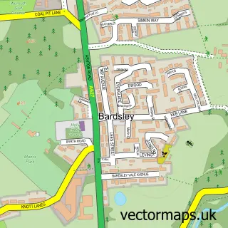
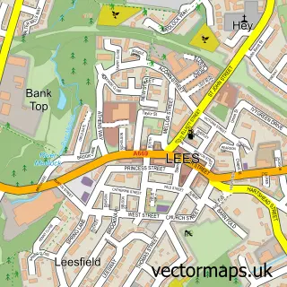
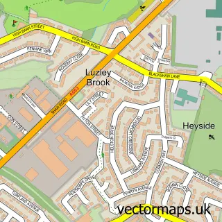
More street maps in Greater Manchester

Street map sample of Woodhouses, Greater Manchester Woodhouses Village - 1.1 miles Street map sample of Droylsden, Greater Manchester Droylsden Town - 2.1 miles Street map sample of Bardsley, Greater Manchester Bardsley Village - 2.3 miles Street map sample of Chadderton, Greater Manchester Chadderton Town - 2.8 miles Street map sample of Ashton-under-Lyne, Greater Manchester Ashton-under-Lyne Town - 3.0 miles

750 metre map area coverage

Boundary, postcode and point of interest information for the 750m x 750m rectangle centred on this sample map.

Boundaries containing map centre

Constituency: Manchester Central Boro Const

District: Oldham District (B)

Icb: NHS Greater Manchester ICB

Police Force: greater manchester

Postcode District: M35

Postcode Sector: M35 0

Ward: Failsworth West Ward

Nearby boundaries intersecting sample

Postcode Sector: M35 9

Ward: Failsworth East Ward

Postcode coverage

M35 M35 0 M35 9

POI category counts

Pub: 9

Retail: 6

Dentist: 5

Fast Food Restaurant: 4

Hair Salon: 4

Professional Services: 4

Bakery: 3

Catholic Church: 3

Elementary School: 3

Fabric Store: 3

Sample points of interest

  • Failsworth Health Centre Accommodation
  • American Golf Trafford Centre Active Life
  • Chillz Restaurant Bar and Lounge African Restaurant
  • Age UK Antique Store
  • Go Fix It Arts And Crafts
  • Angels at Work Astrologer
  • Lord Lane Playing Field Attractions And Activities
  • Q R G Automotive Automotive
  • QRG Automotive
  • TMS Autoparts - Failsworth Automotive Parts And Accessories
  • TMS Autoparts Automotive Repair
  • GREGGS Bakery

Create a larger editable map of Failsworth

This sample shows only a 750 metre area. To create a larger map of Failsworth, use our map builder to choose your own coverage area, add titles and download editable SVG, PDF and PNG files.

Create a custom map of Failsworth

Phone 01751 473136 | Copyright Vectormaps.uk 2026

Samples Customizer Privacy Disclaimer
Failsworth Vector Street Map
Failsworth enlarged street map sample showing a 750 metre preview area