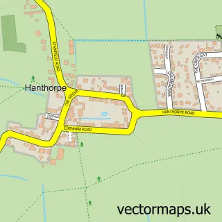
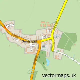
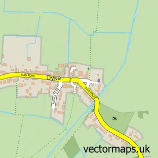
This Edenham street map is a detailed vector street map covering a 750m x 750m area. Select a larger area to create and download your own vector street map of Edenham.
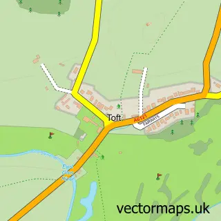
The 750-metre map sample for Edenham covers 53 mapped buildings and approximately 10.4 km of road detail, of which 3 named roads are named. The immediate area includes 1 school and 1 pub. The wider area around Edenham features 1 tourism point of interest and 1 food and drink venue. To create a larger or custom map of Edenham, the map builder lets you define your own coverage area and download editable SVG, PDF and PNG files.
Create a larger editable map of Edenham
Choose any area you need and generate a high-quality vector map instantly. Perfect for print, planning, design, business and personal use.

This Edenham street map in Lincolnshire is available as downloadable SVG, PDF and PNG map files, or as a printed map for planning, business, display, education, local information and design work. You can also create a larger custom map area using the map selector.
What this Edenham map sample shows
Edenham lies within Edenham Cp parish, part of Castle ward in the South Kesteven District local authority area. The postcode geography for this area includes the PE postcode area, the PE10 postcode district and the PE10 0 postcode sector. Residents fall under the Nhs Lincolnshire Integrated Care Board for NHS services.
Local features near Edenham
Within 2 milesAmenities and services in and around Edenham.
Administrative and postcode information for Edenham
Edenham lies within Edenham Cp parish, part of Castle ward in the South Kesteven District local authority area. The postcode geography for this area includes the PE postcode area, the PE10 postcode district and the PE10 0 postcode sector. Residents fall under the Nhs Lincolnshire Integrated Care Board for NHS services.
Nearby street map samples around Edenham

More street maps in Lincolnshire
750 metre map area coverage
Boundary, postcode and point of interest information for the 750m x 750m rectangle centred on this sample map.
Boundaries containing map centre
Constituency: Rutland and Stamford Co Const
County: Lincolnshire County
District: South Kesteven District
Icb: NHS Lincolnshire ICB
Parish: Edenham CP
Police Force: lincolnshire
Postcode District: PE10
Postcode Sector: PE10 0
Ward: Castle Ward
Nearby boundaries intersecting sample
No additional intersecting boundaries found.
Postcode coverage
POI category counts
Church Cathedral: 2
Post Office: 2
Anglican Church: 1
British Restaurant: 1
Coal And Coke: 1
Community Center: 1
Community Services Non Profits: 1
Flowers And Gifts Shop: 1
Landmark And Historical Building: 1
Nail Salon: 1
Sample points of interest
- St Michael
- The Five Bells Inn
- Edenham Regional House
- St Michael and All Angels
- The Coal Man
- Edenham Village Hall
- Edenham Regional House
- Sams giftwares
- Edenham, Grimsthorpe, Elsthorpe and Scottlethorpe
- Misty Mitchell The Nail Addict
- Edenham Post Office
- Post Office-Edenham
Create a larger editable map of Edenham
This sample shows only a 750 metre area. To create a larger map of Edenham, use our map builder to choose your own coverage area, add titles and download editable SVG, PDF and PNG files.
Create a custom map of Edenham