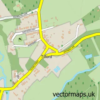
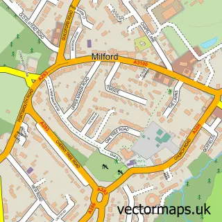
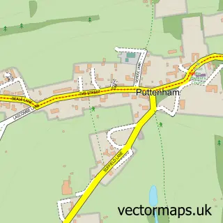
This Elstead street map is a detailed vector street map covering a 750m x 750m area. Select a larger area to create and download your own vector street map of Elstead.
The 750-metre map sample for Elstead covers 275 mapped buildings and approximately 10.7 km of road detail, of which 20 named roads are named. The immediate area includes 1 school, 1 GP surgery, 4 pubs and 1 MOT station. The wider area around Elstead features 1 tourism point of interest and 6 food and drink venues. To create a larger or custom map of Elstead, the map builder lets you define your own coverage area and download editable SVG, PDF and PNG files.
Create a larger editable map of Elstead
Choose any area you need and generate a high-quality vector map instantly. Perfect for print, planning, design, business and personal use.

This Elstead street map in Surrey is available as downloadable SVG, PDF and PNG map files, or as a printed map for planning, business, display, education, local information and design work. You can also create a larger custom map area using the map selector.
What this Elstead map sample shows
Elstead lies within Elstead Cp parish, part of Elstead And Thursley ward in the Waverley District (B) local authority area. The postcode geography for this area includes the GU postcode area, the GU8 postcode district and the GU8 6 postcode sector. Residents fall under the Nhs Surrey Heartlands Integrated Care Board for NHS services.
Local features near Elstead
Within 2 milesAmenities and services in and around Elstead.
Administrative and postcode information for Elstead
Elstead lies within Elstead Cp parish, part of Elstead And Thursley ward in the Waverley District (B) local authority area. The postcode geography for this area includes the GU postcode area, the GU8 postcode district and the GU8 6 postcode sector. Residents fall under the Nhs Surrey Heartlands Integrated Care Board for NHS services.
Nearby street map samples around Elstead

More street maps in Surrey
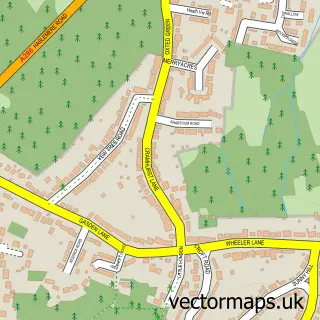
750 metre map area coverage
Boundary, postcode and point of interest information for the 750m x 750m rectangle centred on this sample map.
Boundaries containing map centre
Constituency: Godalming and Ash Co Const
County: Surrey County
District: Waverley District (B)
Icb: NHS Surrey and Sussex ICB
Parish: Elstead CP
Police Force: surrey
Postcode District: GU8
Postcode Sector: GU8 6
Ward: Elstead & Peper Harow Ward
Nearby boundaries intersecting sample
No additional intersecting boundaries found.
Postcode coverage
POI category counts
Pub: 4
Automotive Repair: 2
Elementary School: 2
Scout Hall: 2
Antique Store: 1
Atms: 1
Beauty Salon: 1
Building Supply Store: 1
Business Consulting: 1
Cafe: 1
Sample points of interest
- Honeypot Antiques
- BR Spar Elstead (ERF), Thursley Road
- Chandlers Garage
- G Chandler
- Ultimate Beauty
- Electrotech Electrical Services
- Cellarworld International
- The Little Barn Cafe
- St James Church
- South Downs Coffee Co
- The Royal British Legion
- Bartos Building Ltd
Create a larger editable map of Elstead
This sample shows only a 750 metre area. To create a larger map of Elstead, use our map builder to choose your own coverage area, add titles and download editable SVG, PDF and PNG files.
Create a custom map of Elstead