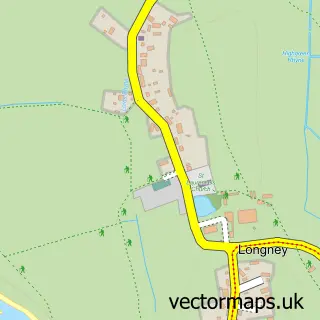
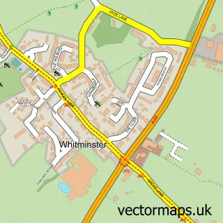
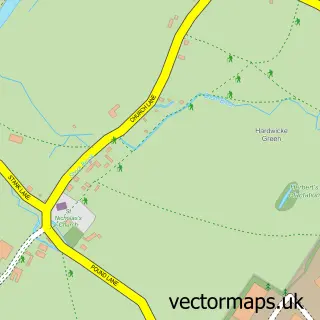
This Epney street map is a detailed vector street map covering a 750m x 750m area. Select a larger area to create and download your own vector street map of Epney.
The 750-metre map sample for Epney covers 67 mapped buildings and approximately 21.7 km of road detail, of which 1 named road are named. The immediate area includes 1 pub and 2 MOT stations within 2 miles. The wider area around Epney features 1 food and drink venue. To create a larger or custom map of Epney, the map builder lets you define your own coverage area and download editable SVG, PDF and PNG files.
Create a larger editable map of Epney
Choose any area you need and generate a high-quality vector map instantly. Perfect for print, planning, design, business and personal use.

This Epney street map in Gloucestershire is available as downloadable SVG, PDF and PNG map files, or as a printed map for planning, business, display, education, local information and design work. You can also create a larger custom map area using the map selector.
What this Epney map sample shows
Epney lies within Fretherne With Saul Cp parish, part of Severn ward in the Stroud District local authority area. The postcode geography for this area includes the GL postcode area, the GL2 postcode district and the GL2 7 postcode sector. Residents fall under the Nhs Gloucestershire Integrated Care Board for NHS services.
Local features near Epney
Within 2 milesAmenities and services in and around Epney.
Administrative and postcode information for Epney
Epney lies within Fretherne With Saul Cp parish, part of Severn ward in the Stroud District local authority area. The postcode geography for this area includes the GL postcode area, the GL2 postcode district and the GL2 7 postcode sector. Residents fall under the Nhs Gloucestershire Integrated Care Board for NHS services.
Nearby street map samples around Epney

More street maps in Gloucestershire
750 metre map area coverage
Boundary, postcode and point of interest information for the 750m x 750m rectangle centred on this sample map.
Boundaries containing map centre
Constituency: North Cotswolds Co Const
County: Gloucestershire County
District: Stroud District
Icb: NHS Gloucestershire ICB
Parish: Longney and Epney CP
Police Force: gloucestershire
Postcode District: GL2
Postcode Sector: GL2 7
Ward: Hardwicke Ward
Nearby boundaries intersecting sample
Constituency: Forest of Dean Co Const
District: Forest of Dean District
Parish: Moreton Valence CP, Westbury-on-Severn CP
Postcode District: GL14
Postcode Sector: GL14 1, GL2 3
Ward: Westbury-on-Severn Ward
Postcode coverage
POI category counts
Auto Body Shop: 1
Marketing Consultant: 1
Property Management: 1
Pub: 1
Septic Services: 1
Wedding Planning: 1
Sample points of interest
- Severnside Refinishing
- Ocean Ecology Ltd.
- Bond Brothers
- The Anchor Inn
- DC Merrett
- Catherines Carriages:Horse drawn Weddings & Funerals.+ Mini Donkey Breeder.
Create a larger editable map of Epney
This sample shows only a 750 metre area. To create a larger map of Epney, use our map builder to choose your own coverage area, add titles and download editable SVG, PDF and PNG files.
Create a custom map of Epney