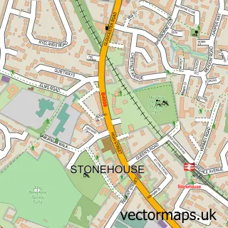
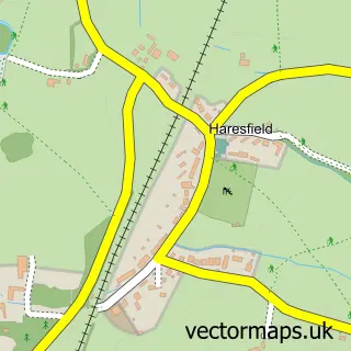
This Whitminster street map is a detailed vector street map covering a 750m x 750m area. Select a larger area to create and download your own vector street map of Whitminster.
The 750-metre map sample for Whitminster covers 253 mapped buildings and approximately 32.3 km of road detail, of which 13 named roads are named. The immediate area includes 3 pubs and 4 MOT stations within 2 miles. The wider area around Whitminster features 1 tourism point of interest and 5 food and drink venues. To create a larger or custom map of Whitminster, the map builder lets you define your own coverage area and download editable SVG, PDF and PNG files.
Create a larger editable map of Whitminster
Choose any area you need and generate a high-quality vector map instantly. Perfect for print, planning, design, business and personal use.

This Whitminster street map in Gloucestershire is available as downloadable SVG, PDF and PNG map files, or as a printed map for planning, business, display, education, local information and design work. You can also create a larger custom map area using the map selector.
What this Whitminster map sample shows
Whitminster lies within Whitminster Cp parish, part of Severn ward in the Stroud District local authority area. The postcode geography for this area includes the GL postcode area, the GL2 postcode district and the GL2 7 postcode sector. Residents fall under the Nhs Gloucestershire Integrated Care Board for NHS services.
Local features near Whitminster
Within 2 milesAmenities and services in and around Whitminster.
Administrative and postcode information for Whitminster
Whitminster lies within Whitminster Cp parish, part of Severn ward in the Stroud District local authority area. The postcode geography for this area includes the GL postcode area, the GL2 postcode district and the GL2 7 postcode sector. Residents fall under the Nhs Gloucestershire Integrated Care Board for NHS services.
Nearby street map samples around Whitminster


More street maps in Gloucestershire
750 metre map area coverage
Boundary, postcode and point of interest information for the 750m x 750m rectangle centred on this sample map.
Boundaries containing map centre
Constituency: Stroud Co Const
County: Gloucestershire County
District: Stroud District
Icb: NHS Gloucestershire ICB
Parish: Whitminster CP
Police Force: gloucestershire
Postcode District: GL2
Postcode Sector: GL2 7
Ward: Severn Ward
Nearby boundaries intersecting sample
No additional intersecting boundaries found.
Postcode coverage
POI category counts
Nursery And Gardening: 3
Pub: 3
Building Supply Store: 2
Home Developer: 2
Outdoor Gear: 2
Sports Club And League: 2
Amateur Sports Team: 1
Appliance Manufacturer: 1
Auto Electrical Repair: 1
Barbecue Restaurant: 1
Sample points of interest
- Cotswold Rangers Football Club
- Machinery Development Services
- K M Keates Electrical Contracting Ltd.
- Hotbox
- Whitminster Barbers
- The Beauty Room
- Elegance Beauty Room
- Orchard View B&B
- Newent Skips
- Top Tints
- Whitminster Village Hall & Playing Field Charity
- China Garden
Create a larger editable map of Whitminster
This sample shows only a 750 metre area. To create a larger map of Whitminster, use our map builder to choose your own coverage area, add titles and download editable SVG, PDF and PNG files.
Create a custom map of Whitminster