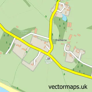
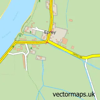
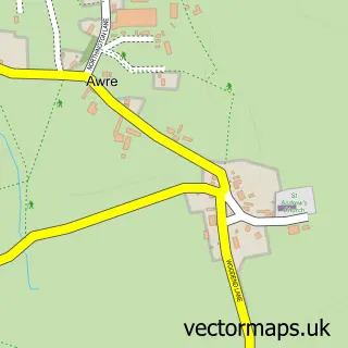
This Frampton on Severn street map is a detailed vector street map covering a 750m x 750m area. Select a larger area to create and download your own vector street map of Frampton on Severn.
The 750-metre map sample for Frampton on Severn covers 212 mapped buildings and approximately 30.4 km of road detail, of which 10 named roads are named. The immediate area includes 1 pub and 2 MOT stations within 2 miles. The wider area around Frampton on Severn features 2 tourism points of interest, 1 food and drink venue and 1 hotel. To create a larger or custom map of Frampton on Severn, the map builder lets you define your own coverage area and download editable SVG, PDF and PNG files.
Create a larger editable map of Frampton on Severn
Choose any area you need and generate a high-quality vector map instantly. Perfect for print, planning, design, business and personal use.

This Frampton on Severn street map in Gloucestershire is available as downloadable SVG, PDF and PNG map files, or as a printed map for planning, business, display, education, local information and design work. You can also create a larger custom map area using the map selector.
What this Frampton on Severn map sample shows
Frampton on Severn lies within Frampton On Severn Cp parish, part of Severn ward in the Stroud District local authority area. The postcode geography for this area includes the GL postcode area, the GL2 postcode district and the GL2 7 postcode sector. Residents fall under the Nhs Gloucestershire Integrated Care Board for NHS services.
Local features near Frampton on Severn
Within 2 milesAmenities and services in and around Frampton on Severn.
Administrative and postcode information for Frampton on Severn
The local authority covering Frampton on Severn is Stroud District, within the county of Gloucestershire. The settlement lies within Severn ward and Frampton On Severn Cp civil parish. The GL2 postcode district and GL2 7 postcode sector serve the immediate area. NHS provision in the area is delivered through Gloucestershire Hospitals Nhs Foundation Trust.
Nearby street map samples around Frampton on Severn

More street maps in Gloucestershire
750 metre map area coverage
Boundary, postcode and point of interest information for the 750m x 750m rectangle centred on this sample map.
Boundaries containing map centre
Constituency: Stroud Co Const
County: Gloucestershire County
District: Stroud District
Icb: NHS Gloucestershire ICB
Parish: Frampton on Severn CP
Police Force: gloucestershire
Postcode District: GL2
Postcode Sector: GL2 7
Ward: Severn Ward
Nearby boundaries intersecting sample
Parish: Fretherne with Saul CP
Postcode coverage
POI category counts
Beauty Salon: 2
Building Supply Store: 2
Shipping Center: 2
Accommodation: 1
Auto Body Shop: 1
Business Manufacturing And Supply: 1
Cabin: 1
Campground: 1
Car Dealer: 1
Driving School: 1
Sample points of interest
- The Orangery
- Martin Pollard Bodyshop
- Medical Cosmetic Service
- Pure Relax
- A B Services
- Style Interiors
- Shipton Mill Ltd
- Morzine Lets
- Mikes campers
- True Commercials
- Coady's Driving School
- The Wool Barn
Create a larger editable map of Frampton on Severn
This sample shows only a 750 metre area. To create a larger map of Frampton on Severn, use our map builder to choose your own coverage area, add titles and download editable SVG, PDF and PNG files.
Create a custom map of Frampton on Severn