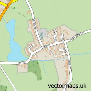
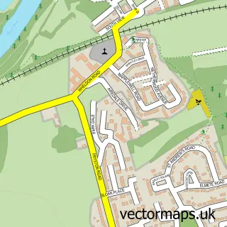
This Fairburn street map is a detailed vector street map covering a 750m x 750m area. Select a larger area to create and download your own vector street map of Fairburn.
The 750-metre map sample for Fairburn covers 247 mapped buildings and approximately 12.3 km of road detail, of which 24 named roads are named. The immediate area includes 1 school, 1 GP surgery within 2 miles, 1 pub and 4 MOT stations within 2 miles. The wider area around Fairburn features 1 food and drink venue. To create a larger or custom map of Fairburn, the map builder lets you define your own coverage area and download editable SVG, PDF and PNG files.
Create a larger editable map of Fairburn
Choose any area you need and generate a high-quality vector map instantly. Perfect for print, planning, design, business and personal use.

This Fairburn street map in North Yorkshire is available as downloadable SVG, PDF and PNG map files, or as a printed map for planning, business, display, education, local information and design work. You can also create a larger custom map area using the map selector.
What this Fairburn map sample shows
Fairburn lies within Fairburn Cp parish, part of Byram & Brotherton ward in the North Yorkshire local authority area. The postcode geography for this area includes the WF postcode area, the WF11 postcode district and the WF11 9 postcode sector. Residents fall under the Nhs Humber And North Yorkshire Integrated Care Board for NHS services.
Local features near Fairburn
Within 2 milesAmenities and services in and around Fairburn.
Administrative and postcode information for Fairburn
The local authority covering Fairburn is North Yorkshire, within the county of North Yorkshire. The settlement lies within Byram & Brotherton ward and Fairburn Cp civil parish. The WF11 postcode district and WF11 9 postcode sector serve the immediate area. NHS provision in the area is delivered through Mid Yorkshire Teaching Nhs Trust.
Nearby street map samples around Fairburn


More street maps in North Yorkshire
750 metre map area coverage
Boundary, postcode and point of interest information for the 750m x 750m rectangle centred on this sample map.
Boundaries containing map centre
Constituency: Selby Co Const
District: North Yorkshire
Icb: NHS Humber and North Yorkshire ICB
Parish: Fairburn CP
Police Force: north yorkshire
Postcode District: WF11
Postcode Sector: WF11 9
Nearby boundaries intersecting sample
Parish: Brotherton CP
Postcode coverage
POI category counts
Home Goods Store: 2
Anglican Church: 1
Art Gallery: 1
Auto Detailing: 1
Automotive Services And Repair: 1
Community Center: 1
Elementary School: 1
Financial Service: 1
Garbage Collection Service: 1
Kids Recreation And Party: 1
Sample points of interest
- Fairburn: St James
- The Wildgoose Gallery
- LS Valeting & Detailing
- Mastercraft Boat Co
- Fairburn Community Centre
- Fairburn Community Primary School
- Arbiter
- Ings Environmental
- JIR Refrigeration
- Shaws Blinds
- Pisces Swimming School Ltd.
- C & C Fabrications
Create a larger editable map of Fairburn
This sample shows only a 750 metre area. To create a larger map of Fairburn, use our map builder to choose your own coverage area, add titles and download editable SVG, PDF and PNG files.
Create a custom map of Fairburn