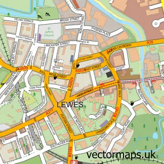
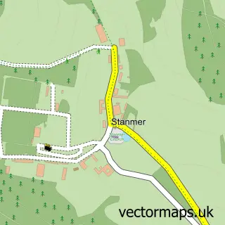
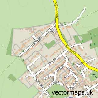
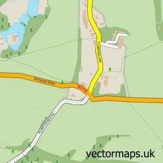
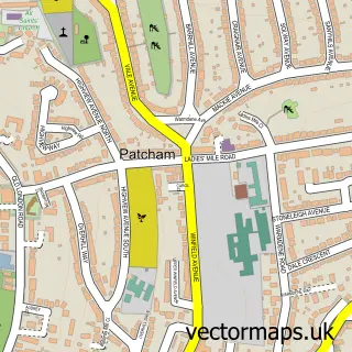
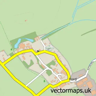
This Falmer street map is a detailed vector street map covering a 750m x 750m area. Select a larger area to create and download your own vector street map of Falmer.
The 750-metre map sample for Falmer covers 59 mapped buildings and approximately 12.8 km of road detail, of which 10 named roads are named. The immediate area includes 2 GP surgeries within 2 miles, 1 pub and 3 MOT stations within 2 miles. The wider area around Falmer features 1 tourism point of interest, 1 food and drink venue and 1 campsite within 2 miles. To create a larger or custom map of Falmer, the map builder lets you define your own coverage area and download editable SVG, PDF and PNG files.
Create a larger editable map of Falmer
Choose any area you need and generate a high-quality vector map instantly. Perfect for print, planning, design, business and personal use.

This Falmer street map in East Sussex is available as downloadable SVG, PDF and PNG map files, or as a printed map for planning, business, display, education, local information and design work. You can also create a larger custom map area using the map selector.
What this Falmer map sample shows
Falmer lies within Falmer Cp parish, part of Kingston ward in the Lewes District local authority area. The postcode geography for this area includes the BN postcode area, the BN1 postcode district and the BN1 9 postcode sector. Residents fall under the Nhs Sussex Integrated Care Board for NHS services.
Local features near Falmer
Within 2 milesAmenities and services in and around Falmer.
Administrative and postcode information for Falmer
Falmer lies within Falmer Cp parish, part of Kingston ward in the Lewes District local authority area. The postcode geography for this area includes the BN postcode area, the BN1 postcode district and the BN1 9 postcode sector. Residents fall under the Nhs Sussex Integrated Care Board for NHS services.
Nearby street map samples around Falmer

More street maps in East Sussex
750 metre map area coverage
Boundary, postcode and point of interest information for the 750m x 750m rectangle centred on this sample map.
Boundaries containing map centre
Constituency: Lewes Co Const
County: East Sussex County
District: Lewes District
Icb: NHS Surrey and Sussex ICB
Parish: Falmer CP
Police Force: sussex
Postcode District: BN1
Postcode Sector: BN1 9
Ward: Kingston Ward
Nearby boundaries intersecting sample
Constituency: Brighton Kemptown and Peacehaven Boro Const
District: The City of Brighton and Hove (B)
Postcode District: BN7
Postcode Sector: BN7 3
Ward: Coldean & Stanmer Ward
Postcode coverage
POI category counts
Alternative Medicine: 1
Anglican Church: 1
Bar: 1
Cosmetic And Beauty Supplies: 1
Elementary School: 1
Event Planning: 1
Farmers Market: 1
Indian Restaurant: 1
Landmark And Historical Building: 1
Preschool: 1
Sample points of interest
- Jewel of Peace
- St Laurence's
- Falmer Bar Uni of Sussex
- M·A·C
- Language Garden
- Great Thatch Barn at Falmer Court
- Park Farm Shop
- Sagorika Indian Restaurant
- Falmer Court
- Singing Tree Steiner Kindergarten
- The Swan Inn
- Sussex Isoc
Create a larger editable map of Falmer
This sample shows only a 750 metre area. To create a larger map of Falmer, use our map builder to choose your own coverage area, add titles and download editable SVG, PDF and PNG files.
Create a custom map of Falmer