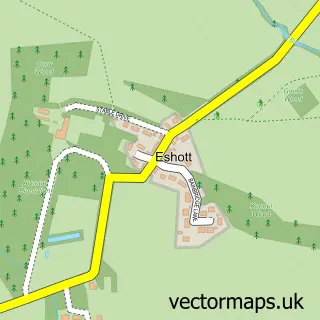
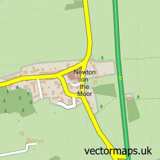
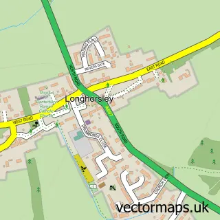
This Felton street map is a detailed vector street map covering a 750m x 750m area. Select a larger area to create and download your own vector street map of Felton.
The 750-metre map sample for Felton covers 115 mapped buildings and approximately 11.3 km of road detail, of which 17 named roads are named. The immediate area includes 1 school, 1 pub and 1 MOT station within 2 miles. The wider area around Felton features 1 tourism point of interest, 2 food and drink venues and 1 hotel. To create a larger or custom map of Felton, the map builder lets you define your own coverage area and download editable SVG, PDF and PNG files.
Create a larger editable map of Felton
Choose any area you need and generate a high-quality vector map instantly. Perfect for print, planning, design, business and personal use.

This Felton street map in Northumberland is available as downloadable SVG, PDF and PNG map files, or as a printed map for planning, business, display, education, local information and design work. You can also create a larger custom map area using the map selector.
What this Felton map sample shows
Felton lies within Felton Cp parish, part of Shilbottle ward in the Northumberland local authority area. The postcode geography for this area includes the NE postcode area, the NE65 postcode district and the NE65 9 postcode sector. Residents fall under the Nhs North East And North Cumbria Integrated Care Board for NHS services.
Local features near Felton
Within 2 milesAmenities and services in and around Felton.
Administrative and postcode information for Felton
The local authority covering Felton is Northumberland, within the county of Northumberland. The settlement lies within Shilbottle ward and Felton Cp civil parish. The NE65 postcode district and NE65 9 postcode sector serve the immediate area. NHS provision in the area is delivered through Northumbria Healthcare Nhs Foundation Trust.
Nearby street map samples around Felton

More street maps in Northumberland
750 metre map area coverage
Boundary, postcode and point of interest information for the 750m x 750m rectangle centred on this sample map.
Boundaries containing map centre
Constituency: North Northumberland Co Const
District: Northumberland
Icb: NHS North East and North Cumbria ICB
Parish: Felton CP
Police Force: northumberland
Postcode District: NE65
Postcode Sector: NE65 9
Nearby boundaries intersecting sample
Constituency: Hexham Co Const
Parish: Thirston CP
Postcode coverage
POI category counts
Art Gallery: 3
Arts And Crafts: 2
Bridal Shop: 2
Building Supply Store: 2
Home Service: 2
Scout Hall: 2
Bakery: 1
Cafe: 1
Church Cathedral: 1
Community Center: 1
Sample points of interest
- Art Evolution
- Gallery 45
- Sarah Farooqi Art
- Awl by Hand
- Fine Fettle Fibres
- The Running Fox
- Alan Mason Photography
- Chrischev Photographer
- Essential Garden Services
- Northumberland Tree & Landscaping Solutions
- The Cheviot
- Church of St Michael and All Angels, Felton
Create a larger editable map of Felton
This sample shows only a 750 metre area. To create a larger map of Felton, use our map builder to choose your own coverage area, add titles and download editable SVG, PDF and PNG files.
Create a custom map of Felton