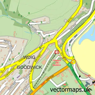
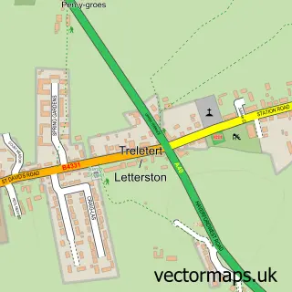
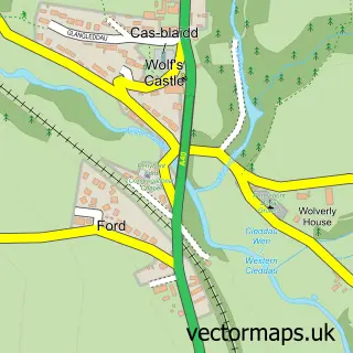
This Fishguard street map is a detailed vector street map covering a 750m x 750m area. Select a larger area to create and download your own vector street map of Fishguard.
The 750-metre map sample for Fishguard covers 499 mapped buildings and approximately 19.2 km of road detail, of which 43 named roads are named. The immediate area includes 2 schools, 10 pubs and 1 MOT station, with 3 within 2 miles. The wider area around Fishguard features 3 tourism points of interest, 23 food and drink venues and 5 hotels. To create a larger or custom map of Fishguard, the map builder lets you define your own coverage area and download editable SVG, PDF and PNG files.
Create a larger editable map of Fishguard
Choose any area you need and generate a high-quality vector map instantly. Perfect for print, planning, design, business and personal use.

This Fishguard street map in Dyfed is available as downloadable SVG, PDF and PNG map files, or as a printed map for planning, business, display, education, local information and design work. You can also create a larger custom map area using the map selector.
What this Fishguard map sample shows
Fishguard lies within Fishguard And Goodwick Community parish, part of Fishguard North West ward in the Sir Benfro - Pembrokeshire local authority area. The postcode geography for this area includes the SA postcode area, the SA65 postcode district and the SA65 9 postcode sector. Residents fall under the Hywel Dda University Health Board for NHS services.
Local features near Fishguard
Within 2 milesAmenities and services in and around Fishguard.
Administrative and postcode information for Fishguard
Fishguard lies within Fishguard And Goodwick Community parish, part of Fishguard North West ward in the Sir Benfro - Pembrokeshire local authority area. The postcode geography for this area includes the SA postcode area, the SA65 postcode district and the SA65 9 postcode sector. Residents fall under the Hywel Dda University Health Board for NHS services.
Nearby street map samples around Fishguard

More street maps in Dyfed
750 metre map area coverage
Boundary, postcode and point of interest information for the 750m x 750m rectangle centred on this sample map.
Boundaries containing map centre
Constituency: Ceredigion Preseli Co Const
District: Sir Benfro - Pembrokeshire
Icb: Hywel Dda
Parish: Fishguard and Goodwick Community
Police Force: dyfed-powys
Postcode District: SA65
Postcode Sector: SA65 9
Nearby boundaries intersecting sample
No additional intersecting boundaries found.
Postcode coverage
POI category counts
Pub: 10
Flowers And Gifts Shop: 8
Professional Services: 8
Cafe: 7
Convenience Store: 5
Hotel: 5
Coffee Shop: 4
Accountant: 3
Bar: 3
Beauty Salon: 3
Sample points of interest
- GoDigital Accounting
- Pritchard & Co. Accountants
- Pritchard and Co
- West Wales Acupuncture
- Fishguard Ambulance Station
- Jeans Diner
- Fishguard and Goodwick Area Churches - Church in Wales
- St Mary's Church
- John Francis Ltd.
- Kinver Kreations Ltd
- RLH Architectural Design Solutions
- Oriel Glan Y Mor Gallery
Create a larger editable map of Fishguard
This sample shows only a 750 metre area. To create a larger map of Fishguard, use our map builder to choose your own coverage area, add titles and download editable SVG, PDF and PNG files.
Create a custom map of Fishguard