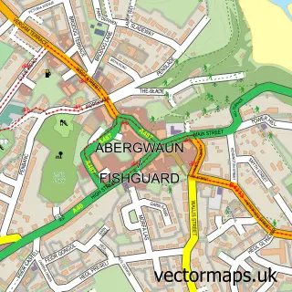
This Harbour Village street map is a detailed vector street map covering a 750m x 750m area. Select a larger area to create and download your own vector street map of Harbour Village.
The 750-metre map sample for Harbour Village covers 60 mapped buildings and approximately 6.1 km of road detail, of which 2 named roads are named. The immediate area includes 1 railway station and 4 MOT stations within 2 miles. The wider area around Harbour Village features 1 tourism point of interest. To create a larger or custom map of Harbour Village, the map builder lets you define your own coverage area and download editable SVG, PDF and PNG files.
Create a larger editable map of Harbour Village
Choose any area you need and generate a high-quality vector map instantly. Perfect for print, planning, design, business and personal use.

This Harbour Village street map in Dyfed is available as downloadable SVG, PDF and PNG map files, or as a printed map for planning, business, display, education, local information and design work. You can also create a larger custom map area using the map selector.
What this Harbour Village map sample shows
Harbour Village lies within Pencaer Community parish, part of Scleddau ward in the Sir Benfro - Pembrokeshire local authority area. The postcode geography for this area includes the SA postcode area, the SA64 postcode district and the SA64 0 postcode sector. Residents fall under the Hywel Dda University Health Board for NHS services.
Local features near Harbour Village
Within 2 milesAmenities and services in and around Harbour Village.
Administrative and postcode information for Harbour Village
Harbour Village lies within Pencaer Community parish, part of Scleddau ward in the Sir Benfro - Pembrokeshire local authority area. The postcode geography for this area includes the SA postcode area, the SA64 postcode district and the SA64 0 postcode sector. Residents fall under the Hywel Dda University Health Board for NHS services.
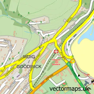
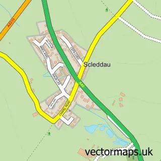
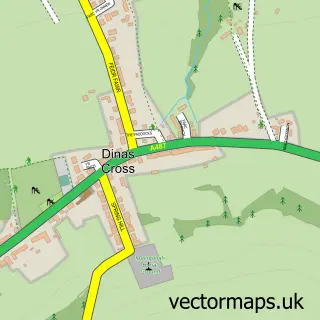
Nearby street map samples around Harbour Village


More street maps in Dyfed
750 metre map area coverage
Boundary, postcode and point of interest information for the 750m x 750m rectangle centred on this sample map.
Boundaries containing map centre
Constituency: Ceredigion Preseli Co Const
District: Sir Benfro - Pembrokeshire
Icb: Hywel Dda
Parish: Fishguard and Goodwick Community
Police Force: dyfed-powys
Postcode District: SA64
Postcode Sector: SA64 0
Nearby boundaries intersecting sample
No additional intersecting boundaries found.
Postcode coverage
POI category counts
Train Station: 2
Airport: 1
Government Services: 1
Holiday Rental Home: 1
International Business And Trade Services: 1
Jewelry Store: 1
Mountain: 1
Topic Publisher: 1
Tours: 1
Sample points of interest
- Stena Line Rosslare Port
- RNLI Fishguard Lifeboat Station
- Harbour Village Views
- Pinestrike Ltd.
- Icatcha Jewellery
- Harbour Village Mountain
- Stena Europe
- Refreshing North Pembrokeshire
- Fishguard Harbour
- Fishguard Harbour railway station
Create a larger editable map of Harbour Village
This sample shows only a 750 metre area. To create a larger map of Harbour Village, use our map builder to choose your own coverage area, add titles and download editable SVG, PDF and PNG files.
Create a custom map of Harbour Village