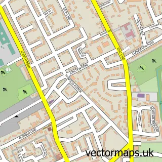
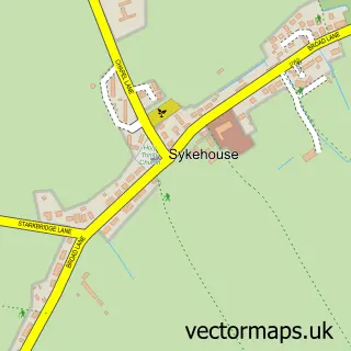
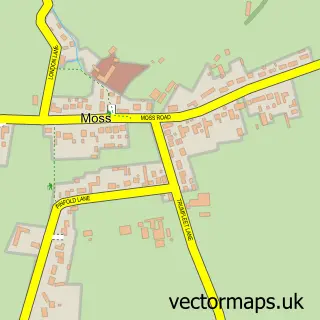
This Fishlake street map is a detailed vector street map covering a 750m x 750m area. Select a larger area to create and download your own vector street map of Fishlake.
The 750-metre map sample for Fishlake covers 220 mapped buildings and approximately 8.8 km of road detail, of which 11 named roads are named. The immediate area includes 3 GP surgeries within 2 miles, 2 pubs and 4 MOT stations within 2 miles. The wider area around Fishlake features 4 food and drink venues. To create a larger or custom map of Fishlake, the map builder lets you define your own coverage area and download editable SVG, PDF and PNG files.
Create a larger editable map of Fishlake
Choose any area you need and generate a high-quality vector map instantly. Perfect for print, planning, design, business and personal use.

This Fishlake street map in South Yorkshire is available as downloadable SVG, PDF and PNG map files, or as a printed map for planning, business, display, education, local information and design work. You can also create a larger custom map area using the map selector.
What this Fishlake map sample shows
Fishlake lies within Fishlake Cp parish, part of Norton & Askern ward in the Doncaster District (B) local authority area. The postcode geography for this area includes the DN postcode area, the DN7 postcode district and the DN7 5 postcode sector. Residents fall under the Nhs South Yorkshire Integrated Care Board for NHS services.
Local features near Fishlake
Within 2 milesAmenities and services in and around Fishlake.
Administrative and postcode information for Fishlake
Fishlake lies within Fishlake Cp parish, part of Norton & Askern ward in the Doncaster District (B) local authority area. The postcode geography for this area includes the DN postcode area, the DN7 postcode district and the DN7 5 postcode sector. Residents fall under the Nhs South Yorkshire Integrated Care Board for NHS services.
Nearby street map samples around Fishlake

More street maps in South Yorkshire
750 metre map area coverage
Boundary, postcode and point of interest information for the 750m x 750m rectangle centred on this sample map.
Boundaries containing map centre
Constituency: Doncaster North Co Const
District: Doncaster District (B)
Icb: NHS South Yorkshire ICB
Parish: Fishlake CP
Police Force: south yorkshire
Postcode District: DN7
Postcode Sector: DN7 5
Ward: Norton & Askern Ward
Nearby boundaries intersecting sample
Parish: Stainforth CP
Ward: Stainforth & Barnby Dun Ward
Postcode coverage
POI category counts
Cafe: 2
Church Cathedral: 2
Pub: 2
Anglican Church: 1
Beauty Salon: 1
Bed And Breakfast: 1
Computer Store: 1
Day Care Preschool: 1
Farm: 1
Funeral Services And Cemeteries: 1
Sample points of interest
- St Cuthbert - Fishlake
- Juxtapose
- River Lane Bed & Breakfast
- Cafe Bleu
- The Old Butchers
- Fishlake St Cuthbert
- St Cuthbert's Church of England Church
- Q C Engineering And Design Ltd.
- Willow Daycare
- Hazel Hurst Farm
- B a Wright & Sons
- Think Tank Creative Design
Create a larger editable map of Fishlake
This sample shows only a 750 metre area. To create a larger map of Fishlake, use our map builder to choose your own coverage area, add titles and download editable SVG, PDF and PNG files.
Create a custom map of Fishlake