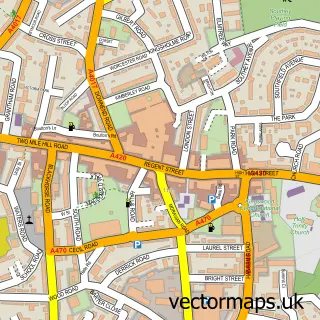
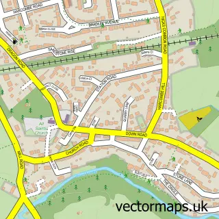
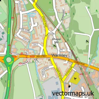
This Frenchay street map is a detailed vector street map covering a 750m x 750m area. Select a larger area to create and download your own vector street map of Frenchay.
The 750-metre map sample for Frenchay covers 347 mapped buildings and approximately 13.5 km of road detail, of which 28 named roads are named. The immediate area includes 1 school, 7 GP surgeries within 2 miles, 5 pubs and 27 MOT stations within 2 miles. The wider area around Frenchay features 1 tourism point of interest and 5 food and drink venues. To create a larger or custom map of Frenchay, the map builder lets you define your own coverage area and download editable SVG, PDF and PNG files.
Create a larger editable map of Frenchay
Choose any area you need and generate a high-quality vector map instantly. Perfect for print, planning, design, business and personal use.

This Frenchay street map in Gloucestershire is available as downloadable SVG, PDF and PNG map files, or as a printed map for planning, business, display, education, local information and design work. You can also create a larger custom map area using the map selector.
What this Frenchay map sample shows
Frenchay lies within Winterbourne Cp parish, part of Winterbourne ward in the South Gloucestershire local authority area. The postcode geography for this area includes the BS postcode area, the BS16 postcode district and the BS16 1 postcode sector. Residents fall under the Nhs Bristol, North Somerset And South Gloucestershire Integrated Care Board for NHS services.
Local features near Frenchay
Within 2 milesAmenities and services in and around Frenchay.
Administrative and postcode information for Frenchay
Frenchay lies within Winterbourne Cp parish, part of Winterbourne ward in the South Gloucestershire local authority area. The postcode geography for this area includes the BS postcode area, the BS16 postcode district and the BS16 1 postcode sector. Residents fall under the Nhs Bristol, North Somerset And South Gloucestershire Integrated Care Board for NHS services.
Nearby street map samples around Frenchay

More street maps in Gloucestershire
750 metre map area coverage
Boundary, postcode and point of interest information for the 750m x 750m rectangle centred on this sample map.
Boundaries containing map centre
Constituency: Filton and Bradley Stoke Boro Const
District: South Gloucestershire
Icb: NHS Bristol North Somerset and South Gloucestershire ICB
Parish: Winterbourne CP
Police Force: avon and somerset
Postcode District: BS16
Postcode Sector: BS16 1
Ward: Frenchay & Downend Ward
Nearby boundaries intersecting sample
Constituency: Bristol North East Boro Const
District: City of Bristol (B)
Postcode Sector: BS16 2
Ward: Frome Vale Ward
Postcode coverage
POI category counts
Pub: 5
Assisted Living Facility: 3
Church Cathedral: 3
Hospital: 3
Home Developer: 2
Abuse And Addiction Treatment: 1
Advertising Agency: 1
Anglican Church: 1
Automotive Repair: 1
Cleaning Services: 1
Sample points of interest
- Frenchay Brain Injury Rehabilitation Centre
- Nick McKay Design
- Frenchay Parish Church
- Able Care
- Ablecare Homes
- Frenchay Park
- Frenchay Garage
- All Saints C of E Church Winterbourne Down
- Frenchay Parish Church
- St John the Baptist Church
- Frenchay Chimney Sweep
- Frenchay C of E Primary School
Create a larger editable map of Frenchay
This sample shows only a 750 metre area. To create a larger map of Frenchay, use our map builder to choose your own coverage area, add titles and download editable SVG, PDF and PNG files.
Create a custom map of Frenchay