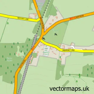
This Fulking street map is a detailed vector street map covering a 750m x 750m area. Select a larger area to create and download your own vector street map of Fulking.
The 750-metre map sample for Fulking covers 103 mapped buildings and approximately 6.4 km of road detail, of which 2 named roads are named. The immediate area includes 3 pubs and 2 MOT stations within 2 miles. The wider area around Fulking features 3 food and drink venues and 1 campsite within 2 miles. To create a larger or custom map of Fulking, the map builder lets you define your own coverage area and download editable SVG, PDF and PNG files.
Create a larger editable map of Fulking
Choose any area you need and generate a high-quality vector map instantly. Perfect for print, planning, design, business and personal use.

This Fulking street map in West Sussex is available as downloadable SVG, PDF and PNG map files, or as a printed map for planning, business, display, education, local information and design work. You can also create a larger custom map area using the map selector.
What this Fulking map sample shows
Fulking lies within Fulking Cp parish, part of Hurstpierpoint And Downs ward in the Mid Sussex District local authority area. The postcode geography for this area includes the BN postcode area, the BN5 postcode district and the BN5 9 postcode sector. Residents fall under the Nhs Sussex Integrated Care Board for NHS services.
Local features near Fulking
Within 2 milesAmenities and services in and around Fulking.
Administrative and postcode information for Fulking
The local authority covering Fulking is Mid Sussex District, within the county of West Sussex. The settlement lies within Hurstpierpoint And Downs ward and Fulking Cp civil parish. The BN5 postcode district and BN5 9 postcode sector serve the immediate area. NHS provision in the area is delivered through University Hospitals Sussex Nhs Foundation Trust.
Nearby street map samples around Fulking

More street maps in West Sussex
750 metre map area coverage
Boundary, postcode and point of interest information for the 750m x 750m rectangle centred on this sample map.
Boundaries containing map centre
Constituency: Mid Sussex Co Const
County: West Sussex County
District: Mid Sussex District
Icb: NHS Surrey and Sussex ICB
Parish: Fulking CP
Police Force: sussex
Postcode District: BN5
Postcode Sector: BN5 9
Ward: Downland Villages Ward
Nearby boundaries intersecting sample
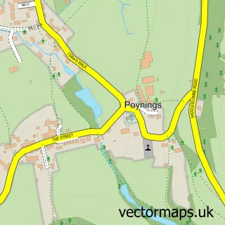
Parish: Poynings CP
Postcode coverage
POI category counts
Pub: 3
Cleaning Services: 1
Dog Trainer: 1
Nursery And Gardening: 1
Pet Store: 1
School: 1
Sports Club And League: 1
Sample points of interest
- Poynings Cleaners
- Dogs in Line Training And Behaviour
- The Ginger Jungle
- Dogs in Line
- Shepherd & Dog
- Shepherd And Dog
- The Shepherd and Dog
- Good Start School
- Preston Nomads Cricket Club
Create a larger editable map of Fulking
This sample shows only a 750 metre area. To create a larger map of Fulking, use our map builder to choose your own coverage area, add titles and download editable SVG, PDF and PNG files.
Create a custom map of Fulking