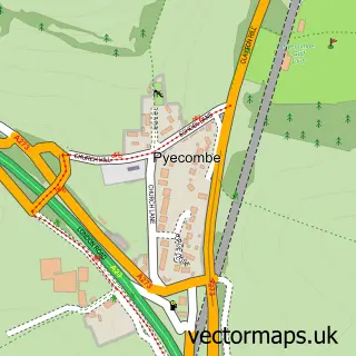
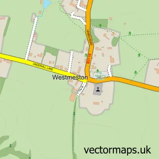
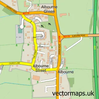
This Clayton street map is a detailed vector street map covering a 750m x 750m area. Select a larger area to create and download your own vector street map of Clayton.
The 750-metre map sample for Clayton covers 44 mapped buildings and approximately 5.8 km of road detail, of which 5 named roads are named. The immediate area includes 1 GP surgery within 2 miles, 1 pub and 4 MOT stations within 2 miles. The wider area around Clayton features 2 tourism points of interest, 1 food and drink venue and 3 campsites within 2 miles. To create a larger or custom map of Clayton, the map builder lets you define your own coverage area and download editable SVG, PDF and PNG files.
Create a larger editable map of Clayton
Choose any area you need and generate a high-quality vector map instantly. Perfect for print, planning, design, business and personal use.

This Clayton street map in West Sussex is available as downloadable SVG, PDF and PNG map files, or as a printed map for planning, business, display, education, local information and design work. You can also create a larger custom map area using the map selector.
What this Clayton map sample shows
Clayton lies within Pyecombe Cp parish, part of Hurstpierpoint And Downs ward in the Mid Sussex District local authority area. The postcode geography for this area includes the BN postcode area, the BN45 postcode district and the BN45 7 postcode sector. Residents fall under the Nhs Sussex Integrated Care Board for NHS services.
Local features near Clayton
Within 2 milesAmenities and services in and around Clayton.
Administrative and postcode information for Clayton
Clayton lies within Pyecombe Cp parish, part of Hurstpierpoint And Downs ward in the Mid Sussex District local authority area. The postcode geography for this area includes the BN postcode area, the BN45 postcode district and the BN45 7 postcode sector. Residents fall under the Nhs Sussex Integrated Care Board for NHS services.
Nearby street map samples around Clayton

More street maps in West Sussex
750 metre map area coverage
Boundary, postcode and point of interest information for the 750m x 750m rectangle centred on this sample map.
Boundaries containing map centre
Constituency: Mid Sussex Co Const
County: West Sussex County
District: Mid Sussex District
Icb: NHS Surrey and Sussex ICB
Parish: Hassocks CP
Police Force: sussex
Postcode District: BN6
Postcode Sector: BN6 9
Ward: Hassocks Ward
Nearby boundaries intersecting sample
Parish: Pyecombe CP
Postcode District: BN45
Postcode Sector: BN45 7
Ward: Downland Villages Ward
Postcode coverage
POI category counts
Church Cathedral: 3
Beer Garden: 1
Home Service: 1
Landmark And Historical Building: 1
Park: 1
Pub: 1
Swimming Pool: 1
Travel: 1
Sample points of interest
- Jack And Jill Inn
- Clayton Church
- St John The Baptist Church
- St. John's, Clayton
- Apple Tree Montessori Forest School
- Clayton Tunnel
- Clayton Recreation Ground
- The Jack & Jill Inn, Clayton, West Sussex
- Clayton Court Barn Pool
- Underhill Lane
Create a larger editable map of Clayton
This sample shows only a 750 metre area. To create a larger map of Clayton, use our map builder to choose your own coverage area, add titles and download editable SVG, PDF and PNG files.
Create a custom map of Clayton