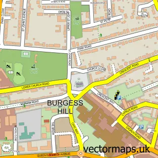
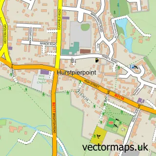
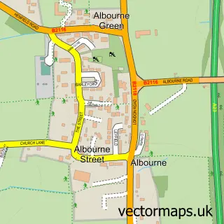
This Hassocks street map is a detailed vector street map covering a 750m x 750m area. Select a larger area to create and download your own vector street map of Hassocks.
The 750-metre map sample for Hassocks covers 499 mapped buildings and approximately 15.7 km of road detail, of which 30 named roads are named. The immediate area includes 1 school, 1 railway station, 1 GP surgery within 2 miles and 1 pub among other local services. The wider area around Hassocks features 6 food and drink venues and 3 campsites within 2 miles. To create a larger or custom map of Hassocks, the map builder lets you define your own coverage area and download editable SVG, PDF and PNG files.
Create a larger editable map of Hassocks
Choose any area you need and generate a high-quality vector map instantly. Perfect for print, planning, design, business and personal use.

This Hassocks street map in West Sussex is available as downloadable SVG, PDF and PNG map files, or as a printed map for planning, business, display, education, local information and design work. You can also create a larger custom map area using the map selector.
What this Hassocks map sample shows
Hassocks lies within Hassocks Cp parish, part of Hassocks ward in the Mid Sussex District local authority area. The postcode geography for this area includes the BN postcode area, the BN6 postcode district and the BN6 8 postcode sector. Residents fall under the Nhs Sussex Integrated Care Board for NHS services.
Local features near Hassocks
Within 2 milesAmenities and services in and around Hassocks.
Administrative and postcode information for Hassocks
The local authority covering Hassocks is Mid Sussex District, within the county of West Sussex. The settlement lies within Hassocks ward and Hassocks Cp civil parish. The BN6 postcode district and BN6 8 postcode sector serve the immediate area. NHS provision in the area is delivered through University Hospitals Sussex Nhs Foundation Trust.
Nearby street map samples around Hassocks

More street maps in West Sussex
750 metre map area coverage
Boundary, postcode and point of interest information for the 750m x 750m rectangle centred on this sample map.
Boundaries containing map centre
Constituency: Mid Sussex Co Const
County: West Sussex County
District: Mid Sussex District
Icb: NHS Surrey and Sussex ICB
Parish: Hassocks CP
Police Force: sussex
Postcode District: BN6
Postcode Sector: BN6 8
Ward: Hassocks Ward
Nearby boundaries intersecting sample
Postcode Sector: BN6 9
Postcode coverage
POI category counts
Professional Services: 7
Flowers And Gifts Shop: 6
Hair Salon: 6
Automotive Repair: 5
Beauty Salon: 4
Building Supply Store: 4
Printing Services: 4
Beauty Product Supplier: 3
Cafe: 3
Dentist: 3
Sample points of interest
- Aspire Fitness Solutions
- Acupuncture Hassocks
- Humanity at Heart
- Procapitalart
- Pavilion Electrics
- Just Plans Ltd.
- Morrisons Daily - Hassocks
- Jaguar Wheel Trims & Rims
- Jag Wheel Trims
- Hassocks
- National Tyres and Autocare
- National Tyres and Autocare
Create a larger editable map of Hassocks
This sample shows only a 750 metre area. To create a larger map of Hassocks, use our map builder to choose your own coverage area, add titles and download editable SVG, PDF and PNG files.
Create a custom map of Hassocks