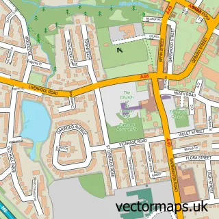
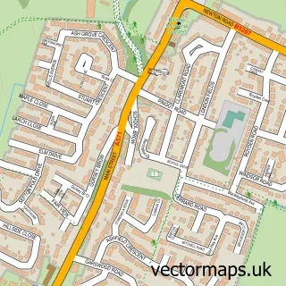
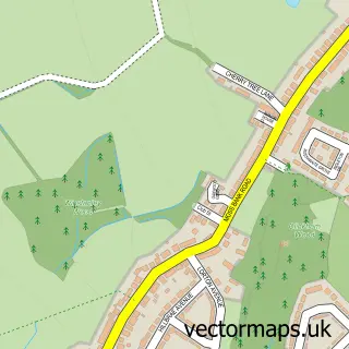
This Garswood street map is a detailed vector street map covering a 750m x 750m area. Select a larger area to create and download your own vector street map of Garswood.
The 750-metre map sample for Garswood covers 249 mapped buildings and approximately 14.7 km of road detail, of which 19 named roads are named. The immediate area includes 1 school, 1 GP surgery, with 8 within 2 miles, 1 pub and 16 MOT stations within 2 miles. The wider area around Garswood features 1 tourism point of interest and 1 food and drink venue. To create a larger or custom map of Garswood, the map builder lets you define your own coverage area and download editable SVG, PDF and PNG files.
Create a larger editable map of Garswood
Choose any area you need and generate a high-quality vector map instantly. Perfect for print, planning, design, business and personal use.

This Garswood street map in Merseyside is available as downloadable SVG, PDF and PNG map files, or as a printed map for planning, business, display, education, local information and design work. You can also create a larger custom map area using the map selector.
What this Garswood map sample shows
Garswood lies within Seneley Green Cp parish, part of Billinge And Seneley Green ward in the St. Helens District (B) local authority area. The postcode geography for this area includes the WN postcode area, the WN4 postcode district and the WN4 0 postcode sector. Residents fall under the Nhs Cheshire And Merseyside Integrated Care Board for NHS services.
Local features near Garswood
Within 2 milesAmenities and services in and around Garswood.
Administrative and postcode information for Garswood
The local authority covering Garswood is St. Helens District (B), within the county of Merseyside. The settlement lies within Billinge And Seneley Green ward and Seneley Green Cp civil parish. The WN4 postcode district and WN4 0 postcode sector serve the immediate area. NHS provision in the area is delivered through Mersey And West Lancashire Teaching Hospitals Nhs Trust.
Nearby street map samples around Garswood

More street maps in Merseyside
750 metre map area coverage
Boundary, postcode and point of interest information for the 750m x 750m rectangle centred on this sample map.
Boundaries containing map centre
Constituency: St. Helens North Co Const
District: St. Helens District (B)
Icb: NHS Cheshire and Merseyside ICB
Parish: Seneley Green CP
Police Force: merseyside
Postcode District: WN4
Postcode Sector: WN4 0
Ward: Billinge & Seneley Green Ward
Nearby boundaries intersecting sample
No additional intersecting boundaries found.
Postcode coverage
POI category counts
Beauty Salon: 2
Convenience Store: 2
Pet Groomer: 2
Accountant: 1
Advertising Agency: 1
Arts And Crafts: 1
Automotive Repair: 1
Bar: 1
Building Supply Store: 1
Car Dealer: 1
Sample points of interest
- Trevor Hall Associates
- Lynart Design & Print
- Reloved by Lady H
- Seneley Green Parish Hall
- Garswood and Simns Road Labour Club
- Radiance Nails And Beauty
- The Hamilton Hair Company
- Sparta Construction
- ImportCentral
- Autosmart
- Texpeed Motorcycle Apparel
- Hc Computer Repairs
Create a larger editable map of Garswood
This sample shows only a 750 metre area. To create a larger map of Garswood, use our map builder to choose your own coverage area, add titles and download editable SVG, PDF and PNG files.
Create a custom map of Garswood