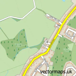
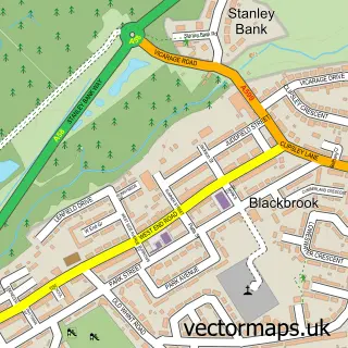
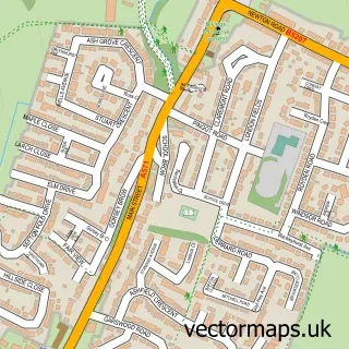
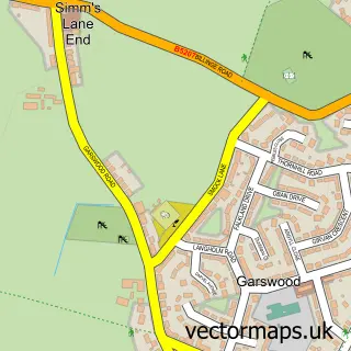
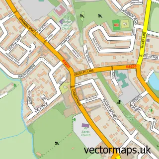
This Carr Mill street map is a detailed vector street map covering a 750m x 750m area. Select a larger area to create and download your own vector street map of Carr Mill.
The 750-metre map sample for Carr Mill covers 255 mapped buildings and approximately 16.3 km of road detail, of which 26 named roads are named. The immediate area includes 1 school, 11 GP surgeries within 2 miles and 15 MOT stations within 2 miles. The wider area around Carr Mill features 1 tourism point of interest. To create a larger or custom map of Carr Mill, the map builder lets you define your own coverage area and download editable SVG, PDF and PNG files.
Create a larger editable map of Carr Mill
Choose any area you need and generate a high-quality vector map instantly. Perfect for print, planning, design, business and personal use.

This Carr Mill street map in Merseyside is available as downloadable SVG, PDF and PNG map files, or as a printed map for planning, business, display, education, local information and design work. You can also create a larger custom map area using the map selector.
What this Carr Mill map sample shows
Carr Mill lies within St. Helens District (B) parish, part of Moss Bank ward in the St. Helens District (B) local authority area. The postcode geography for this area includes the WA postcode area, the WA11 postcode district and the WA11 7 postcode sector. Residents fall under the Nhs Cheshire And Merseyside Integrated Care Board for NHS services.
Local features near Carr Mill
Within 2 milesAmenities and services in and around Carr Mill.
Administrative and postcode information for Carr Mill
The local authority covering Carr Mill is St. Helens District (B), within the county of Merseyside. The settlement lies within Moss Bank ward and St. Helens District (B) civil parish. The WA11 postcode district and WA11 7 postcode sector serve the immediate area. NHS provision in the area is delivered through Mersey And West Lancashire Teaching Hospitals Nhs Trust.
Nearby street map samples around Carr Mill

More street maps in Merseyside
750 metre map area coverage
Boundary, postcode and point of interest information for the 750m x 750m rectangle centred on this sample map.
Boundaries containing map centre
Constituency: St. Helens North Co Const
District: St. Helens District (B)
Icb: NHS Cheshire and Merseyside ICB
Police Force: merseyside
Postcode District: WA11
Postcode Sector: WA11 7
Ward: Moss Bank Ward
Nearby boundaries intersecting sample
Parish: Billinge Chapel End CP, Seneley Green CP
Postcode District: WN5
Postcode Sector: WN5 7
Ward: Billinge & Seneley Green Ward
Postcode coverage
POI category counts
Elementary School: 3
Books Mags Music And Video: 2
Chimney Sweep: 2
Community Center: 2
Pet Services: 2
Professional Services: 2
Accountant: 1
Building Supply Store: 1
Church Cathedral: 1
Cleaning Services: 1
Sample points of interest
- Csl Accounting Services
- Clinkham Wood Post Office
- Post Office-Clinkham Wood
- Urban Clean
- Northwest Chimney Sweep
- Northwest Chimney Sweep
- St Patrick R C Church
- Panther Cleaning Services
- Park Farm ACYP Centre
- Park Farm Community Centre
- One Stop
- Portico at Moss Bank
Create a larger editable map of Carr Mill
This sample shows only a 750 metre area. To create a larger map of Carr Mill, use our map builder to choose your own coverage area, add titles and download editable SVG, PDF and PNG files.
Create a custom map of Carr Mill